
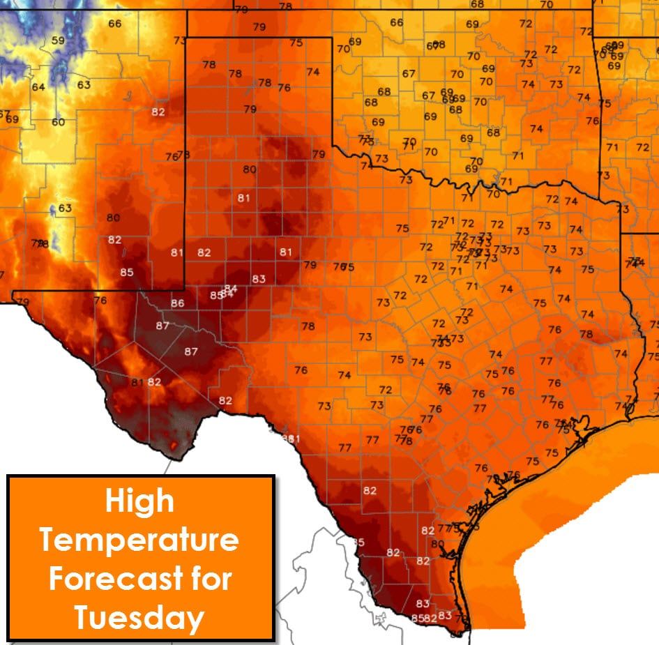
A couple forecast concerns for today before very active weather enters the picture on Wednesday. The first concern is locally dense fog across South Texas this morning. That fog will dissipate by 9-10 AM. Otherwise clouds will be on the increase through tonight. Mostly cloudy to overcast skies can be expected statewide by tonight as we start to see isolated showers. Even with increasing clouds temperatures will be warm this afternoon. The lower-end of the spectrum will be across North Texas into the Hill Country with peak temperatures in the lower 70s. The warmest temperatures this afternoon will be in the Permian Basin and South Texas where we’ll see lower to middle 80s. I wouldn’t be surprised to see a 90 degree reading in the western Permian Basin around Pecos.
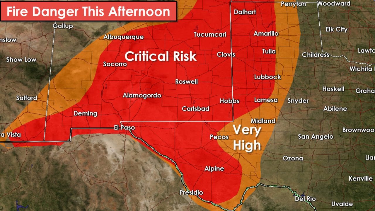
Strong wind gusts up to 40 MPH and low relative humidity will bring a return of critical fire danger to western sections of Texas today. Critical fire danger is forecast across the western half of the Texas Panhandle, South Plains, into Far West Texas. Reduced visibilities due to blowing dust may become a problem after 2 PM in those regions.
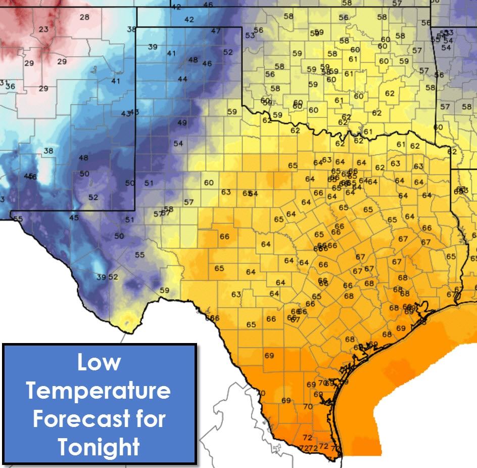
We won’t see temperatures drop much tonight across the eastern two-thirds of Texas. Increasing moisture ahead of a dryline will result in widespread clouds and fog tonight. Temperatures will not drop below the middle 60s tonight so you can expect a muggy start to your Wednesday.

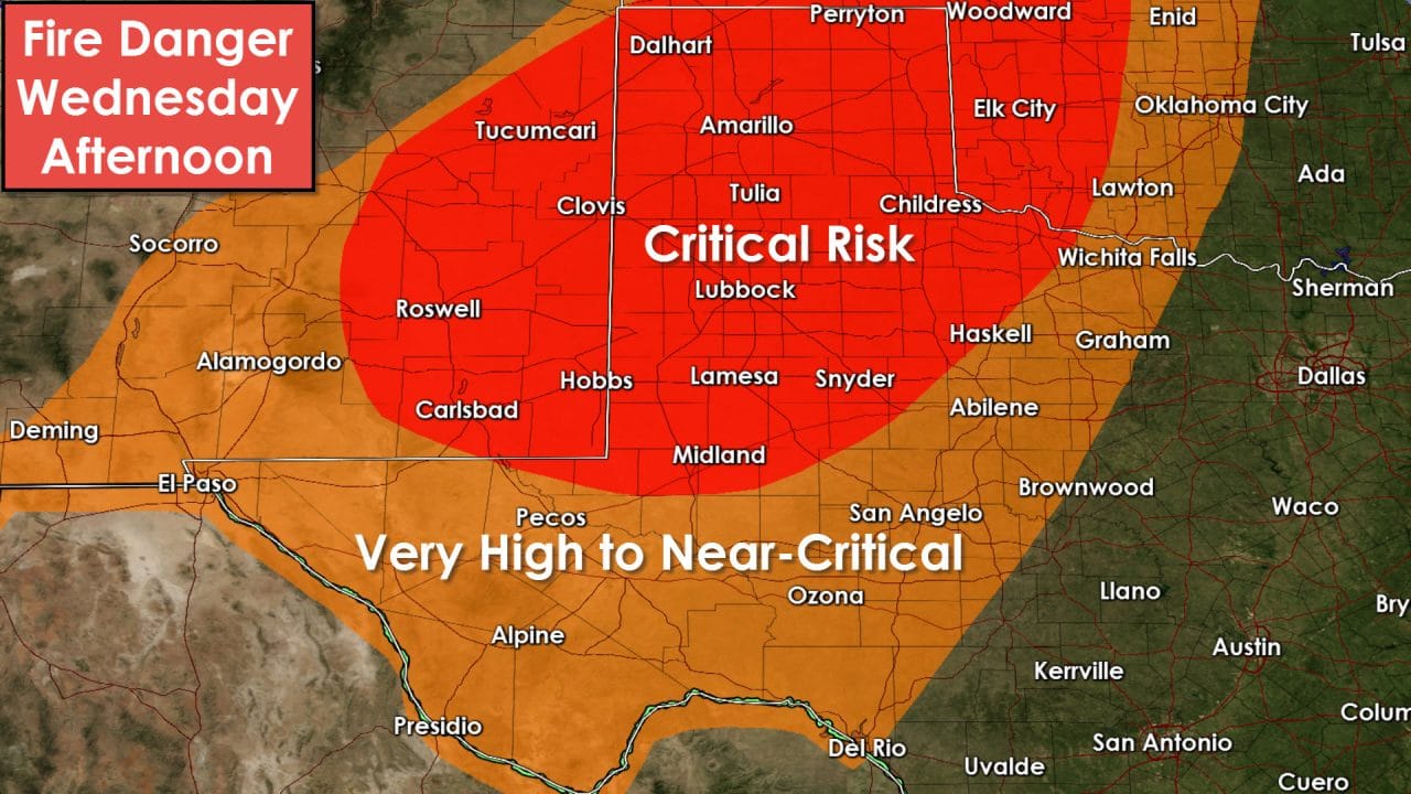
The dryline will surge east towards Highway 281 tomorrow afternoon. Conditions west of the dryline will consist of very warm temperatures, strong west/southwest winds, low-relative humidity, and some blowing dust potential. Conditions east of the dryline will be much more humid with mostly cloudy conditions.
Isolated showers will be possible this afternoon across Southeast Texas and South Texas. I don’t expect anything significant but don’t be surprised if you get a quick shower. By tonight isolated to widely scattered showers/storms will be possible across Northwest Texas, Big Country, Concho Valley, North Texas, Central Texas, the Brazos Valley, and Southeast Texas. A few storms may produce small hail. Storm chances increase on Wednesday with two distinct rounds possible. The first could be underway by Wednesday morning east of Interstate 35. Depending on how much cloud cover there is we may have a severe weather problem develop with isolated supercells in East Texas tomorrow afternoon. Those isolated storms would be in the warm-sector and not associated with the dryline. That conditional risk of severe storms will be refined. Another round of scatterded storms could fire up late Wednesday afternoon west of I-35 from Oklahoma into North Texas in association with the dryline. Any storm that fires up could quickly become severe with large hail the primary threat. If morning rain hangs around then the afternoon storm threat may be reduced. A cold front will catch up with the dryline tomorrow night and could spark off more strong/severe storms. Those storms would march east into Northeast/East Texas tomorrow night with a large hail and damaging wind threat. Finally we’ll have to watch for showers/storms on Thursday in Southeast Texas as the cold front continues to push south. A marginal severe weather risk may develop.
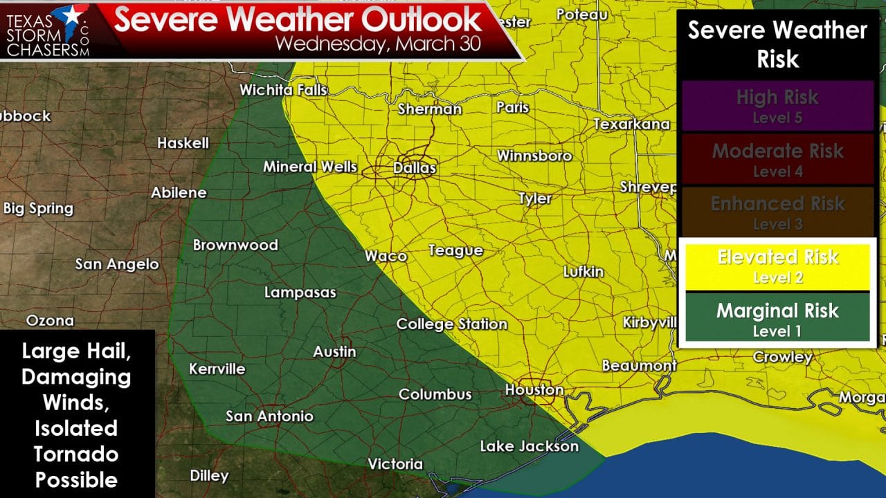
The Storm Prediction Center does have a category 2 severe weather risk in place for Wednesday across North Texas, Northeast Texas, East Texas, and Far Southeast Texas for the reasons described above. There remain several forecast uncertainties that could greatly impact the severe weather forecast. Low-level wind shear won’t be particularly impressive which will help limit the tornado threat. An isolated tornado will be possible. Large hail and spotty damaging wind gusts look to be the primary threats. My plan is to write up a detailed post this afternoon with a severe weather analysis for tomorrow. I’ll geek out a bit and explain in more detail the setup for tomorrow. This does not look to be a significant severe weather or tornado setup. Its spring in Texas and storms are just a part of living here.


0 Comments