
Good morning, happy Sunday and happy first day of astronomical Spring! After a chilly start today, temps will rebound nicely by this afternoon with lots of sunshine and no rain expected again today. A surface high currently situated over the Texas panhandle region will drift towards the southeast which will bring winds around from the southeast later today across the western half of the state. Across the eastern half of the state, we’ll see breezy north winds by this afternoon. Highs will reach the mid 50s to low 60s across a majority of the state this afternoon, with upper 60s further south along the coast and inland counties. Overnight lows will be unseasonably chilly once again with an abundance of readings in the low to mid 30s across the region. A few areas will be warmer tonight than they were last night…mainly across parts of the panhandle and west Texas, while some locations across the eastern half of the state will see cooler lows tonight than were experienced last night. 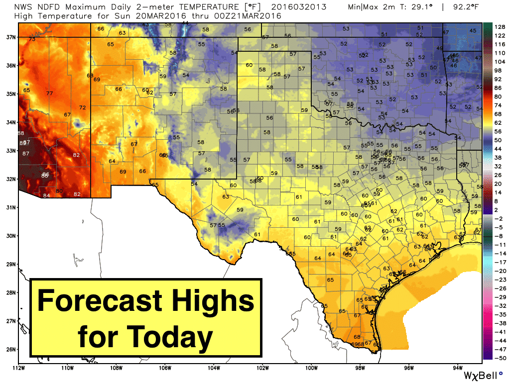

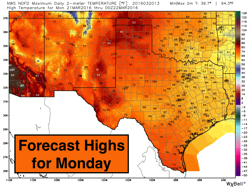
While highs this afternoon will still be at or below seasonal averages for this time of the year, we’ll see a rapid warm-up beginning tomorrow as a brief period of upper level ridging develops over the state ahead of our next upper level system. Highs on Monday will quickly rebound to above normal…especially across the western half of the state where tomorrow’s highs ranging from the mid 70s to near 80 degrees. Tuesday looks to be the warmest day with record to near-record highs expected expected in several areas across western Texas and the Texas panhandle.
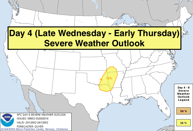
 A Look Ahead: Our next chance for rain and storms arrives late Wednesday into Thursday as our next upper level system arrives bringing another strong cold front along with it. Strong to severe storms are possible along the leading edge of the cold front as it pushes through Late Wednesday into Thursday across north central and northeast Texas. The Storm Prediction Center has parts of north central and northeast Texas highlighted on the Day 4 Outlook as the most likely areas to see severe weather development during this timeframe. While still several days out, initial thoughts are that this region of Texas will likely see a squall line of storms move in overnight with damaging winds being the most likely threat. So, take this as a “heads up” and we will continue to monitor this and keep y’all updated as it gets closer!


0 Comments