
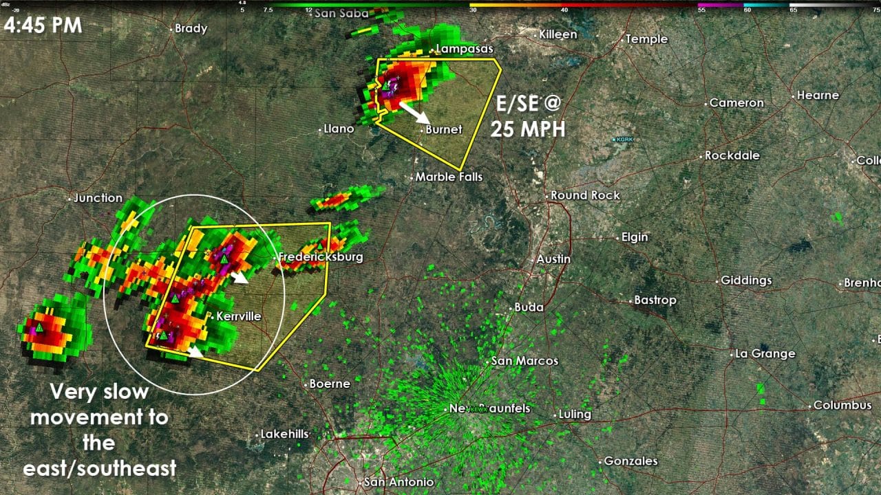
Severe thunderstorms have begun development in the eastern Hill country. At 4:45 PM there were two cells/clusters of interest. The northernmost cell was located a few miles northwest of Burnet. This cell is showing supercell characteristics which will enhance large hail potential. This storm could impact the city of Burnet over the next 30 minutes. Should it continue we’ll have to watch for a potential path towards the Austin metro after 6 PM. The second cluster of storms extends from Fredericksburg to Kerrville. This area of convection is moving more slowly to the east/southeast at 10 to 20 MPH. Hail up to the size of golfballs and localized damaging wind gusts over 60 MPH will be possible with that cluster. These two areas of storms should continue into the evening hours. Additional development further south and southwest is possible. Those storms would also have the possibility of becoming severe with large hail.


0 Comments