
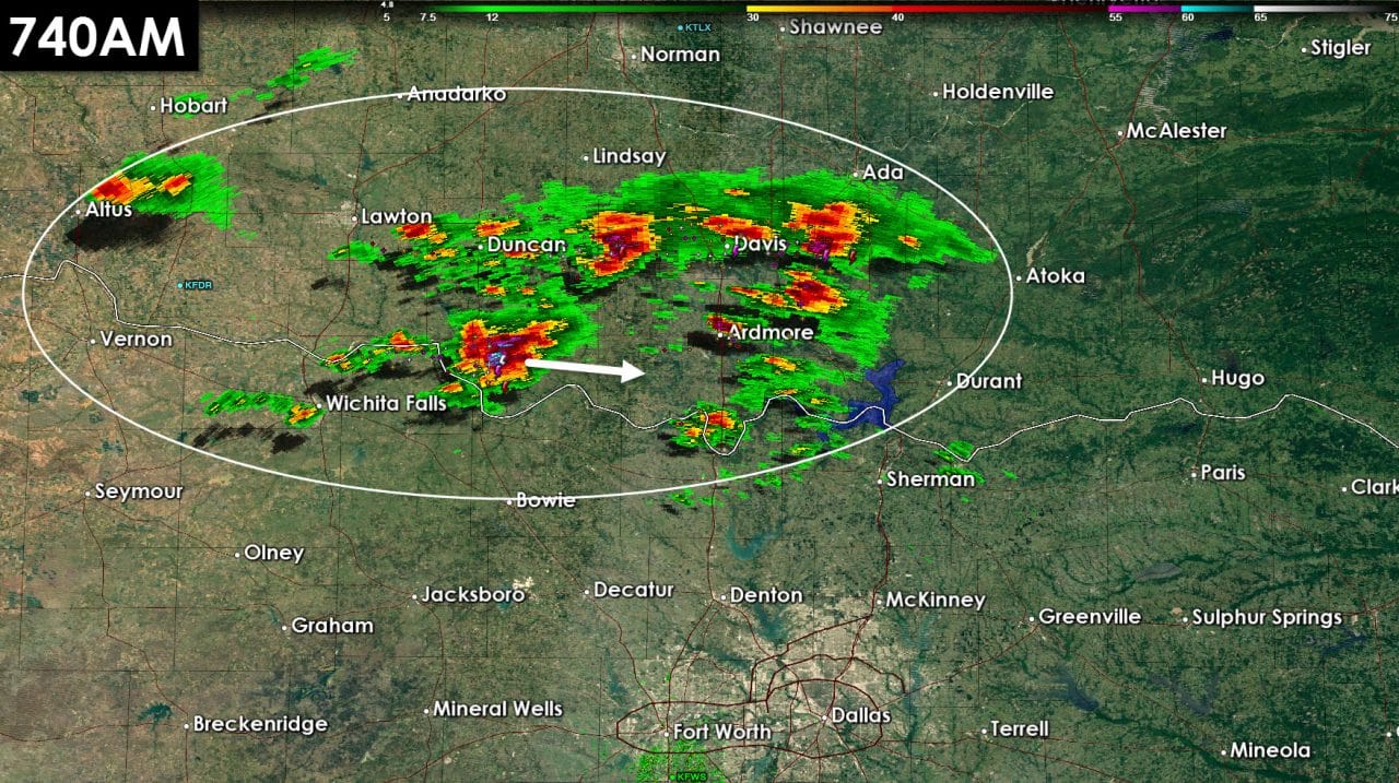
Thunderstorm initiation is underway across southern Oklahoma this morning. These thunderstorms are showing signs of intensifying and we could start to see a few severe warnings pop up soon for the possibility of hail. All the storms are moving east/southeast at 30 MPH. For the moment the most intense activity is north of the Red River. We do note that a shower has developed just south of Wichita Falls. Additional activity will likely fire up over the next hour along the Red River. The highest storm chances this morning will be across Northeast Texas. We’ll be watching for the storms in southern Oklahoma to move across the Red River into Northeast Texas in a few hours. Short-term model guidance suggests the best storm chances should remain just north and northeast of the D/FW Metroplex this morning. A few severe thunderstorms are possible with large hail. Like yesterday some hailstones could approach the size of golfballs. The Storm Prediction Center has indicated they are not expecting to issue a severe weather watch at this time. I wouldn’t be surprised if that changes a bit later this morning. All these storms are elevated above a stable layer near the surface. Tornadoes are not expected with this activity.


0 Comments