
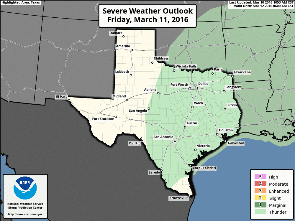
The persistent upper level low that’s been spinning over Mexico the past several days will finally begin to shift northward overnight…eventually phasing in with another low across northern Texas this weekend. A couple of pieces of energy out ahead of it will bring chances for rain again during the overnight hours tonight and through Friday. The rainfall this time will not be concentrated across southeast Texas, instead focusing across central and west central Texas overnight and across north central Texas by Friday afternoon. A frontal boundary that’s been sitting stalled across southeast Texas for the past couple of days will begin to move north tomorrow. As this boundary retreats and additional energy from the upper low moving into south Texas arrives, we could see an increase in rainfall across central and west central Texas…mainly areas south of I-20…by mid-day Friday. The frontal boundary will continue lifting off to the north/northwest through the evening hours bringing rain chances further into north central Texas by Friday evening. Moisture return and instability is still a bit questionable, so is surface heating which is needed to help generate instability, but it may be sufficient to see development of a few strong storms tomorrow afternoon across central Texas along and south of I-20 during peak daytime heating on Friday. At this time, it appears that gusty winds, frequent lightning and some small hail will be the main threats. But if we get some clearing tomorrow with better surface heating and instability, we could see a couple of storms reach severe limits. The Storm Prediction Center Severe Weather Outlook for tomorrow reflects the lack of confidence in seeing any severe weather with a less than marginal risk outlook for Friday.
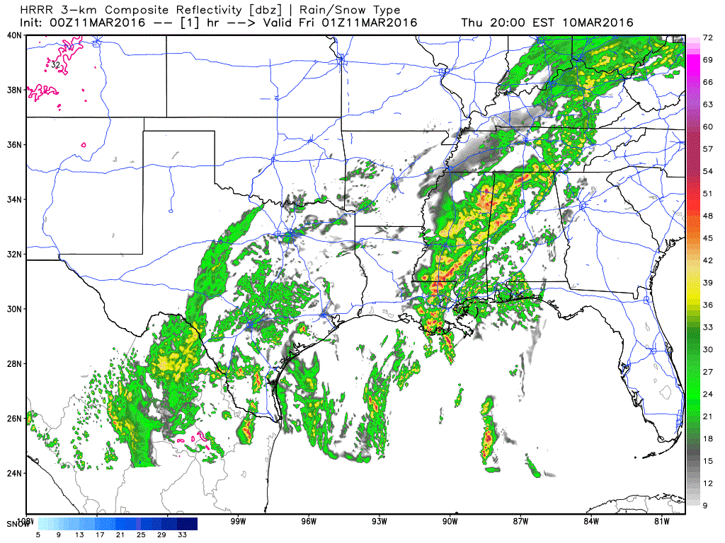
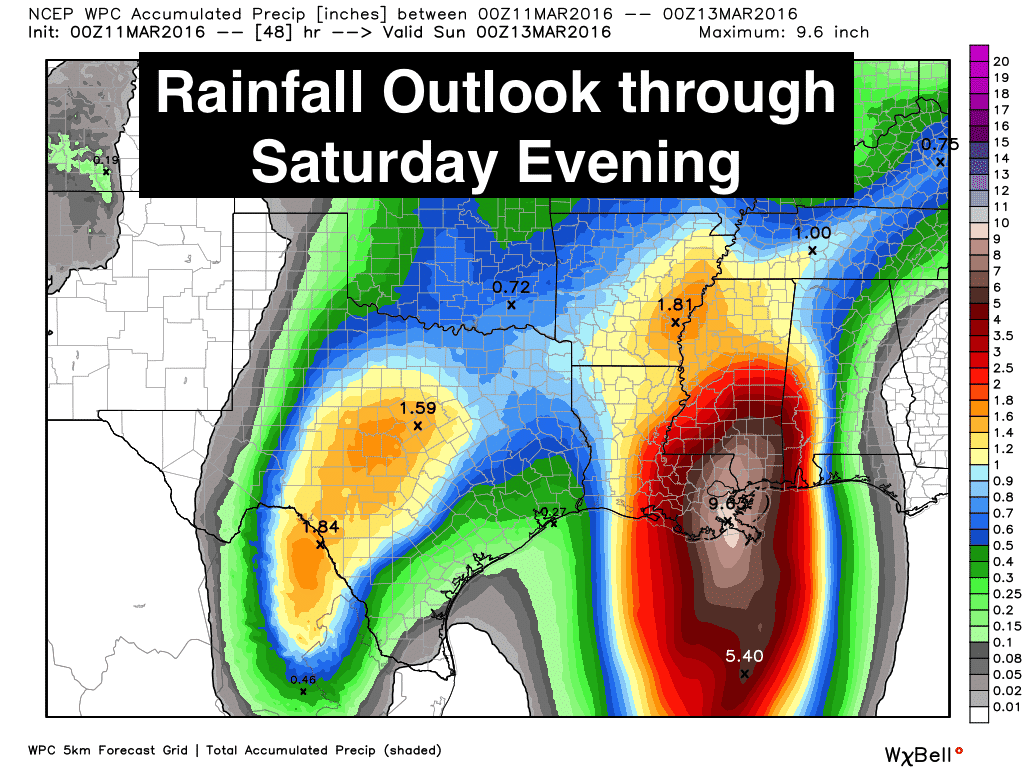
Here’s a look at simulated radar for tonight through 9am tomorrow, plus a look at additional rainfall accumulation expected through Saturday evening.
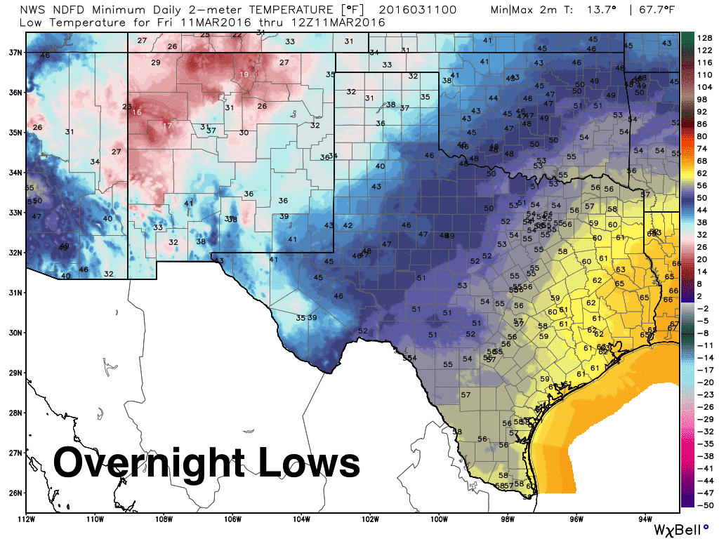
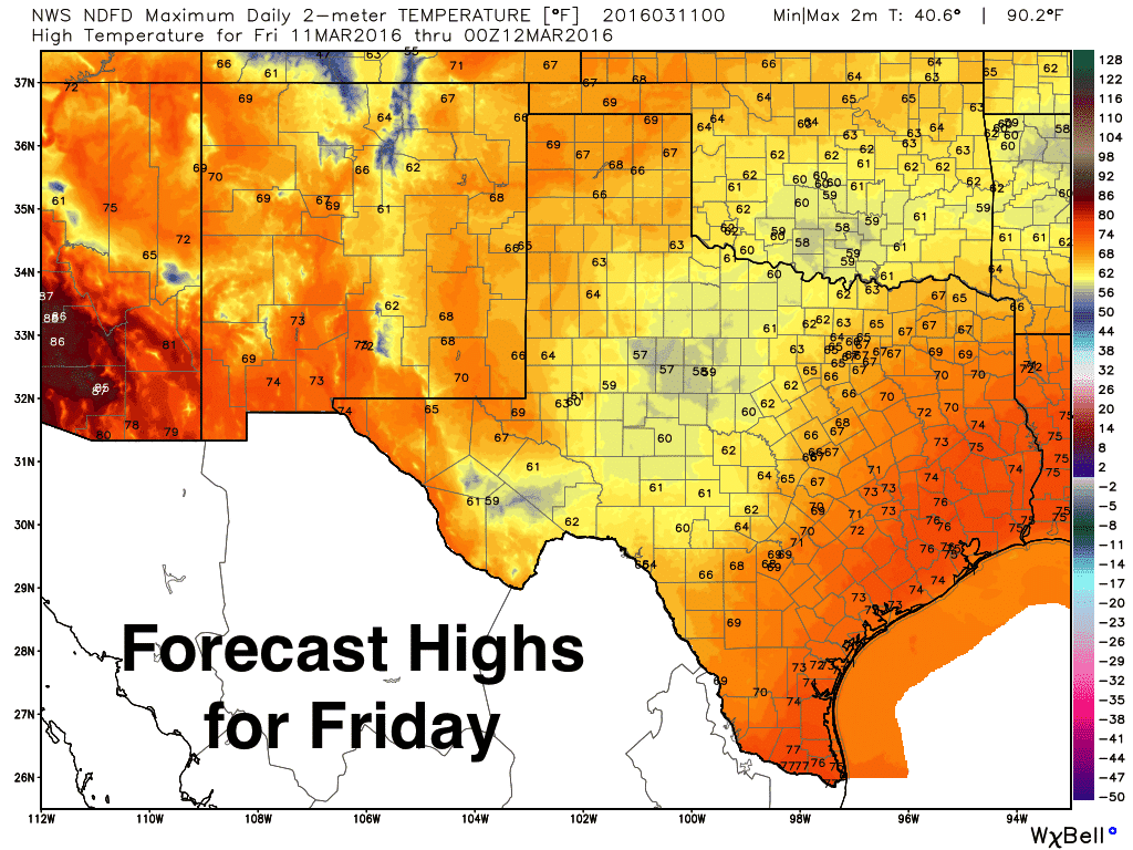
For the rest of the forecast, lows tonight will dip down into the 30s across parts of the panhandle, 40s across west Texas and western north Texas, 50s from north central Texas down into west central Texas, with 60s across east Texas, southeast and south Texas. Highs tomorrow will recover quickly into the upper 60s to low 70s across the panhandle. West central Texas will see highs only climb into the upper 50s to low 60s, and we’ll see a nice warmup across east and southeast Texas with highs tomorrow in the mid to upper 70s. Not bad at all!


0 Comments