
It may be December 12th according to the calendar, but mother nature seems to think it’s early spring with quite an unsettled forecast for today and overnight. Two rounds of rain and storms will impact the state over the next 24 hours along with heavy rain that could bring some flooding issues. Not everyone will be impacted by severe weather, so we’ll address today’s weather threats first in our blog, then return to the general forecast at the end of the blog.
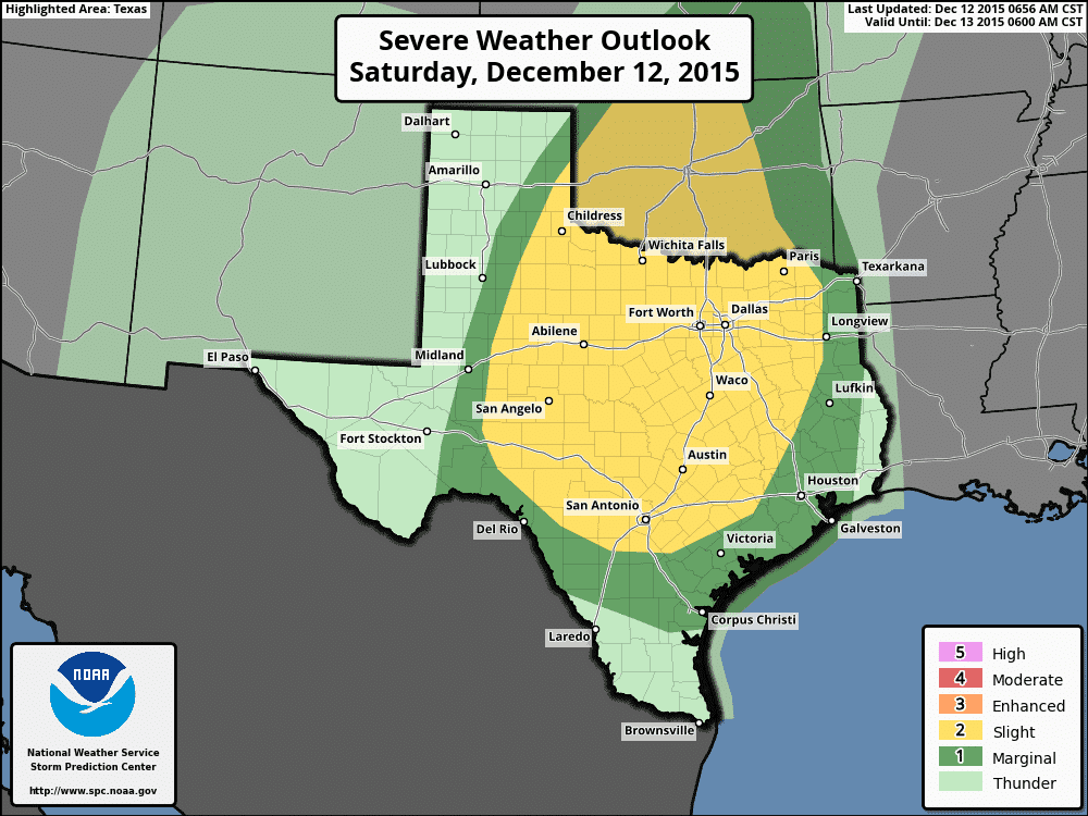
Severe Weather Threats – The Storm Prediction Center has maintained a rather large Slight Risk area across the region today with two rounds of rain and storms both having the potential to produce damaging winds and heavy rain. The first round is developing as I type, moving up from southwest to northeast across south central Texas. Heavy cloud cover already present across the central and eastern regions of the state is expected to somewhat limit instability levels this afternoon, but with strong dynamics in place overhead this afternoon, there remains a conditional threat for a few severe storms with strong winds as the main threat. The more significant round of storms is expected late this evening and during the overnight hours as a squall line of storms is expected to develop along the leading edge of the cold front as is moves east through the state. The highest level of instability values at that time are expected to reside across the rolling plains and northwest Texas where, depending on cloud cover and surface heating, could become moderately unstable by late afternoon with the potential for seeing a few isolated supercell thunderstorms developing out ahead of the squall line. These would carry the greatest potential for producing brief tornadoes along with hail up to 1 inch in diameter. Regardless of whether that happens or not, the squall line will carry its own threats of damaging winds, frequent lightning and very heavy rain as it marches east overnight. We will be up monitoring this overnight, so be sure to check back later for additional updates.
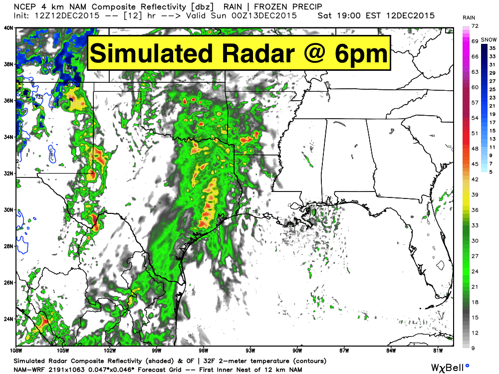
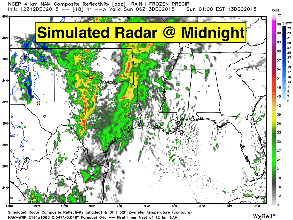
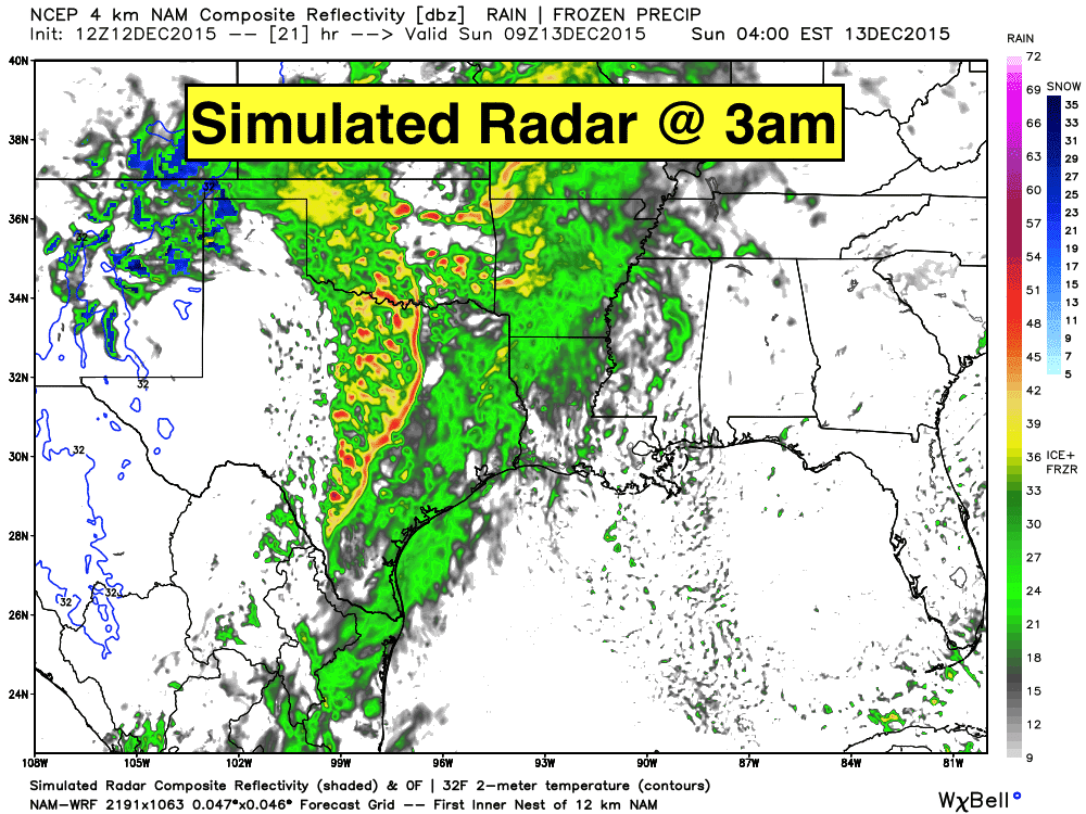
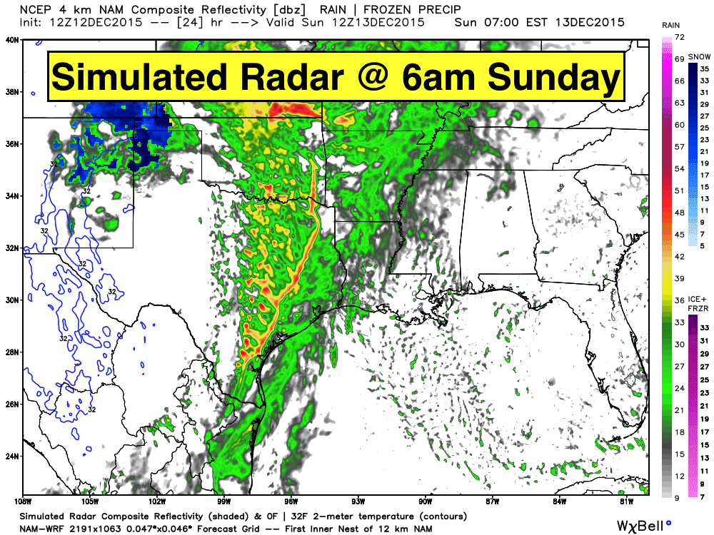
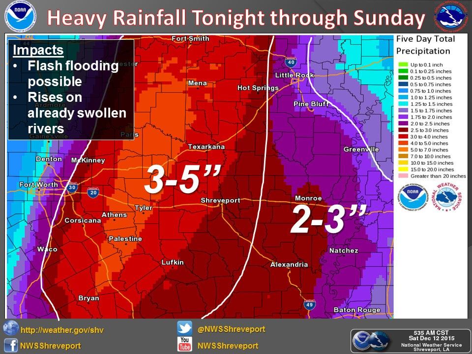
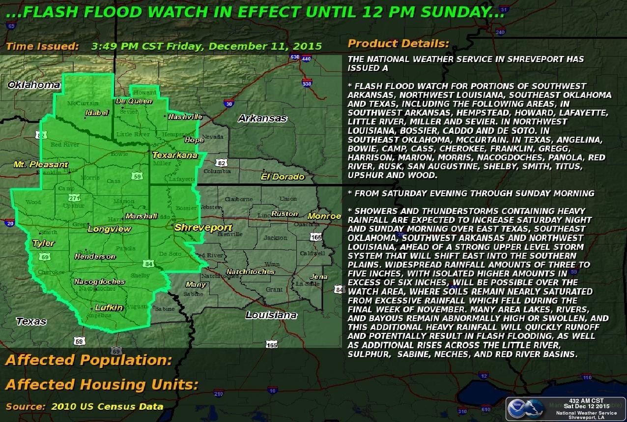
Heavy Rainfall – Training of storms across the eastern half of the state overnight and through Sunday will create the potential for flash flooding for parts of east central and northeast Texas. Highest rainfall totals between 3 – 5 inches, with some locally higher amounts, are expected to remain between Dallas and the Louisiana border. A Flash Flood Watch will begin this evening and remain in effect through Sunday morning. Anyone planning travel across this region overnight will need to remain extra cautious and allow extra time to reach your destination.
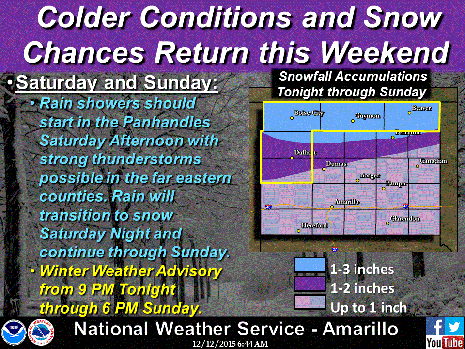
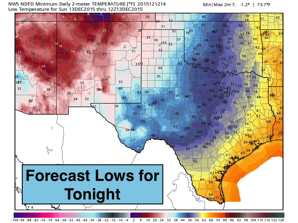
Winter Weather Threats – Rain this afternoon and evening across the panhandle is expected to transition over to snow tonight through Sunday. A Winter Weather Advisory will be in effect from 9pm this evening through 6pm Sunday. If you have stuff to do, get it done sooner rather than later to avoid having to face the typical snowy roadway hazards tomorrow. At this time, highest snowfall amounts are expected to remain north of the Amarillo area, but any change in the track of the storm overnight could alter these projections.
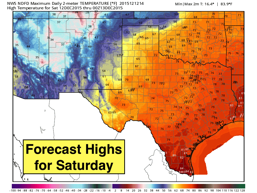
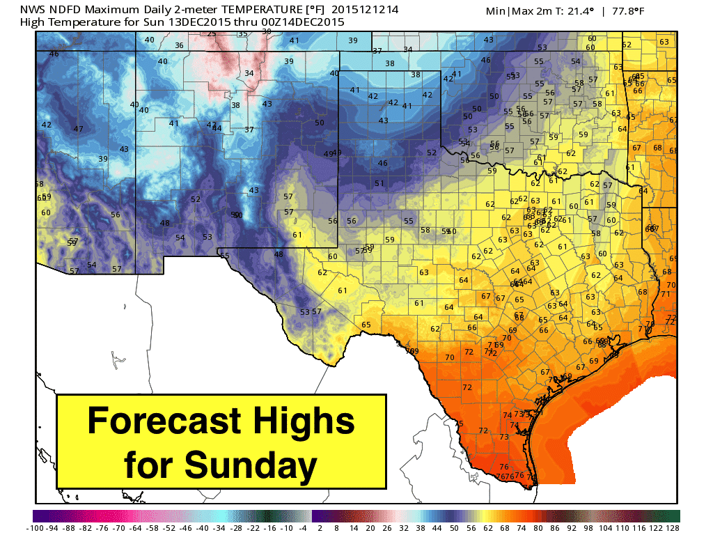
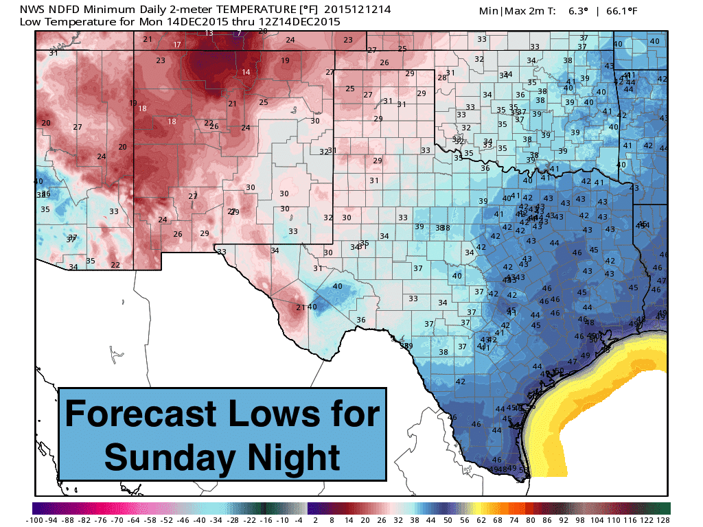
Everything Else – Winds will really pick up across western Texas this afternoon with the approach of a strong upper level system. Gusts upwards of 50mph will be likely especially around the Guadalupe mountain range and the Van Horn highway 54 corridor. Highs today…and even tomorrow behind the front…will remain a bit above average for this time of the year. Skies will be clearing out Sunday and we’ll have a nice start to the work week with no rain expected again until later in the week as our next upper level disturbance and cold front arrives.


0 Comments