
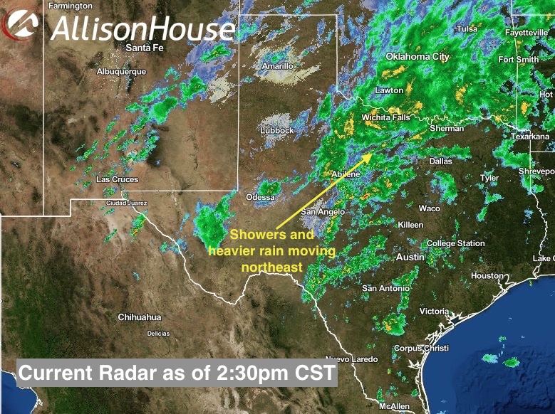
After a little lull in the heavy rainfall this morning across north Texas, mother nature is back at it again with additional batches of heavy rain moving up from the southwest and into the area. We continue to expect multiple rounds of rain…some quite heavy…today, tonight, Saturday and into Sunday before this system finally lifts out of the area by late Sunday. Here’s a look of what we’ve already seen over the past 24 hours, and a peek at what’s to come.
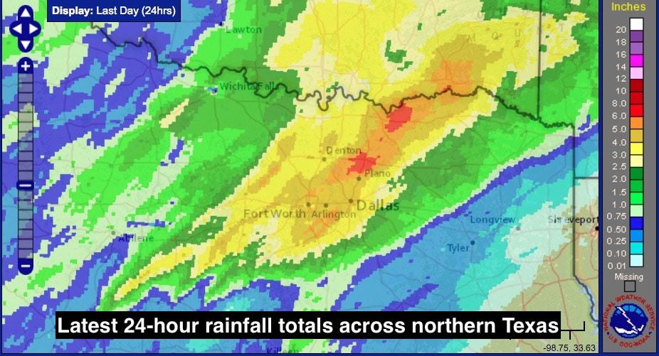
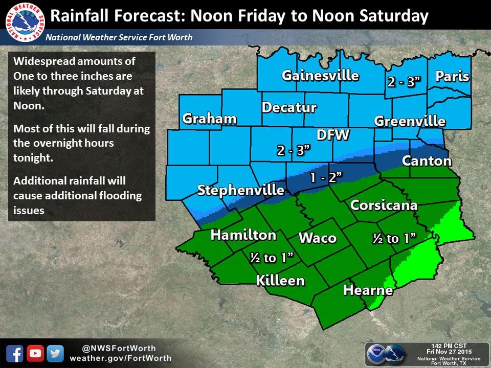
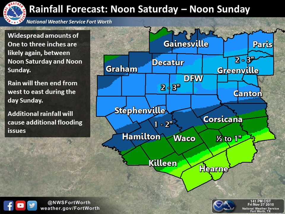
As you can see, we’ve already seen accumulations in excess of 4 to 6 inches across a large swath of the Dallas/Ft. Worth metroplex since yesterday. Local forecasters are calling for an additional 2-3 inches to fall…mainly north of I-20…through Noon on Saturday. Saturday afternoon and into Sunday, we will likely see another 2-3 inches across the DFW metro plus areas along and just south of I-20. Flooding issues will continue along creeks and rivers, even those downstream from where the heaviest rain is currently falling, so do keep that in mind if you’re out and about especially after dark.
Simulated radar through 3am tomorrow morning. Icing overnight will likely not extend as far east as predicted by this particular model; however it will be an issue across the panhandle and parts of far northwest Texas where temps are already below freezing and will stay that way overnight.

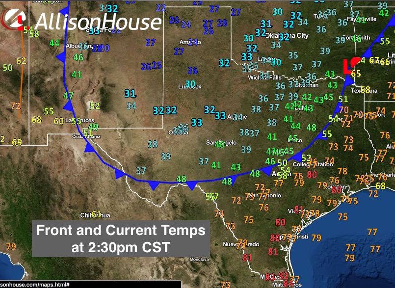
As for the cold front, it continues to slowly drift south and is expected to reach the middle and upper coast by late tonight. Temps ahead of the front across parts of south central Texas have reached the low 80s. Once the front moves through however, expect a quick and steady drop down into the 50s.


0 Comments