
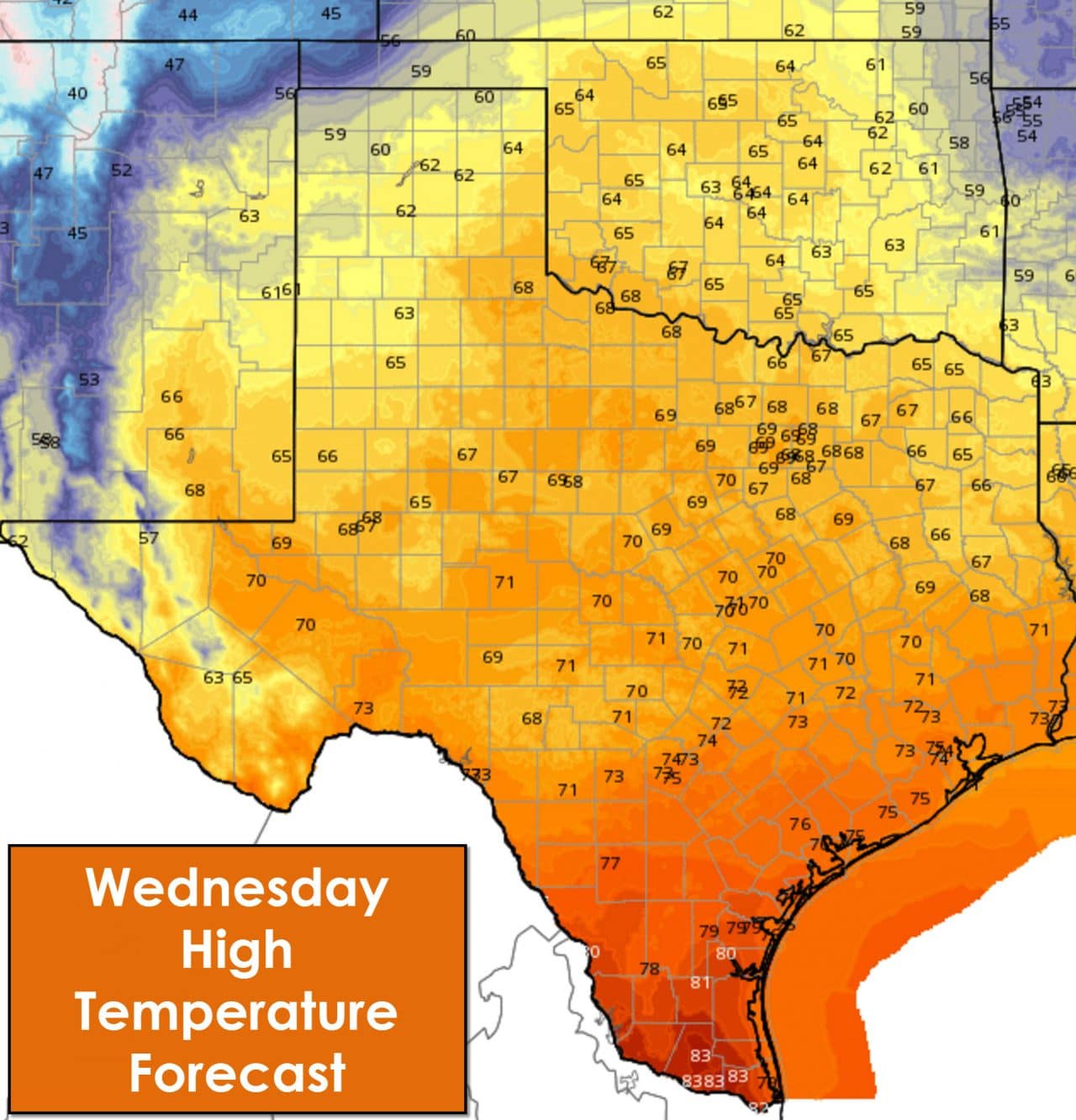
A great Wednesday is setting up! Not only is it hump day but the weather is looking lovely. Skies will be partly cloudy to mostly sunny statewide. High temperatures will be in the low 80s in the Rio Grande Valley and in the upper 50s in the Texas Panhandle. The Permian Basin, Hill Country, North Texas, East Texas, and South-Central Texas plus everyone in-between will enjoy temperatures in the upper 60s to low 70s this afternoon. These temperatures are a few degrees below average to right around where we should be for Mid-November.
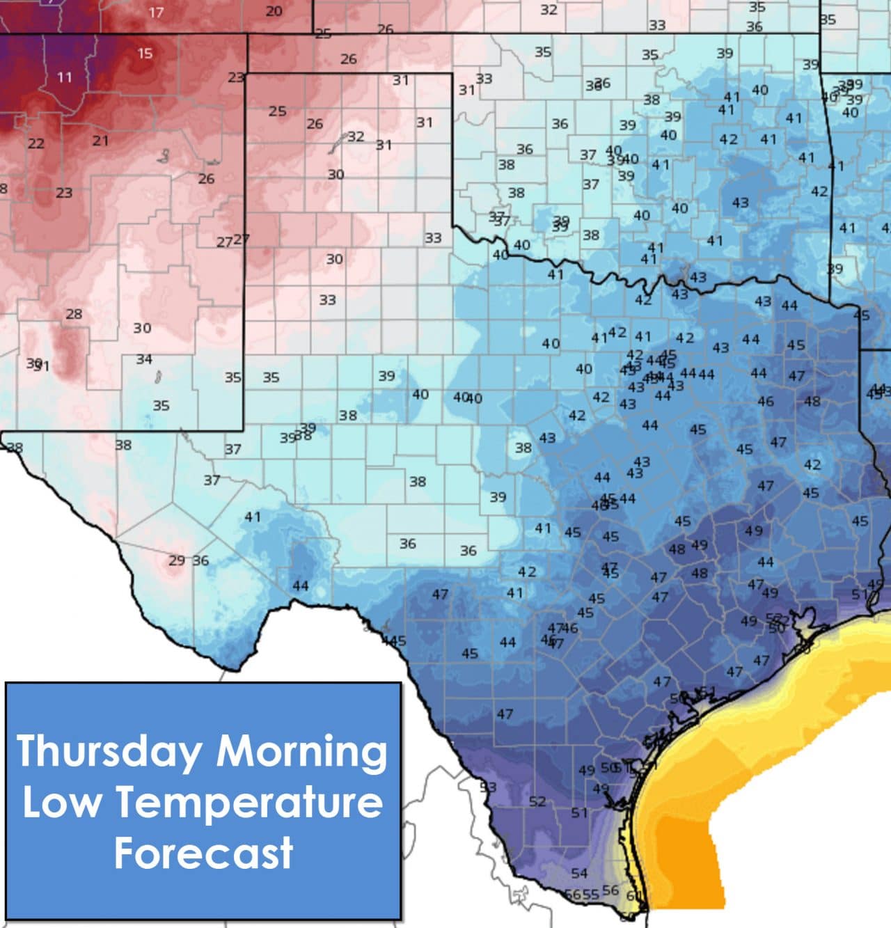
Tonight is going to be chilly across all of Texas. Even the Rio Grande Valley who typically see warmer temperatures will drop down into the 50s tonight. The northwest Texas Panhandle will be coldest with low to mid 20s. The remainder of the Panhandle south into the Rolling Plains and South Plains will experience a freeze tonight with upper 20s to low 30s. The Permian Basin, Concho Valley, and Big Country will drop into the 30s tonight. North Texas, Northwest Texas, and Northeast Texas will be in the low 40s. Central Texas, East Texas, Southeast Texas, South Texas will be in the 40s.
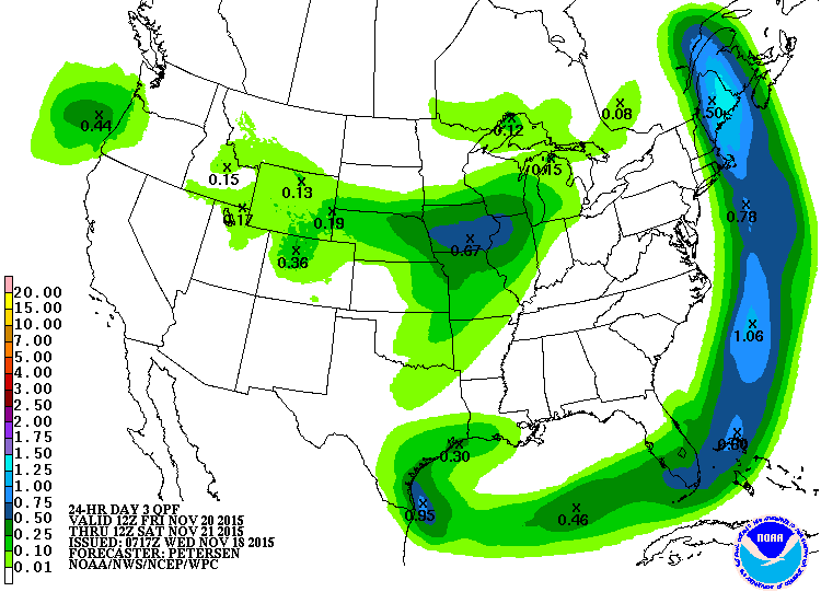
Possible rainfall totals on Friday and Friday Night
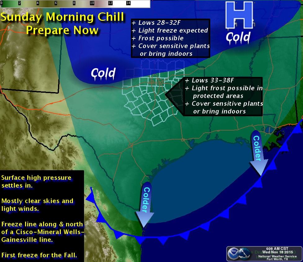

Our next cold front will push through Texas on Friday and Saturday. Sunday Morning will bring the coldest temperatures of the season thus far. A hard freeze is expected across the Texas Panhandle, South Plains, and Rolling Plains. Freezing temperatures are expected across Northwest Texas. That freezing line may push farther south but we’ll see how things trend in the coming days. Mid 30s and possibly frost are expected across the Permian Basin, Big Country, Concho Valley, North Texas, and Northeast Texas. East Texas and Central Texas will drop off into the upper 30s to low 40s. Southeast Texas and South Texas will also be chilly. The cold front will be mostly dry on Friday and Saturday but a few light showers are possible. Our next major storm system could bring a return to active weather right around Thanksgiving. Unlike Monday’s system this upcoming one isn’t as locked in for hazardous weather. Regardless rain/storm chances look to return in the Wednesday-Friday timeframe next week.


0 Comments