
It has been an incredibly busy morning across Central and South-Central Texas. Several tornadoes and catastrophic flash flooding are underway across Hays county. I’ll be honest when I say I was not expecting this type of activity this morning. Some locations across Comal and Hays counties have recorded a foot of rain this morning. This is an extremely life-threatening situation comparable to the historic flooding we saw in May. Many roads are closed and its only going to get worse. However with more areas of Texas expected to be impacted today lets go ahead and take a look at what we can expect through the afternoon.
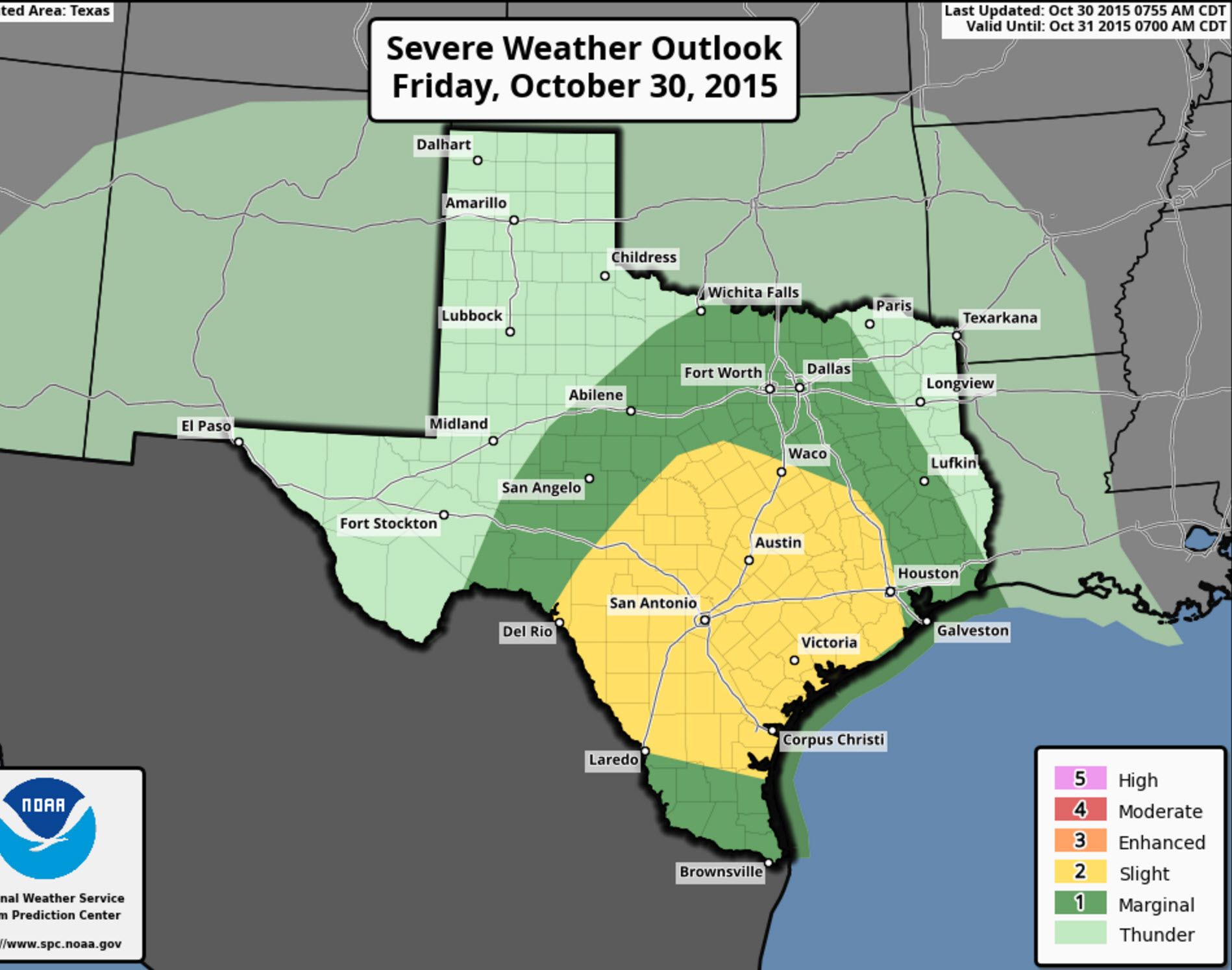
A level 2 possible severe weather risk remains in effect through the late afternoon hours across South Texas, Central Texas, and Southeast Texas. A level 1 marginal risk across the Concho Valley, North Texas, and portions of East Texas. The primary severe weather risk will be isolated tornadoes. As we’ve already seen the atmosphere is supportive of tornadic activity. As a warm front makes slow progress north we could see the severe weather threat also spread into more of Central Texas – like around Temple/Waco. For the past hour the front has stalled out around Austin which is helping to create extreme rainfall rates.
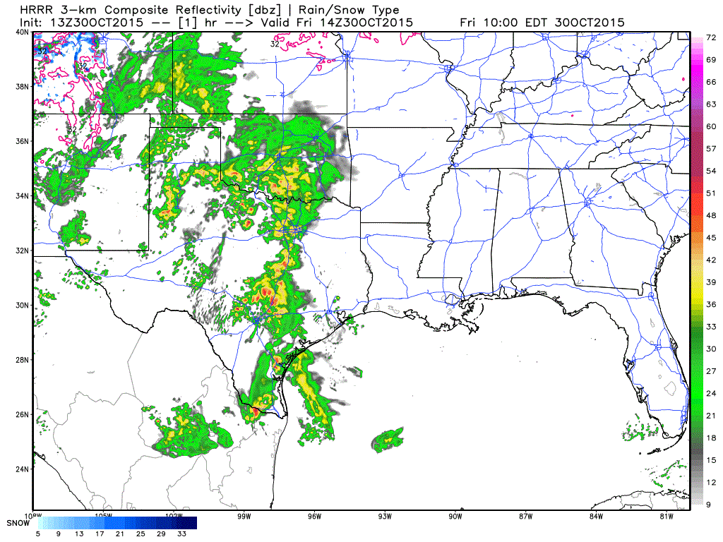
8 AM HRRR Weather Model simulated radar through this evening. Times are in eastern in top-right.
The High Resolution Rapid Refresh suggests additional thunderstorms will form this afternoon and evening across the Big Country and Concho Valley. That activity will move east towards Interstate 35 from D/FW south through the San ANtonio Metro. Some of these storms could be severe with the possibility of damaging wind gusts and a couple tornadoes. The overall severe weather threat will depend on what convection does through early afternoon. By far the most significant threat will be flash flooding. Parts of South Austin into San Marcos and Wimberly are receiving six inches of rain an HOUR. This has been going on for a while now. This is truely going to be a catastrophic and probably historic event for folks that just had to deal with flooding in May.


0 Comments