
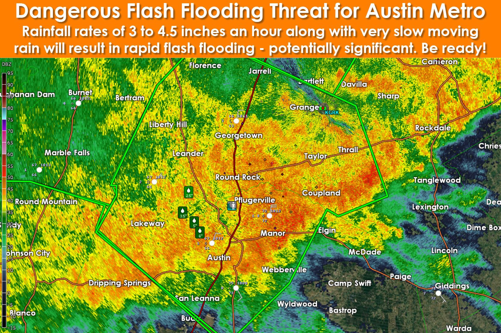
- Very heavy rainfall rates of 3 to nearly 5 inches an hour are falling across Williamson and Travis counties. These exceptional rain rates are due to a collision of cells. The convection is moving east extremely slowly thus the Austin metro is getting dumped on. Travel is strongly discouraged in Travis and Williamson Counties – including Austin, Pflugerville, Round Rock, Lakeway, Liberty Hill, and Georgetown (just to name a few). Dangerous flash flooding is expected and this has the potential to become a high-end flood problem through 7:30 AM.

- Widespread moderate to locally heavy rain continues to fall over the Hill Country, Central Texas, North Texas, and Northeast Texas
- Moisture from Hurricane Patricia is beginning to enhance moisture and lift across South-Central Texas. By this afternoon an area of low pressure across northern Mexico will move into Deep South Texas and the Rio Grande Valley. As the low organizes we’ll see heavier rain shift south out of North Texas into Central Texas, South-Central Texas, and the Rio Grande Valley. By tonight those rain chances will increase across the Coastal Plains and Southeast Texas. This is when the flooding event for those locations will begin.
- Debris flows and enhanced flooding potential is a threat with the Bastrop County burnscar from past fires.
- Widespread rain amounts will range from 2 to 6 inches today, tonight, and Sunday. Isolated totals up to 12 inches will be possible. It goes without saying that flooding will be a threat today.

Advertisements
- Moisture from Patricia and a developing low pressure in northern Mexico is resulting in an increase of thunderstorms across Deep South Texas and the Rio Grande Valley.
- Coverage will continue to increase this morning with locally heavy rain possible.
- Flash flooding is a concern and will likely become a threat as precipitation increases in coverage and intensity.


0 Comments