
After months of expectation and anticipation we can finally say the rain is on the way. An active period of weather across all of Texas is making for busy times. Since all of Texas is expecting rain at some point this week I’ve broken down this blog into rain chances, severe weather potential, flood risk, and the overall temperature trends. As always there is some uncertainty in the forecast so you can expect refinements during the event. All of that said lets get down to it!
Day by Day breakdown on Rain Chances
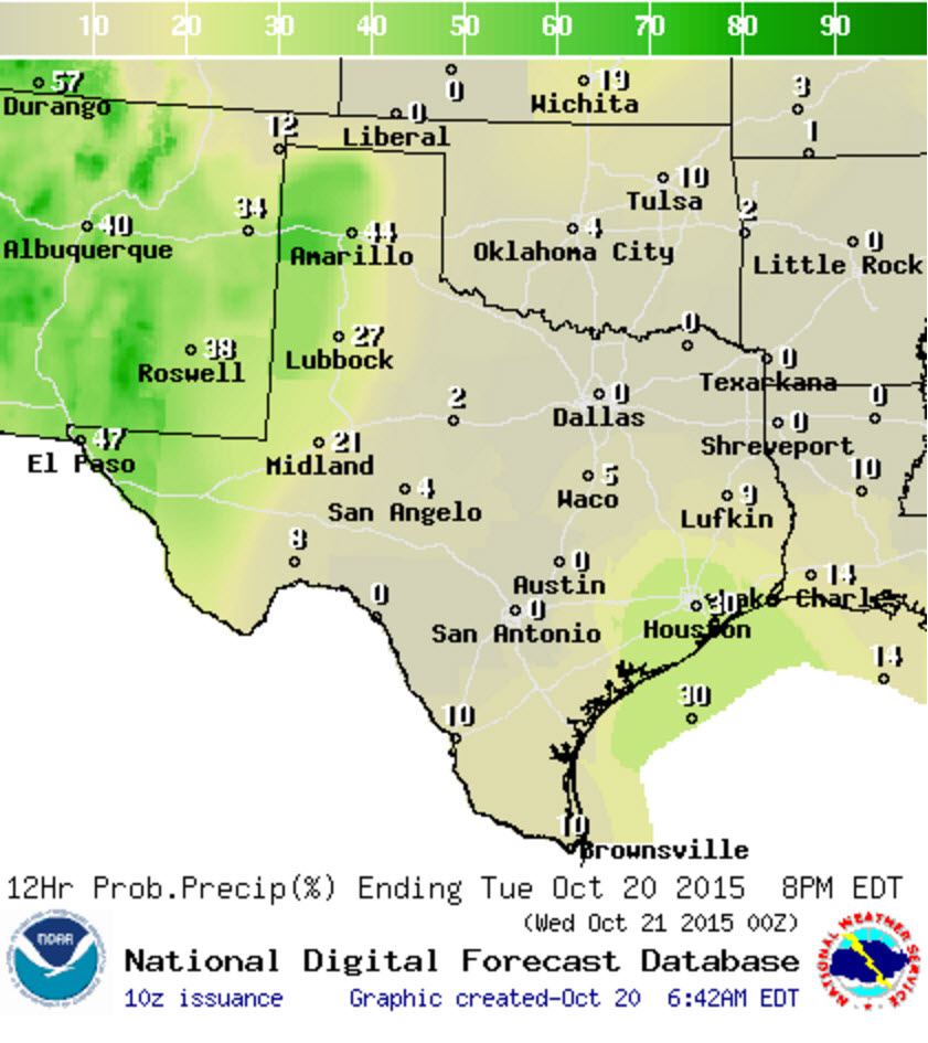
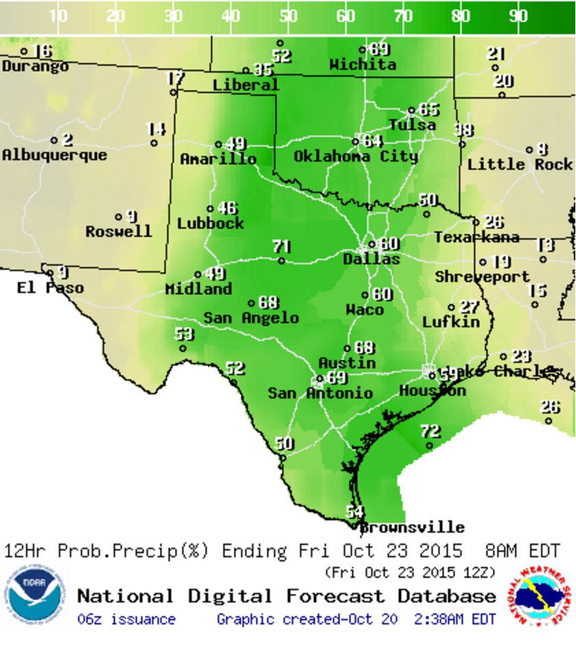
Chance of rain/storms Today

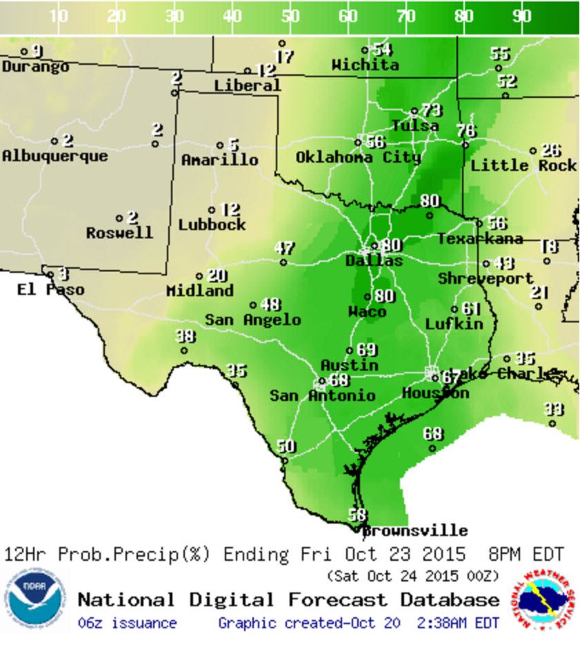
Chance of rain/storms Tonight
A few coastal showers are possible in Southeast Texas this afternoon. Otherwise we’ll be looking out west for the beginning of our rain event across Texas. Scattered showers and thunderstorms are expected across Far West Texas, the Permian Basin, the South Plains, and the western two-thirds of the Texas Panhandle. By tonight activity will become widespread across the far western Texas and the New Mexico/Texas border in the South Plains into the Texas Panhandle.
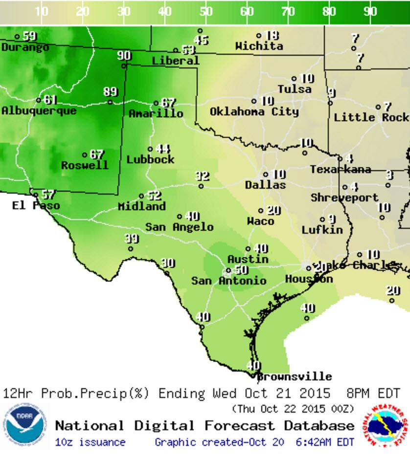
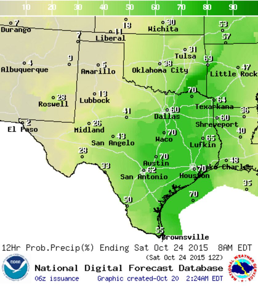
Chance of rain/storms Wednesday
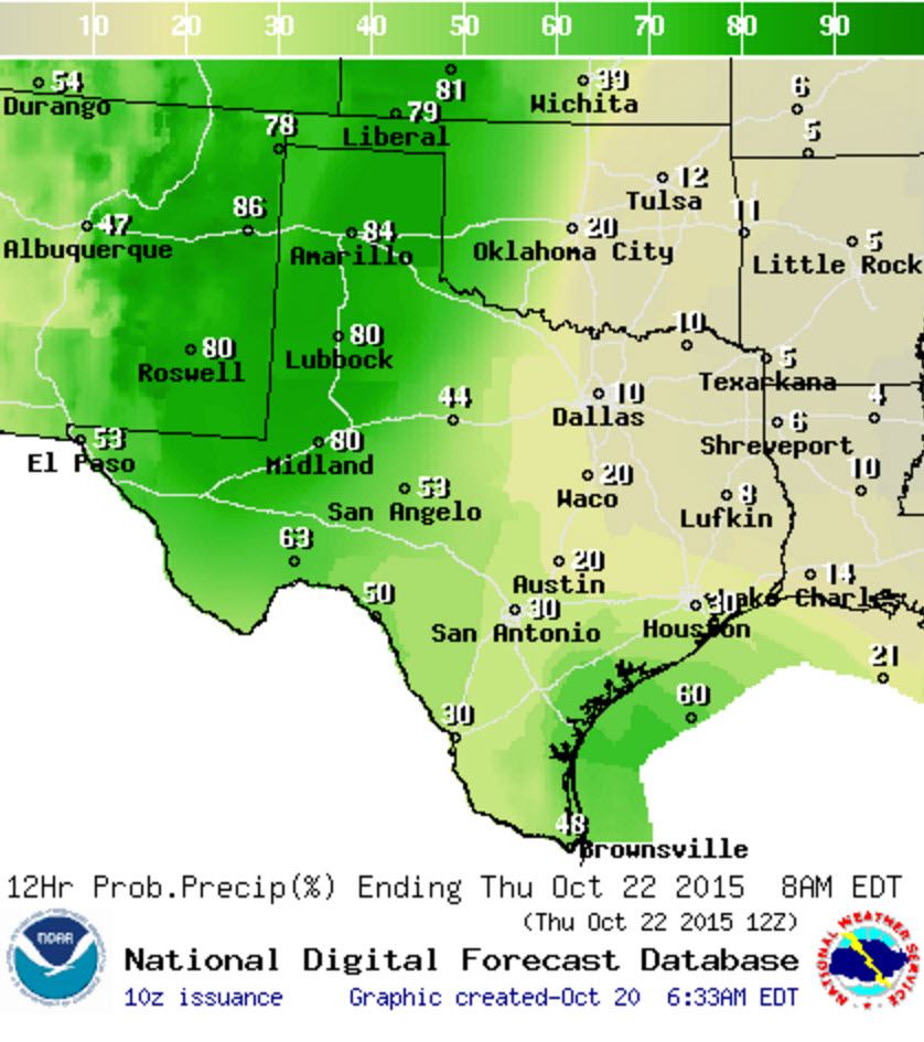
Chance of rain/storms Wednesday Night
Scattered showers and storm chances will spread east on Wednesday to include the Concho Valley, Big Country, South-Central Texas, South Texas, and the Rio Grande Valley. Numerous showers and storm chances will continue for the Texas Panhandle and Far West Texas. Widespread activity will continue Wednesday Night across the Texas Panhandle, South Plains, Northwest Texas, Permian Basin, Far West Texas, and Southwest Texas.
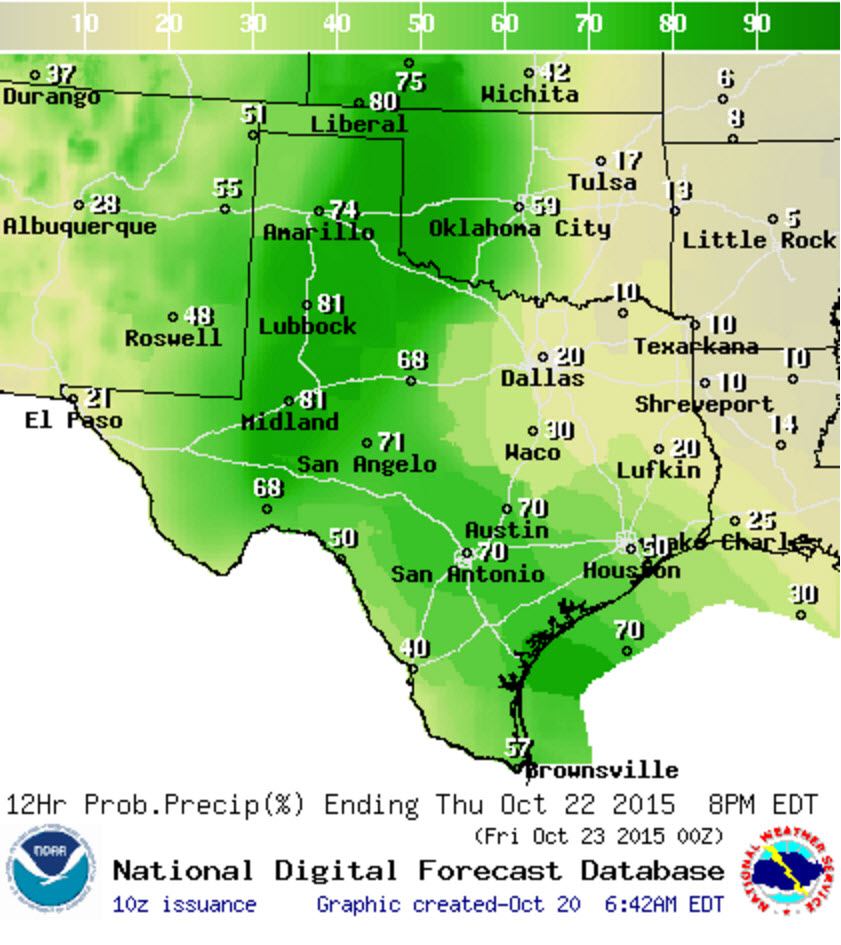
Chance of rain/storms Thursday
Chance of rain/storms Thursday Night
Widespread/numerous showers and storms will continue on Thursday across the Texas Panhandle, Northwest Texas, Big Country, Concho Valley, Permian Basin, South PLains, Southwest Texas, and South Texas. Scattered activity is forecast across North Texas, Central Texas, Southeast Texas, and the Rio Grande Valley. Numerous showers/storms will spread east into North Texas, Central Texas, and Southeast Texas in addition to previously mentioned areas Thursday Night.
Chance of rain/storms Friday
Chance of rain/storms Friday Night
Friday is going to be very wet across North Texas, Northeast Texas, East Texas, Southeast Texas, Central Texas, South-Central Texas, the bIg Country, Concho Valley, South Texas, and the Rio Grande Valley. Those rain chances will continue into Friday Night. By Saturday we should start to see activity diminish in coverage west of Interstate 35 – but it does look wet for some of the football games. We’ll detail the rain chances for the weekend once we get closer.
Forecast Rain Totals
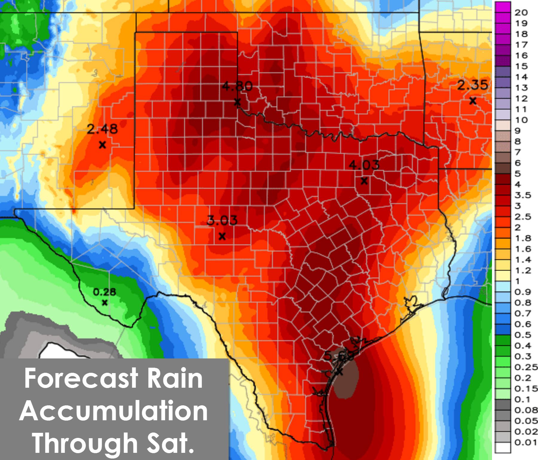
The latest rain total forecast through Saturday from the Weather Prediction Center continues to show a statewide precipitation event. Widespread rain accumulations of 1 to 4 inches are expected across all of Texas. The only exception may be far Southwest Texas where lighter totals are forecast. Localized rain totals over 5 inches are possible but those exact spots cannot be accurately forecast until we’re within 24 hours (at best). This is going to be our best/most widespread rain event since Tropical Storm Bill back in June and I expect everyone in Texas to get rain by the time this event concludes this weekend.
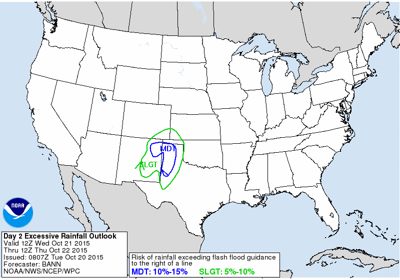
Flash Flood Potential for Wednesday
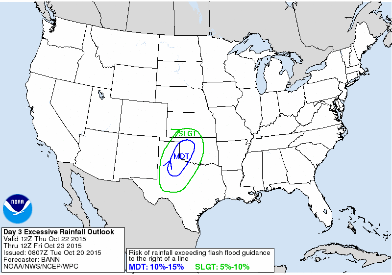
Flash Flood Potential for Thursday
Flash flooding is a possibility across the Texas Panhandle, South Plains, Permian Basin, Rolling Plains, Concho Valley, Big Country, Northwest Texas, and North Texas based on the current outlook from the Weather Prediction Center. Folks out in the Permian Basin and West Texas saw a good rain event about two weeks ago while locations further east haven’t seen diddly squat in weeks to months. The flood threat will continue to be evaluated but with very dry conditions its going to take quite a bit of rain to start up the flooding again. Obviously if we see very heavy rain in a short period of time the dry soils will only help so much.
Severe Weather Threat
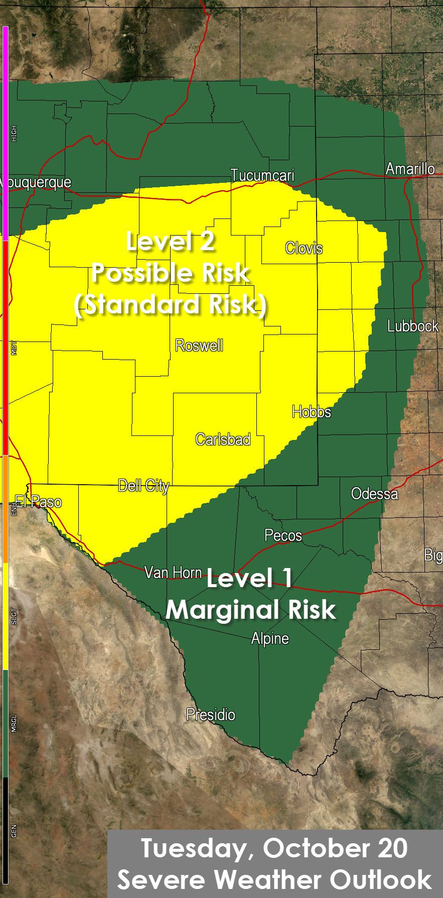
Severe Weather Outlook for Today
An adequate combination of wind shear and instablity will be present today to support the possibility of a few severe thunderstorms across the South Plains, Permian Basin, and Far West Texas. The Storm Prediction Center has placed a level 2 severe weather risk for Southeast New Mexico, Far West Texas, and western parts of the South Plains. A level 1 marginal risk includes Southwest Texas, the Permian Basin, and the western half of the Texas Panhandle and South Plains. The strongest storms today could become supercellular with large hail and localized damaging wind gusts. One or two tornadoes cannot be ruled out but the tornado threat is on the low-end of the spectrum.
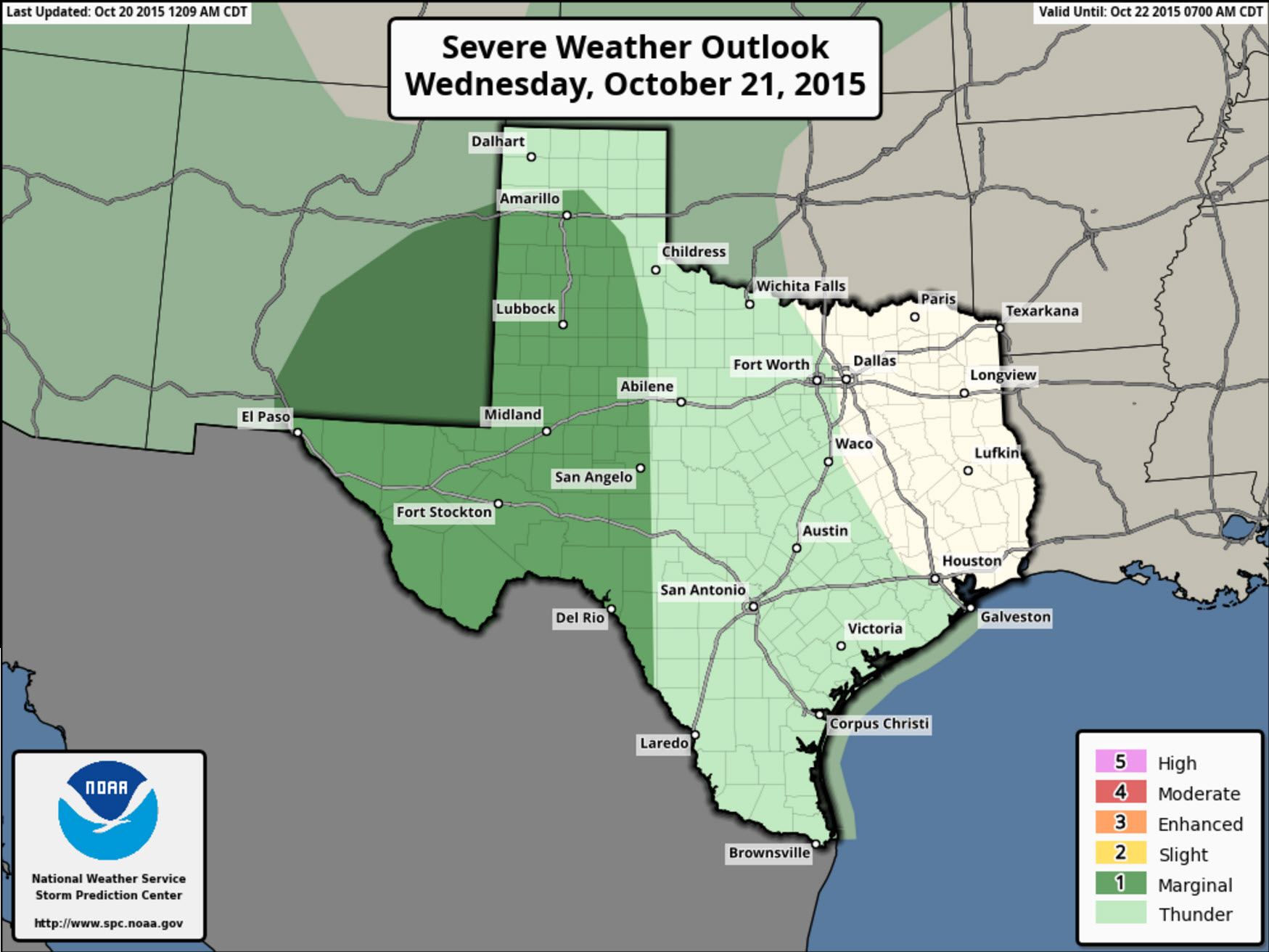
Severe Weather Outlook for Wednesday
A marginal severe weather risk is in place for Wednesday across the Texas Panhandle, South Plains, Permian Basin, Far West Texas, and parts of the Big Country. Wind shear will be supportive of some organized thunderstorms but widespread cloud cover and precipitation are currently forecast to keep the atmosphere only marginally unstable. As we get closer and localized corridors of instablity become more clear we may see part of the risk area upgraded to a level 2/possible risk in later outlooks. Hail and localized damaging winds would again be the primary issue along with a low tornado threat.
Temperatures
Temperatures will be seasonal during the precipitation event. We likely won’t see much variation in day/night temperatures due to the widespread clouds and precipitation. High temperatures will top out in the upper 60s to mid 80s this week once we get rain going. Locations that are not receiving rain at times this week will be warmer with 80s.


0 Comments