
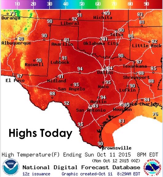
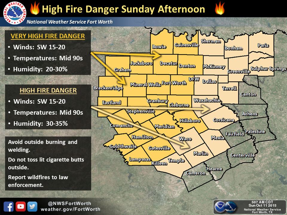
We have a hot, breezy and dry day in the forecast with near record highs expected. Winds will veer from the south to southwest today and carry abundant warm air up from the southwest. With high pressure continuing to sit on top of us, temps will soar into the 90s today…a good 10+ degrees higher than they were for some parts of northern Texas yesterday afternoon.
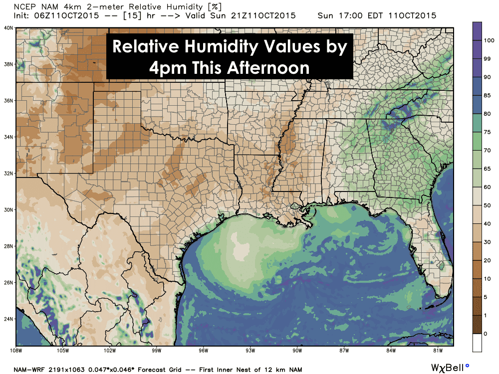
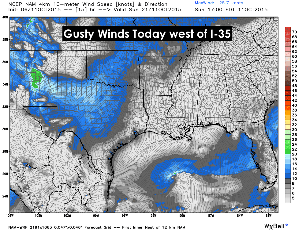
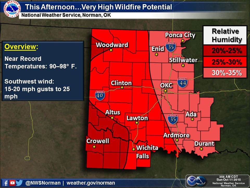
Humidity levels will drop down into the 30% range this afternoon. That coupled with much higher than normal temperatures, gusty winds and the lack of rain across parts of north Texas will lead to elevated wildfire conditions through Monday. Please be extra careful with anything that could cause a spark or flame…that includes tossing cigarette butts out the window. If you plan to do any outdoor camping or cooking this holiday weekend, click here to see if your county is currently under a burn ban: http://tfsfrp.tamu.edu/wildfires/DecBan.png
Lows tonight will range from the 50s to 60s across much of the state. Cooler across the western zones due to less humidity expected overnight.

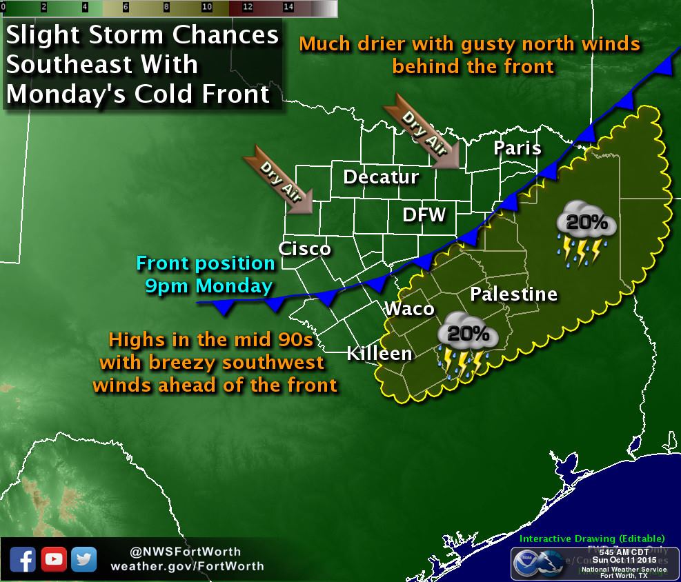
Looking ahead…we’re still expecting a weak cold front to arrive tomorrow which will help to ease temperatures back into the 80s for the next several days. Still above where we should be at this time of the year, but that’s at least better than seeing mid 90s all over the map in mid October. Rain chances, unfortunately, continue to look very slim for the foreseeable future. We could see a few showers and thunderstorms develop ahead of the front Monday into Tuesday mainly south of the DFW metro area and towards the coast, but accumulations are expected to be less than 1/10 inch for most. Prospects of a decent cold front arriving anytime soon are also slim. We are still on track for a strong El Nino pattern this Fall and Winter with increased rain chances and cooler weather in store for Texas. We should begin to feel its impacts by late fall (November-December) and on into January through March. The latest El Nino blog has some interesting statistics on how much of an impact El Nino has on rainfall amounts that you can read about here: https://www.climate.gov/news-features/blogs/enso/october-2015-el-ni%C3%B1o-update-pumpkin-spice


0 Comments