
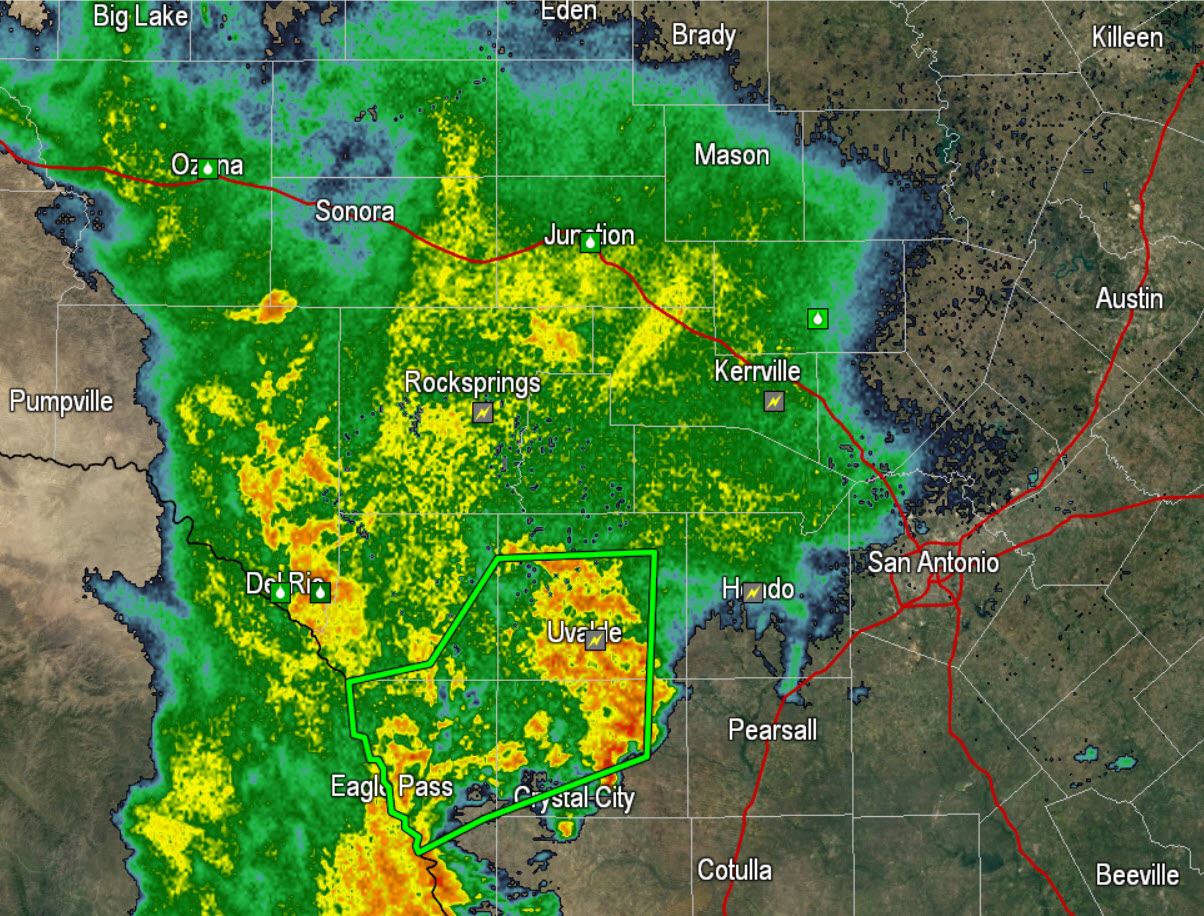
Five to nearly ten inches of rain in some locations fell across the Rio Grande Plains overnight. Significant flooding was reported in Eagle Pass and Uvalde where numerous roads are underwater. The focus of heavy rain was helped by the development of a Mesoscale Convective Vortex (MCV). The MCV created lift and helped widespread rain flourish overnight. Shortly after 6:30 AM this MCV, an area of spin, was near Uvalde. Weakening of precipitation intensity will continue this morning as the rain moves east towards South-Central Texas. Light rain is possible in San Antonio over the next couple of hours.
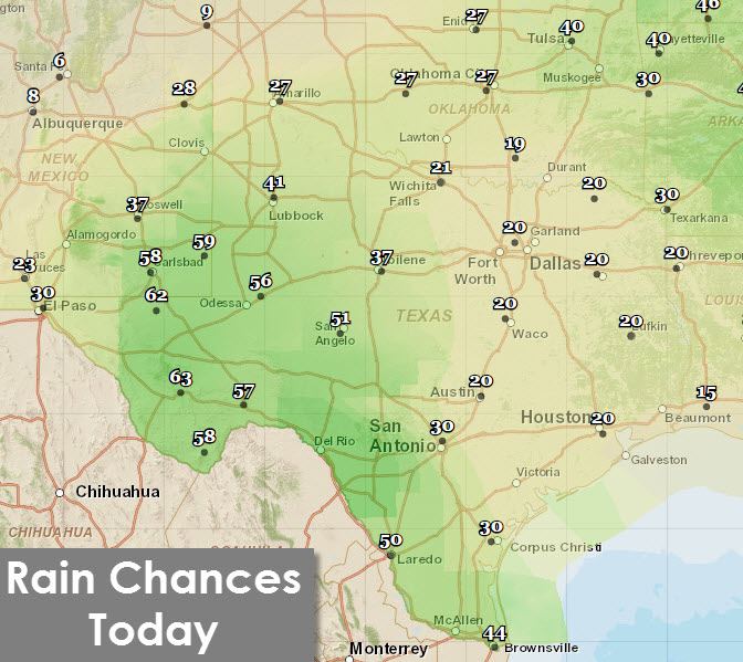
Scattered to numerous showers and thunderstorms are forecast today across the Edwards Plateau, Permian Basin, Concho Valley, and South Texas. While I don’t expect the heavy rains we saw overnight an upper level low located well to our west still has enough of an influence to help develop activity today. Isolated showers are possible across the Texas Panhandle, Northwest Texas, North Texas, and Northeast Texas today as a weak frontal boundary moves south across the Red River.
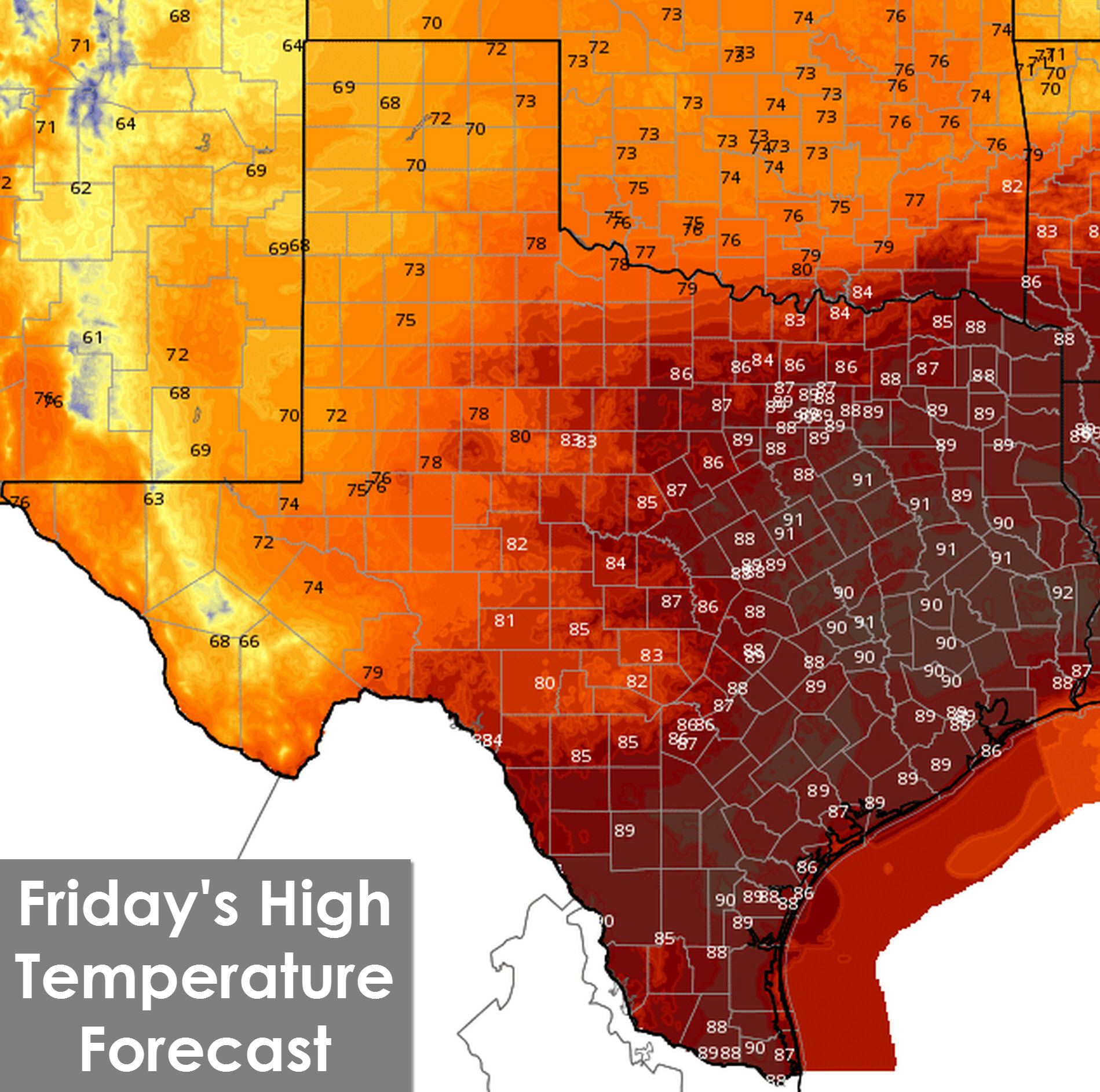
High temperatures across Far West Texas, the Permian Basin, Big Country and COncho Valley will remain in the 70s to lower 80s today thanks to cloud cover and rain chances. Most of the state will experience partly cloudy to mostly cloudy conditions today. The clouds won’t be enough to keep the Interstate 35 and 45 corridor out of the upper 80s to lower 90s. The Panhandle, Northwest Texas, and Texoma will enjoy cooler temperatures today with upper 70s to lower 80s thanks to the frontal boundary moving near or south of the Red River.
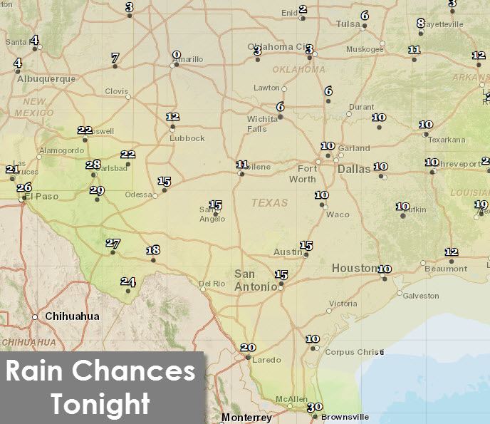
For tonight we’ll see an end to most convection across Texas. Low rain chances will persist across Far West Texas, Southwest Texas, and the Rio Grande Valley overnight. Everyone else will remain dry for the Friday Night Lights.
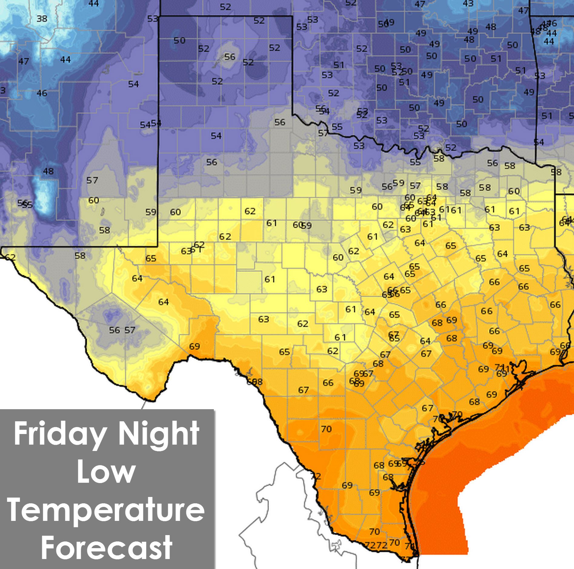
The overnight temperature forecast clearly reflects the position of a weak frontal boundary. North of the front temperatures will fall back into the upper 40s to 50s across the Texas Panhandle, West Texas, Northwest Texas, the Red River Valley, Texoma, and Northwest Texas. Those along Interstate 20 from Midland east through the D/FW Metroplex to Longview will notice more seasonal overnight temperatures around 60 degrees. Southeast Texas, South Texas, and the Rio Grande Valley will be annoyingly warm overnight with low temperatures in the upper 60s to lower 70s.
For football fans planning on being out on Saturday I expect dry and mostly sunny conditions across Texas with 80s by the afternoon. It won’t be ridiculously hot but there will be a bit of warmth by the afternoon. At least it won’t be freezing cold and foggy out. That kind of weather arrives next month. 🙂


0 Comments