
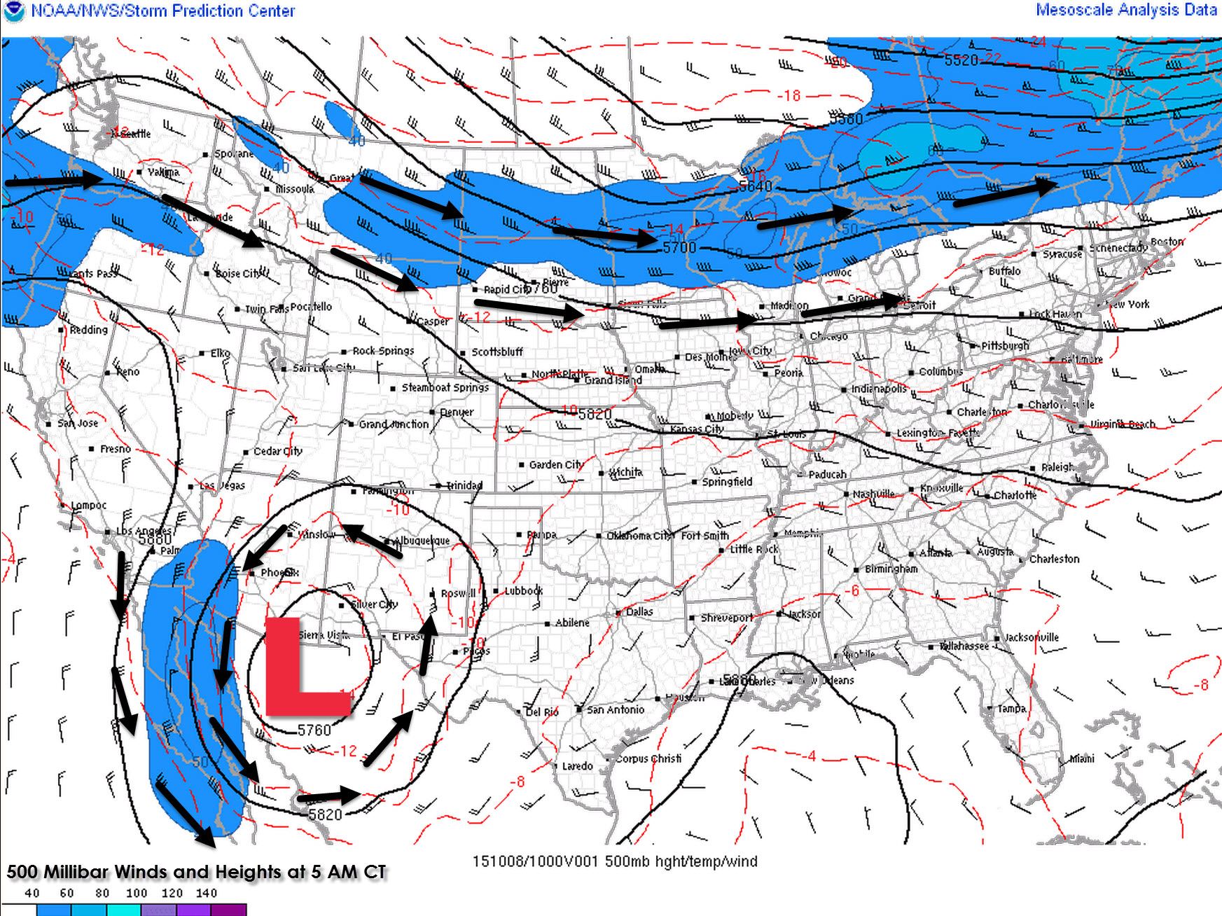
I’m not a meteorologist but as someone who writes about the weather on a daily basis I can say it has not been a particularly good week for me. This morning an upper level low is sitting over northern Mexico or near the Arizona/New Mexico border. A few days ago the Global Forecast System (GFS) had this low sitting over Far West Texas while the European weather model seemed to do better with the low’s position. Regardless with the low considerably farther west than what we hoped for the rain chances for the eastern two-thirds of Texas have evaporated. The low has begun to move slowly to the south and will actually retrograde west by the weekend. The ridge is returning to Texas with temperatures climbing back to well above-average values for October. Say goodbye to fall for at least a week because the 90s are back.
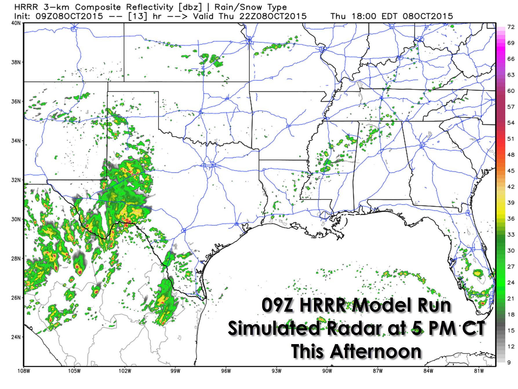
Most of Texas is missing out on the rain but Far West Texas, the Permian Basin, South Plains, and parts of Southwest Texas are getting rained on this morning. Those rain chances will continue throughout the day and into the overnight hours tonight. Marginally severe thunderstorms are possible around El Paso again but instablity values are lower than they were on Wednesday. The Weather Prediction Center is forecasting an additional half inch to 2 inches of rain across the Permian Basin through Friday. Isolated totals up to 3 inches will be possible. Localized flooding can be expected where the heaviest rains fall today or where we saw heavy rain last night.


The High Resolution Rapid Refresh (HRRR) shows widespread shower and thunderstorm activity this afternoon across the Permian Basin into western sections of the Big Country and Concho Valley. Scattered activity will be possible across the South Plains, Deep South Texas, and the Rio Grande Valley as well. Look on the positive side – at least temperatures will be kept down by the clouds in those areas. The rest of Texas won’t be so lucky.
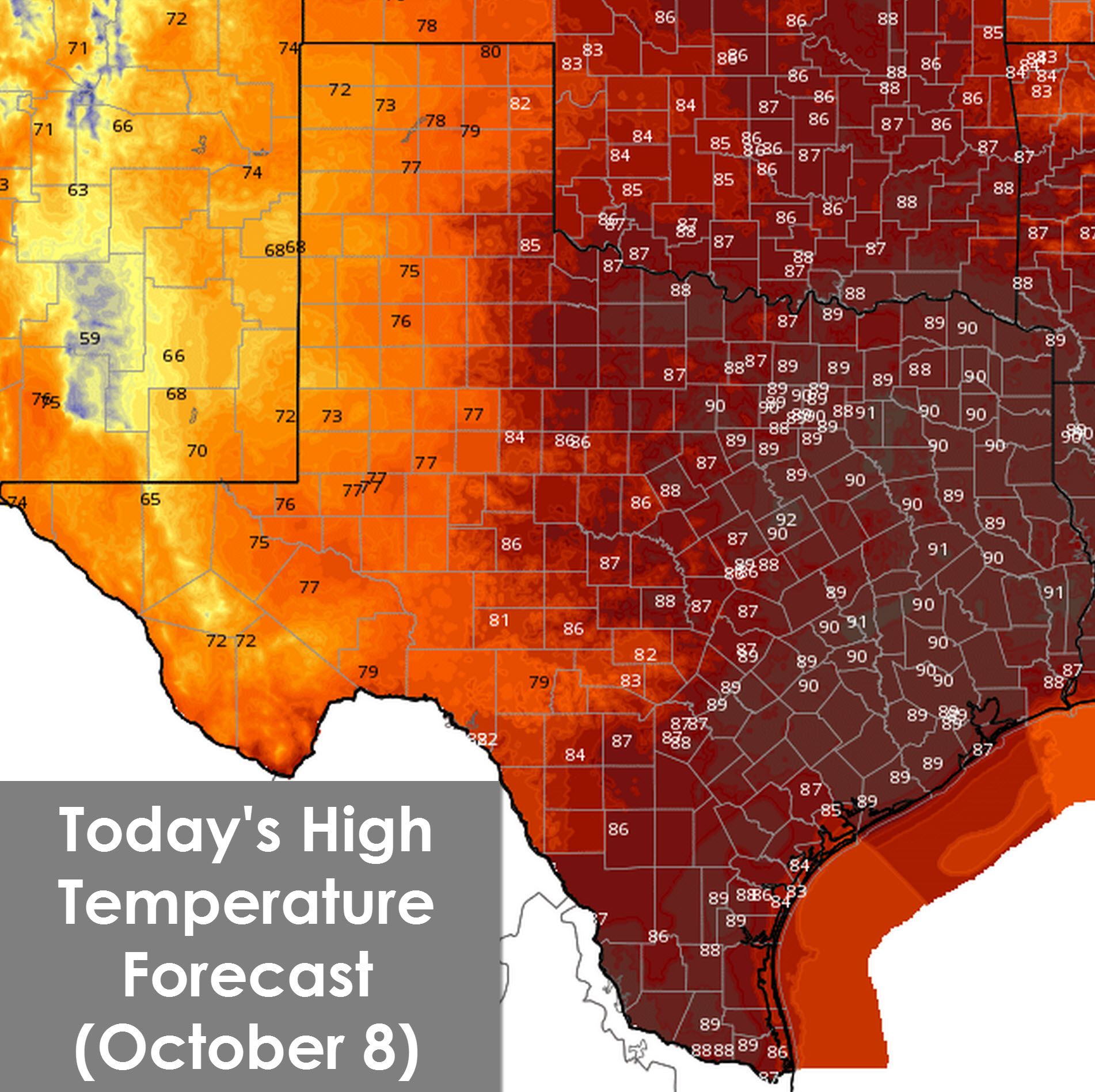
With more rain expected today temperatures will remain in the 70s across West Texas, the Permian Basin, and Far West Texas. Northwest Texas, North Texas, Northeast Texas, East Texas, Southeast Texas, Central Texas, and South-Central Texas into the Rio Grande Valley will climb into the upper 80s to lower 90s today. The scattered thunderstorm activity this afternoon in the Rio Grande Valley could help cool things off locally for those lucky enough to get rained on.
The ridge will hold tough over the next five to ten days. That means no major cold fronts and no return to fall weather expected through the middle of October. We’ve received questions (and complaints) regarding El Nino’s effects on our weather. Sometimes it does help turn fall cooler – but the impacts and overall effects are felt most during the winter months. Assuming weather models are on to something we look to be in for a big pattern shift towards cooler/wet weather by the end of October. Until then warm temperatures look to stick around for the most part with a few storm systems possible. Yeah… I’m not real happy either. This is yet another reminder that Mother Nature will do whatever it wants regardless of how annoying it may be.


0 Comments