
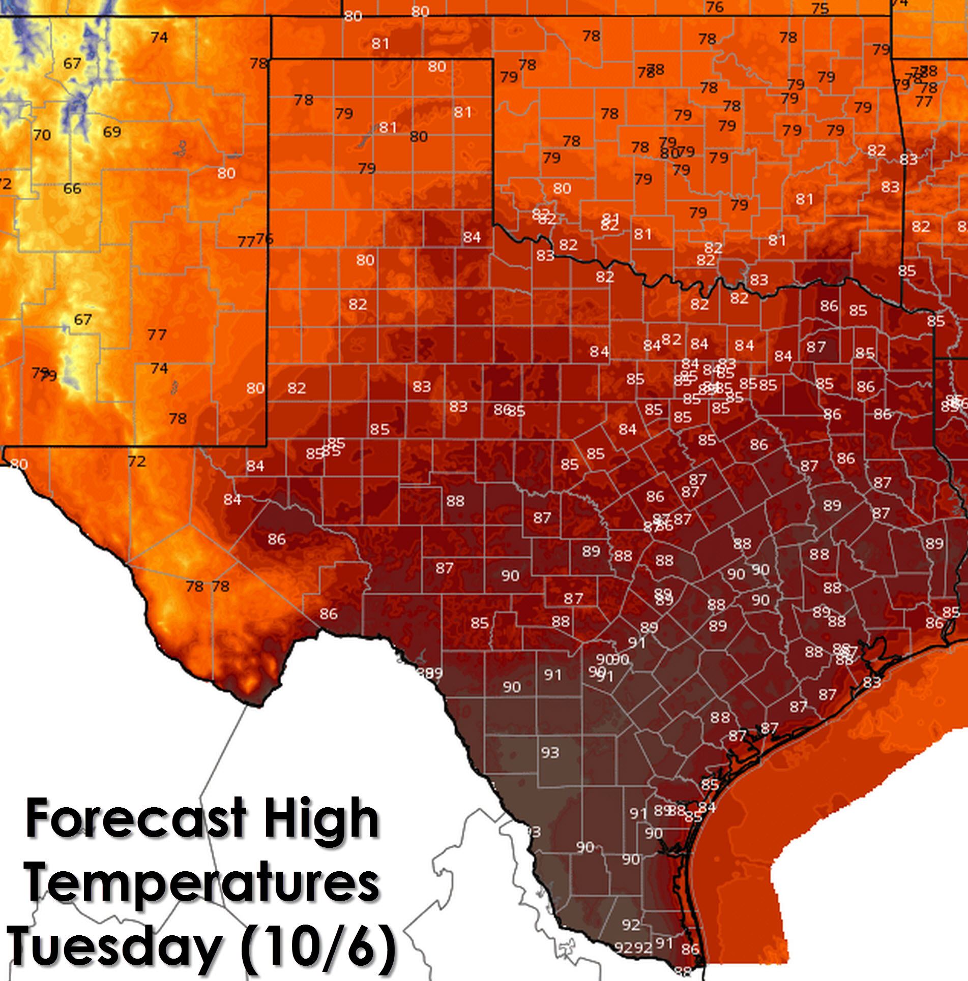
High temperature forecast for this afternoon.
After several days of beautiful fall weather we’re heading back into a warmer period of weather. High temperatures this afternoon will be a few degrees warmer than what we saw on Monday. The warmest folks will be in the Rio Grande Valley and Deep South Texas with mid 90s. South-Central Texas, Southeast Texas, the Brazos Valley, and Hill Country will top out in the upper 80s to low 90s. The Permian Basin into the Big Country, North Texas, and Northwest Texas will top out in the mid to upper 80s. The typically cooler climate across the Texas Panhandle and West Texas will end up around 80 degrees for your Tuesday. Far West Texas around El Paso and the Alpine Mountains will be the coolest spots today with 70s.
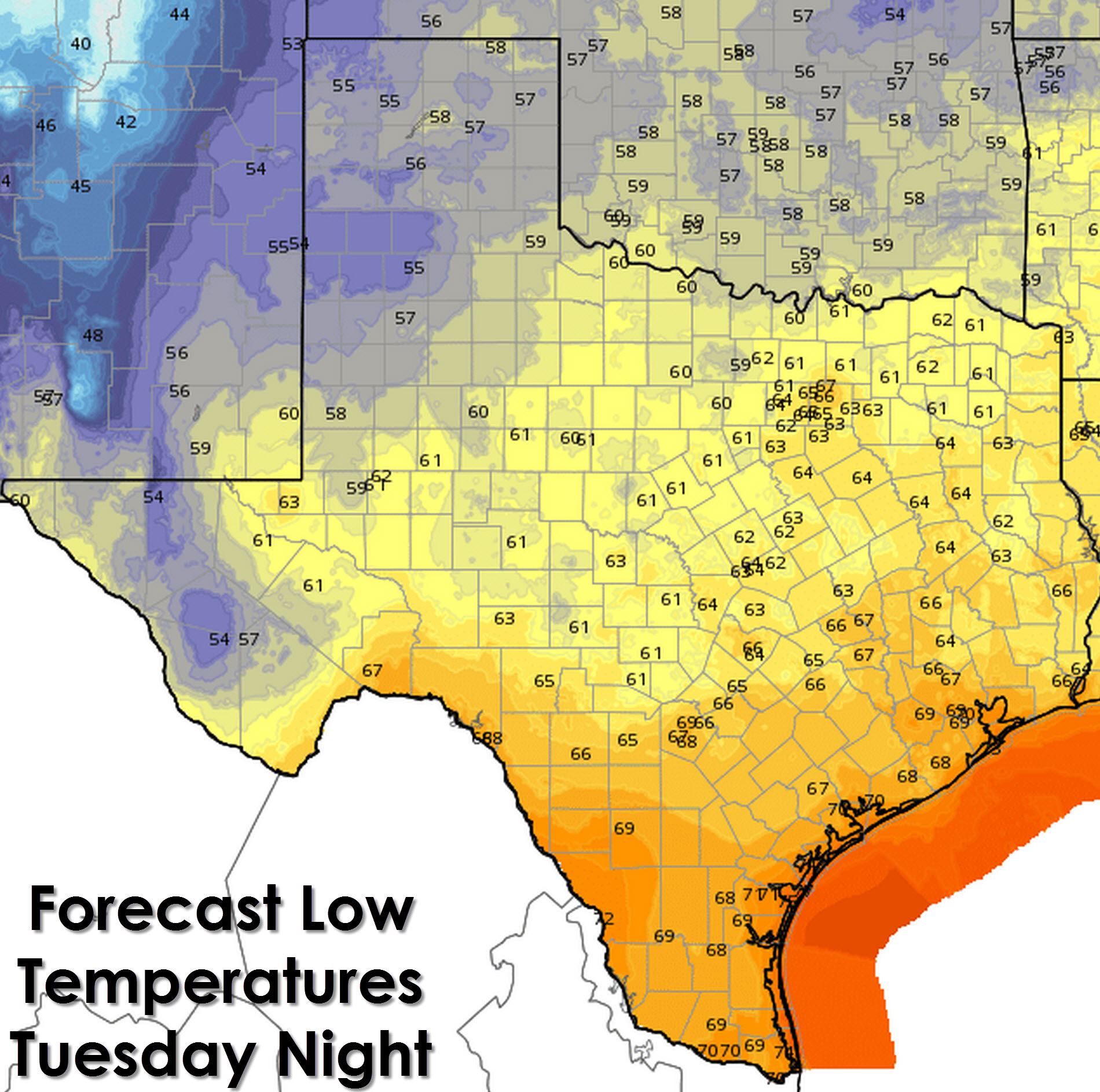
Low temperature forecast tonight (Tuesday Night)
Temperatures tonight will be fairly uniform across Texas with upper 50s in the Texas Panhandle, West Texas, and the Alpine Mountains up to 70 degrees along the coast and in the Rio Grande Valley. The Hill Country, Concho Valley, Central Texas, and East Texas will all end up in the middle ground with 60s overnight into the morning hours on Wednesday.
Each image can be enlarged by clicking on it.
Outside of Far West Texas rain chances will be non-existent across Texas today. This will be the last mostly dry day for the rest of the week. Rain chances will increase tonight across Far West Texas where thunderstorms are likely. Isolated showers and storms are possible across the western portions of the Texas Panhandle and South Plains. Rain chances will increase on Wednesday across the Texas Panhandle and West Texas. Wednesday Night’s forecast indicates rain chances continuing to push east into Northwest Texas, the Big Country, and Concho Valley. Widespread thunderstorms are anticipated Wednesday Night across the Texas Panhandle, West Texas, Permian Basin, Alpine Mountains, and Far West Texas. Those shower and thunderstorm chances will continue into Thursday and Friday in previously mentioned areas in addition to the Interstate 35 corridor from the D/FW Metroplex south to the Mexico border.
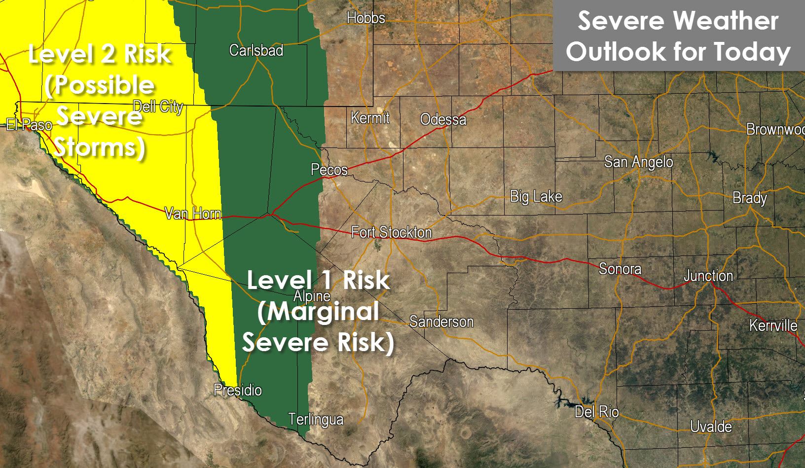
The upper level low responsible for the rain chances will also cause an increase in wind shear across southern New Mexico and far West Texas. That risk is reflected in today’s severe weather outlook from the Storm Prediction Center. A level 2 severe weather risk is in place for Far West Texas, including El Paso. A level 1 severe weather risk runs east to the Interstate 10/20 split in Far West Texas. The strongest storms this afternoon and this evening may produce quarter size hail, 60 MPH wind gusts, and very heavy rain. A low-end risk for a brief tornado cannot be ruled out.

Rain Forecast from NOAA/Weather Prediction Center through Saturday
The latest rain accumulation forecast for the upcoming event continues to focus the heaviest rains across Far West Texas, the Permian Basin, and Southwest Texas. Amounts along and east of Interstate 35 have been lowered and reflect the thinking that the most widespread chances for rain will remain west of Interstate 35. The rain total forecast is for generalized amounts over a broad scale. Some will receive heavier amounts while others will receive less.
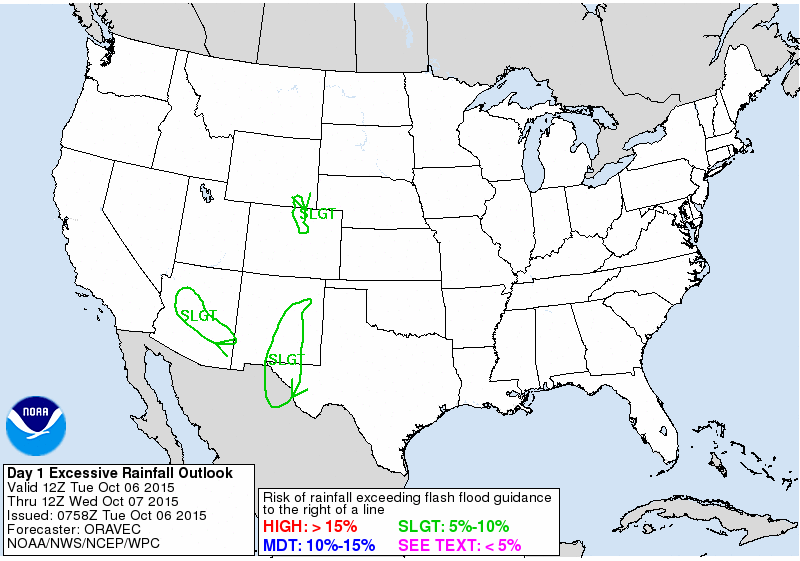
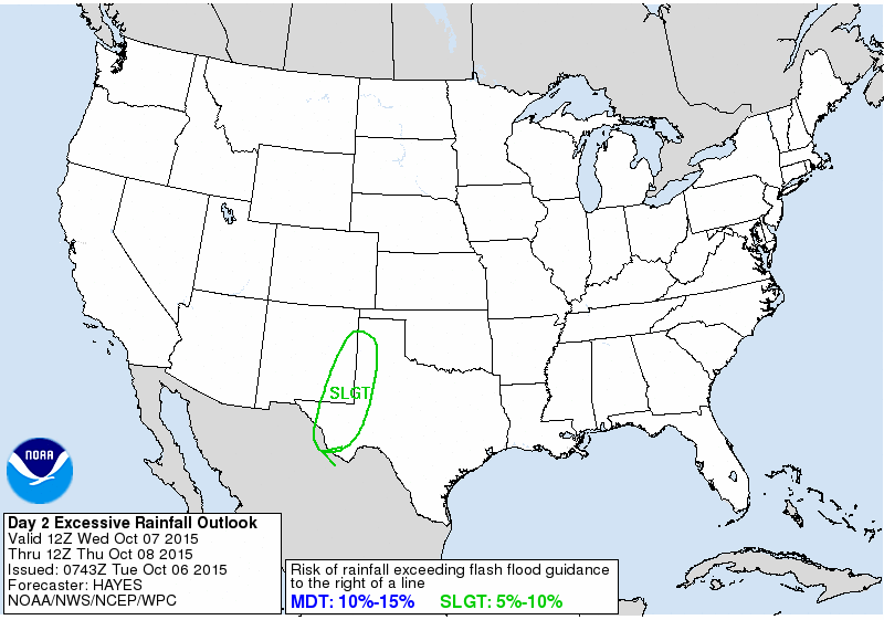

Keeping in mind the rainfall forecast shown above the Weather Prediction Center has placed parts of West Texas, the Permian Basin, and Far West Texas towards El Paso in a level 1 (of 3) risk for flash flooding over the coming days. This generally means widespread flash flooding is not expected but there is certainly the potential for localized issues.


0 Comments