
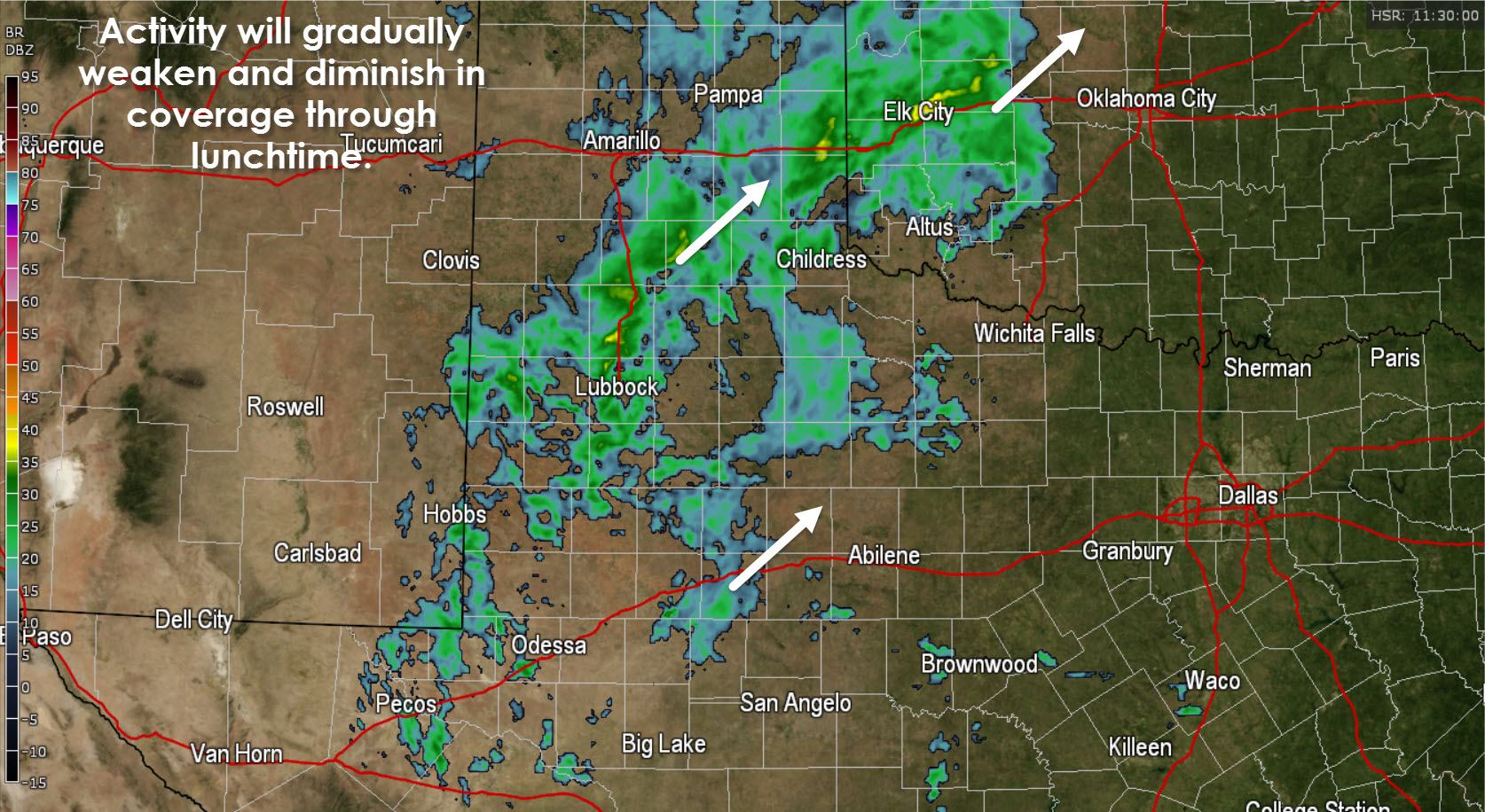
Regional radar across West Texas at 6:30 AM
Widespread light to moderate rain is making for a dreary morning across the eastern Texas Panhandle south into West Texas and parts of the Permian Basin. This activity is well below severe limits and at most is producing a lightning strike here and there. Overall rain accumulations for the remainder of the morning will be light. As we continue towards lunch time activity will decrease in coverage and eventually dissipate as it moves northeast. Most of Texas should be dry this afternoon although a few showers can’t be ruled out.
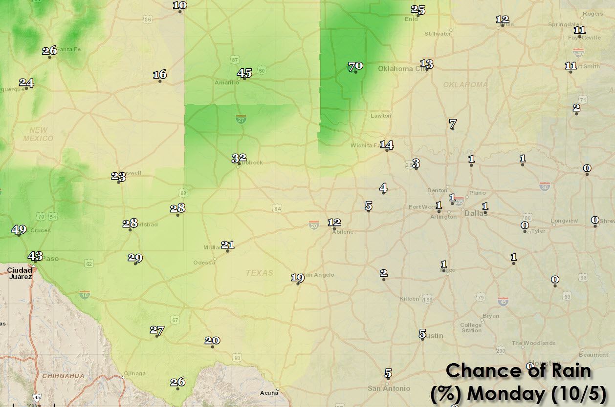
Forecast rain chances Today
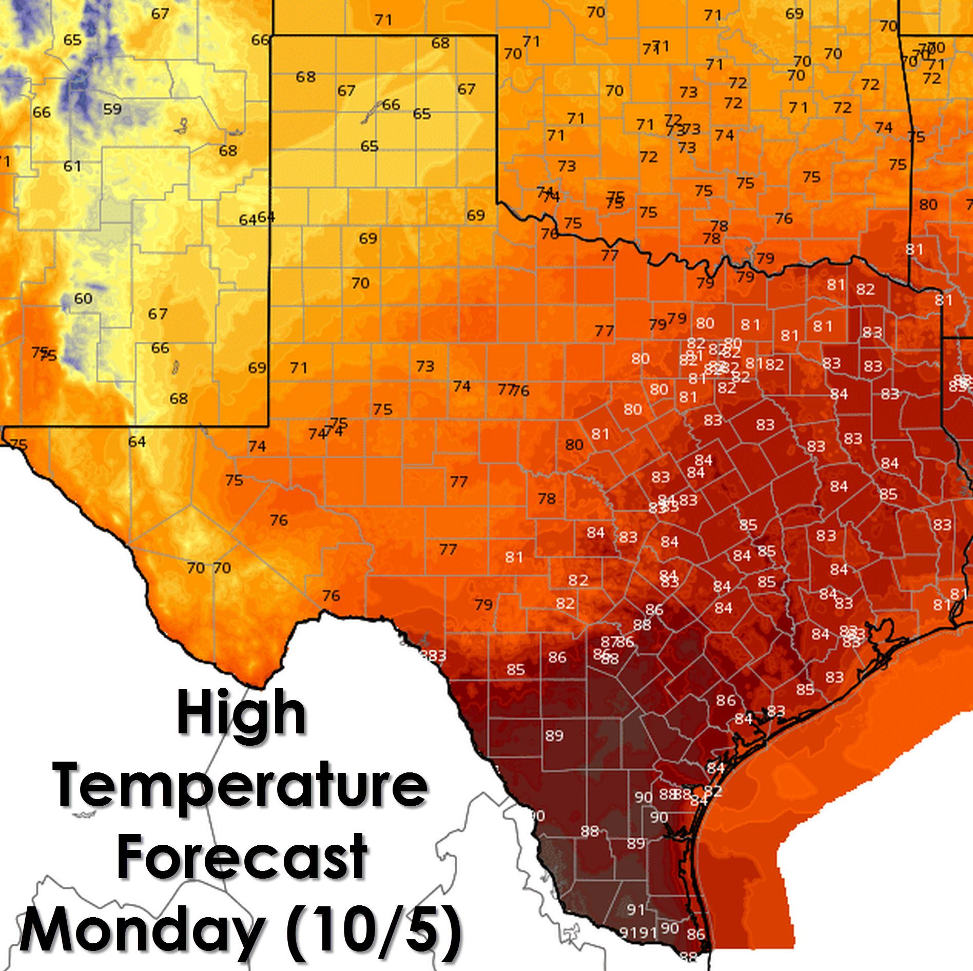
High temperature forecast for this afternoon
Its shaping up to be a rather nice fall day across the state. Even across the typically hot Rio Grande Valley temperatures will only make it up to around 90 degrees today. One reason for the fall temperatures today is that we’re expecting partly cloudy to mostly cloudy skies today. Temperatures will peak in the 60s across the Texas Panhandle this afternoon. Seasonal high temperatures in the 70s to lower 80s are expected across the Permian Basin, Concho Valley, Big Country, Northwest Texas, North Texas, Northeast Texas, East Texas, Southeast Texas, and the Brazos Valley. South-Central Texas, Deep South Texas, and the Rio Grande Valley will be on the upper spectrum of today’s high temperatures with upper 80s to 90 degrees expected. Technically these temperatures are still above average but at least we’re not talking about the widespread mid to upper 90s we were seeing in late September.
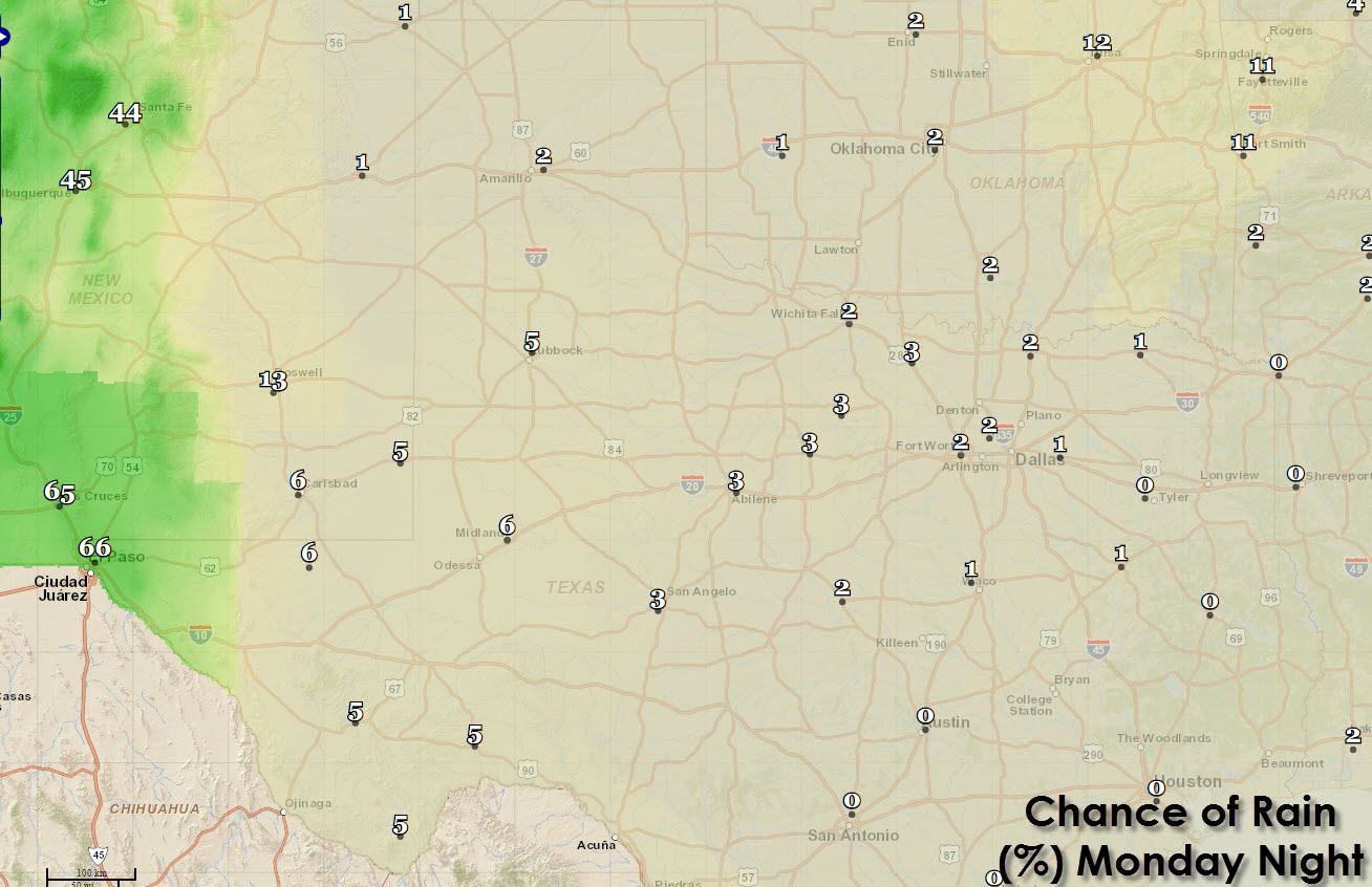
Forecast chance of rain tonight is limited to Far West Texas around El Paso.
Far West Texas will likely see shower and thunderstorm activity tonight in conjunction with our neighbors in southern New Mexico. The highest rain chances will be around El Paso and quickly diminish to near nothing by the time you get east to the Interstate 10/20 split. Non existent to minimal precipitation chances are forecast for the rest of Texas tonight into the pre-dawn hours on Tuesday.
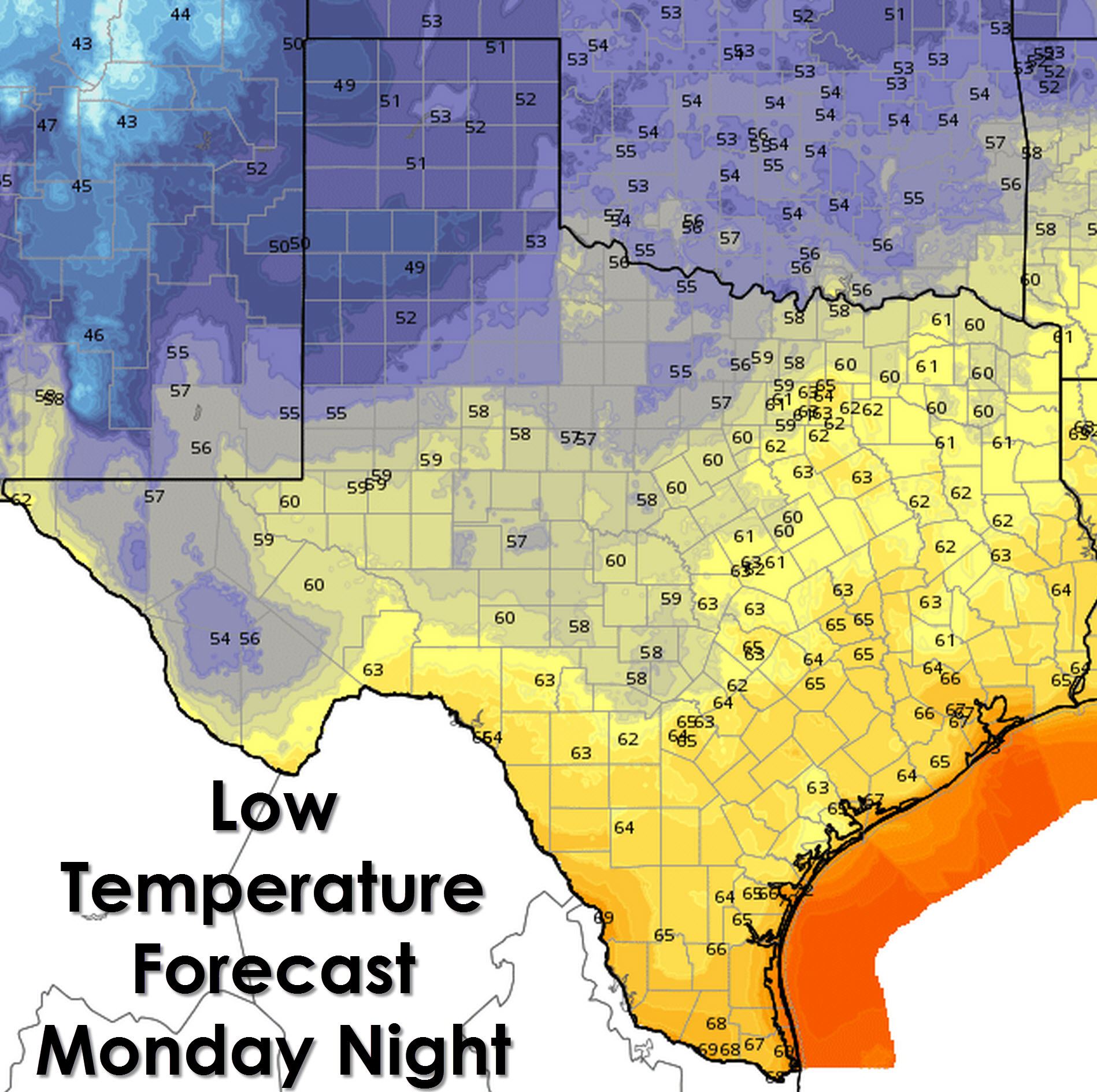
Tonight’s forecast low temperatures across Texas
Clouds are expected to diminish in overall coverage tonight across the eastern two-thirds of Texas. With the clouds clearing out temperatures will be allowed to fall back into the 60s across the southeastern half of Texas. Brownsville should get down to 68, Corpus Christi down to 66 to 70 degrees, Houston down to 64 to 66, San Antonio down to 63 to 65, and Austin down to 65. The Concho Valley, Big Country, Hill Country, the Permian Basin, Northwest Texas, and western North Texas will drop into the upper 50s to 60 degrees tonight. North Texas and Northeast Texas will enjoy upper 50s to lower 60s tonight. The Texas Panhandle, South Plains, and Rolling Plains will drop into the upper 40s to low 50s tonight. Definitely a bit of chill in the air!
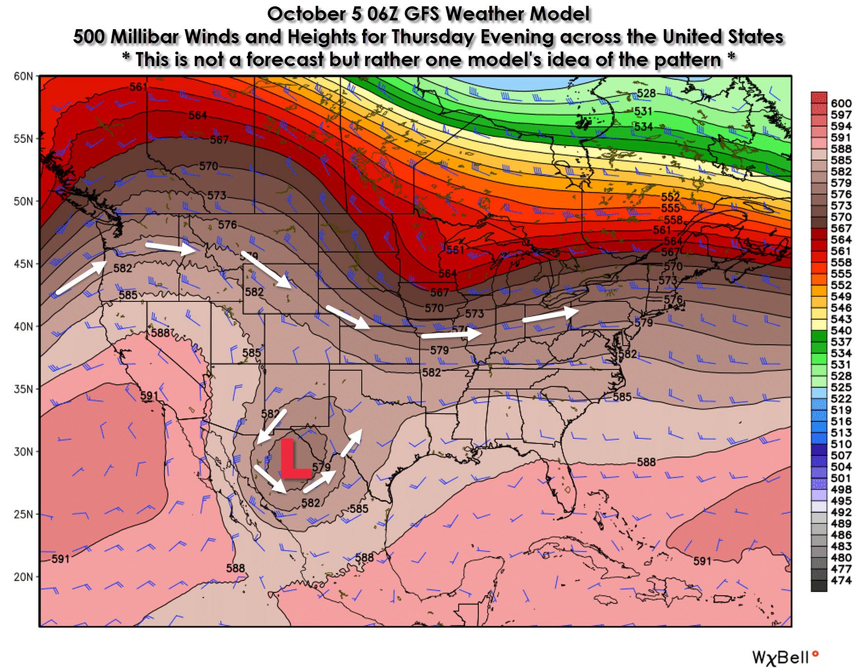
Stormy weather expected for Wednesday-Friday this week.
By Wednesday of this week an upper level low is expected to move into northern sections of Mexico and far Southwest Texas. This type of position is very far south for a storm system but alas that may have something to do with El Nino. The position of the low pressure aloft will be favorable for the western two-thirds of Texas to receive widespread precipitation chances beginning Wednesday and continuing through Friday. Unfortunately the position of the low is too far west to bring much in the way of rain to the drought-stricken Northeast, East, and Southeast Texas. The best rain chances will be along and west of Interstate 35. Parts of Southwest Texas and the Permian Basin may receive several inches of rain. We’ll chat in more detail about the upcoming system in a separate blog later this morning.


0 Comments