
After a month of above average temperatures and little in the way of fall weather it finally looks like that may be about to change. Weather models are showing a variety of solutions for the end of the work week. Some weather models bring a strong cold front into Texas with a noticeable drop in temperatures along with much drier air. Other models still bring drier air and lower humidity into the state but keep the cooler air north. Either way dewpoint temperatures should noticeably drop for the end of the work week into the weekend.
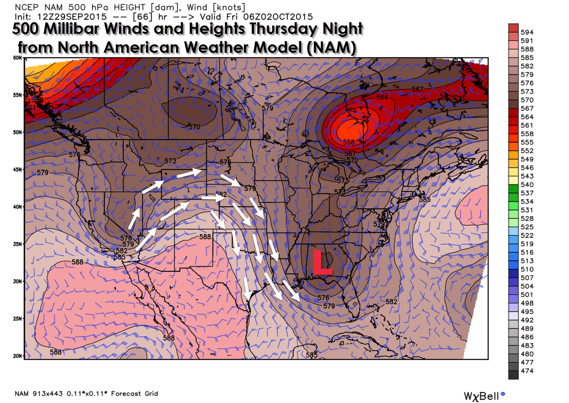
The North American Model (NAM) is showing an active pattern aloft by Thursday Night. A trough with an upper level low across the Southeast United States should bring a north/northwest flow aloft. That pattern would bring drier air and hopefully a decent cold front for the end of the work week.
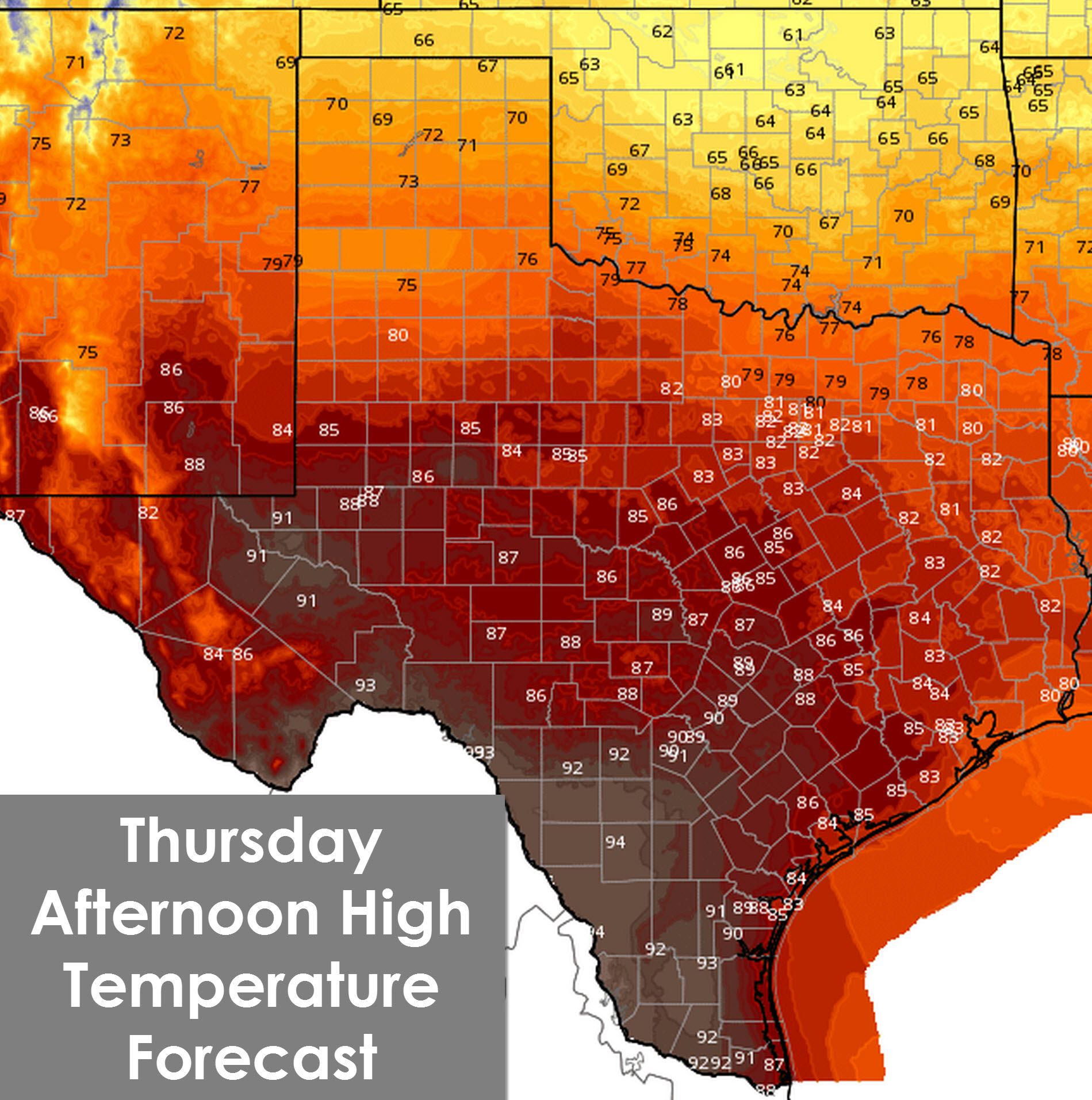
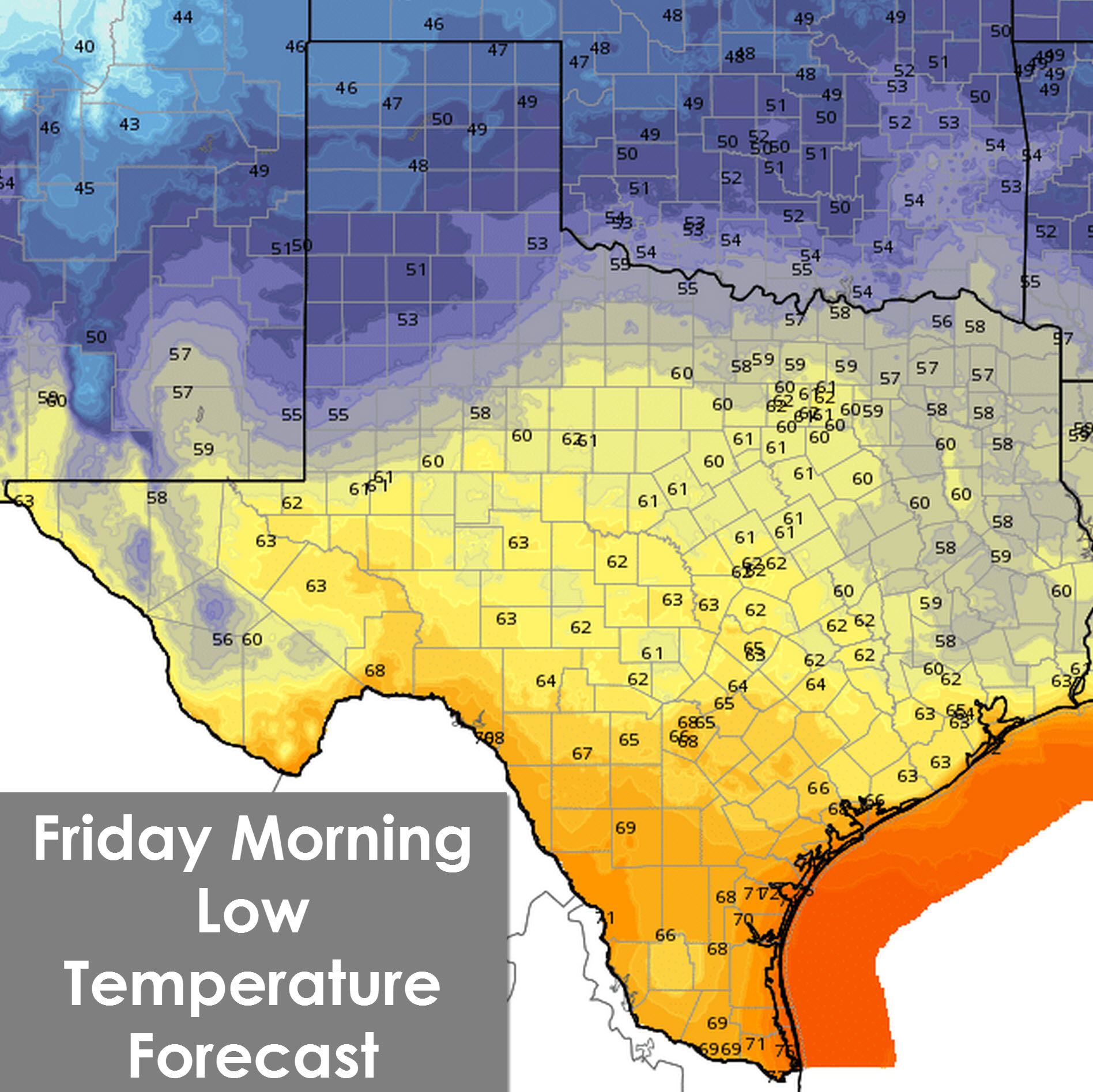
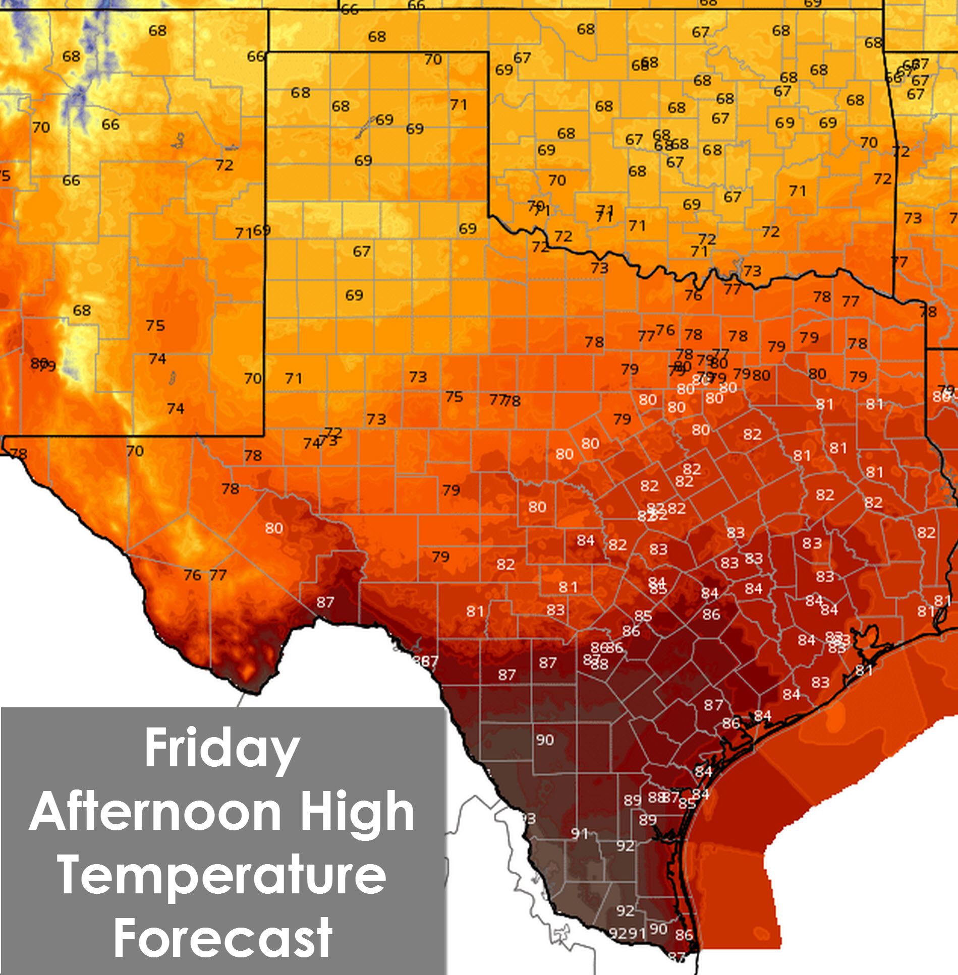
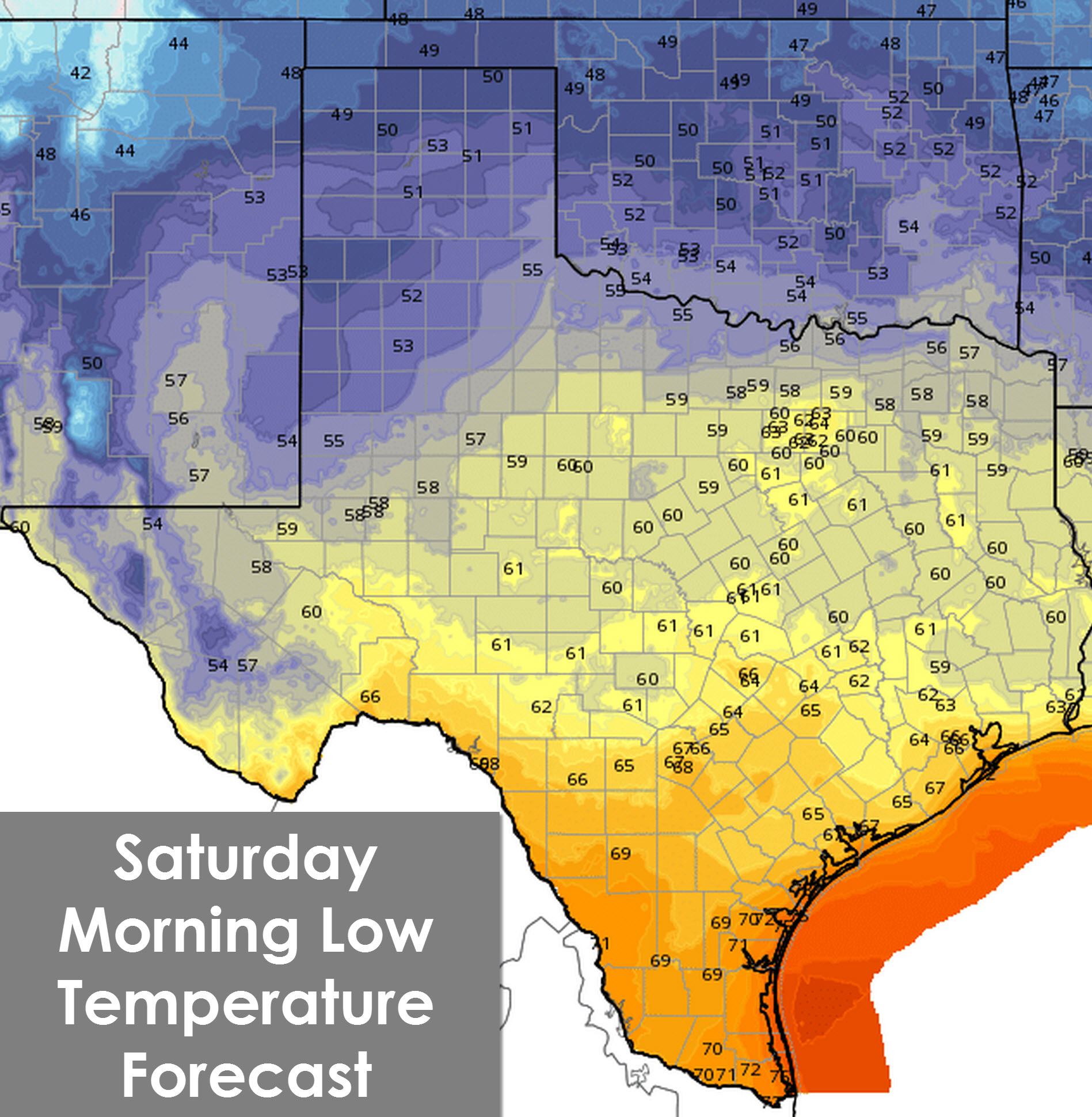
Forecast confidence for the Thursday-Saturday timeframe is low. The reason for the low confidence forecast is weather model variability. One weather model sets up a pattern which would bring a strong cold front south into Texas. Another model keeps the high pressure aloft in place with continued above-average temperatures. The official forecast from the National Weather Service uses a blend of the weather model data. High temperatures on Friday will be noticeably cooler along and north of Interstate 10 with upper 60s to mid 80s. Obviously the most noticeable cool off will be across the northern portions of Texas. Another benefit of this cold front is that a northerly flow will usher in much drier air. That means lower dewpoints and lower humidity across all of Texas – even if temperatures remain warm.
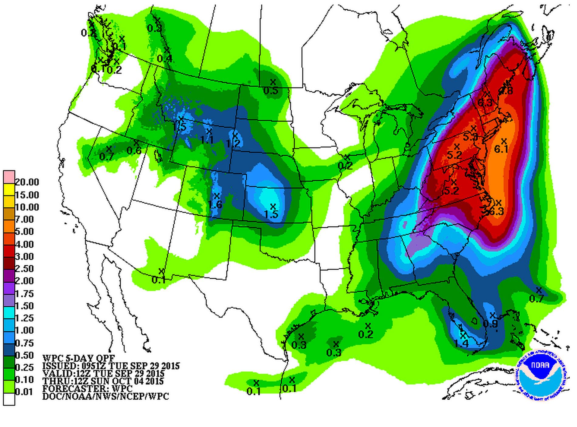
Precipitation chances will greatly depend on how the upper air pattern sets up at the end of the week. There may be some rain chances across the Panhandle and Northwest Texas but overall I don’t expect a big rain maker with this upcoming front. The Weather Prediction Center indicates only very light precipitation totals on Friday in the Panhandle. The remainder of the precipitation shown across Southeast Texas is from potential rain today.


0 Comments