
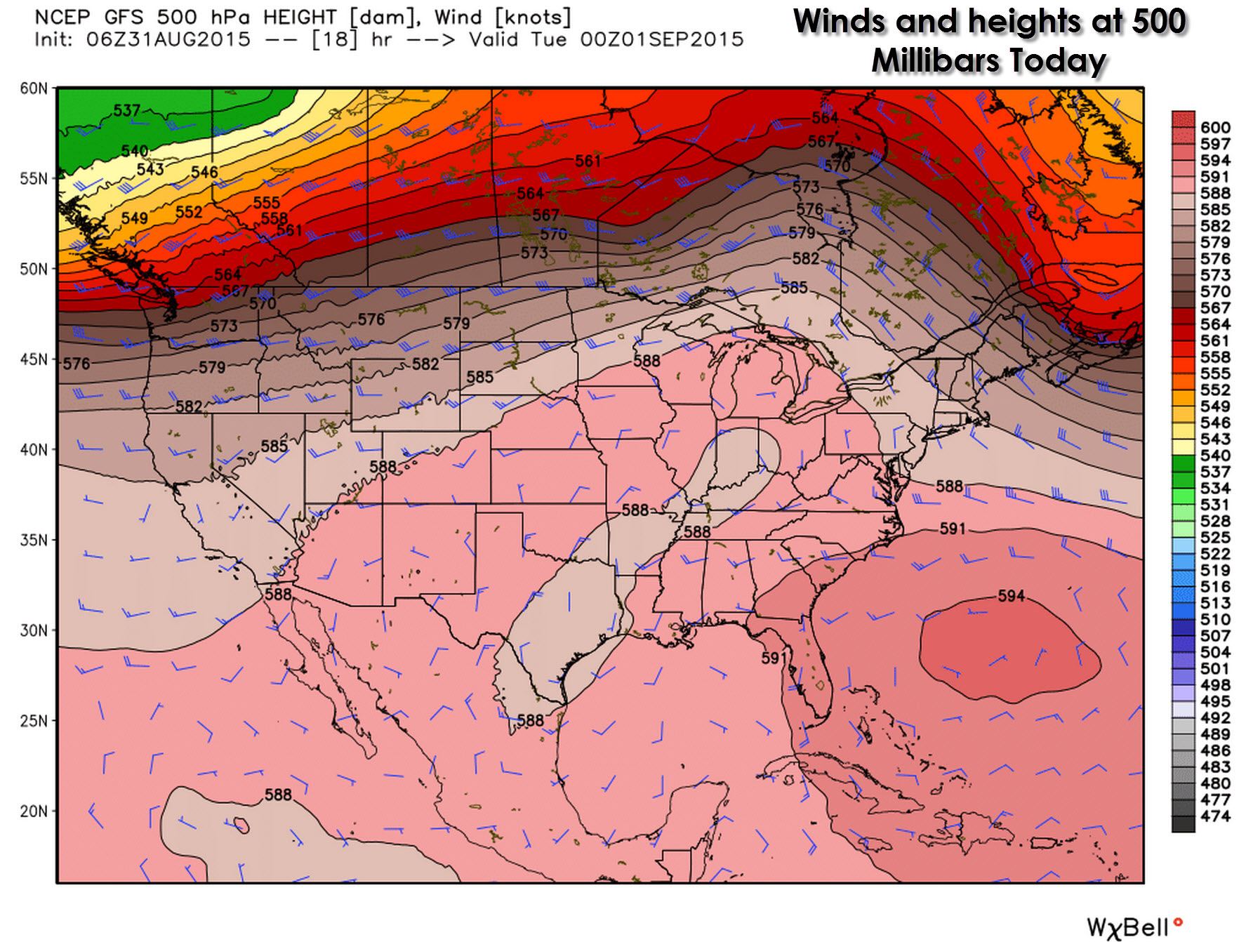
Our weather across Texas won’t be too exciting over the coming days. The main jetstream is located across the Northwest United States east/northeast into Canada. A ridge is in place across the southern United States but isn’t too bad for the last day of August. We may see some changes by next week but while this pattern remains don’t expect much in the way of changes weather-wise. Winds aloft remain weak and below 20 MPH.
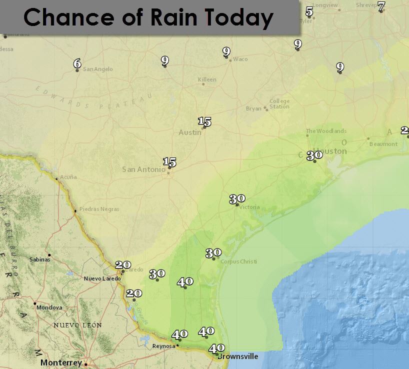
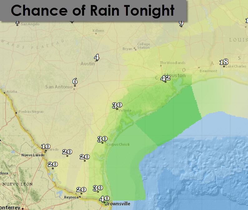
Coastal regions of our state do have a chance of thunderstorms today and tonight. Weak wind shear aloft means we’re not concerned about a severe weather threat. Folks across Southeast Texas southwest to Corpus Christi and into the Rio Grande Valley have a 30 to 40 percent chance of showers/storms today and tonight. Higher rain chances will be just off-shore. It won’t rain all day but if you’re lucky you’ll get some rain and rain-cooled outflow. All thunderstorms produce lightning which is deadly to those caught outdoors. Localized damaging winds (microbursts) are possible as stronger storms collapse.
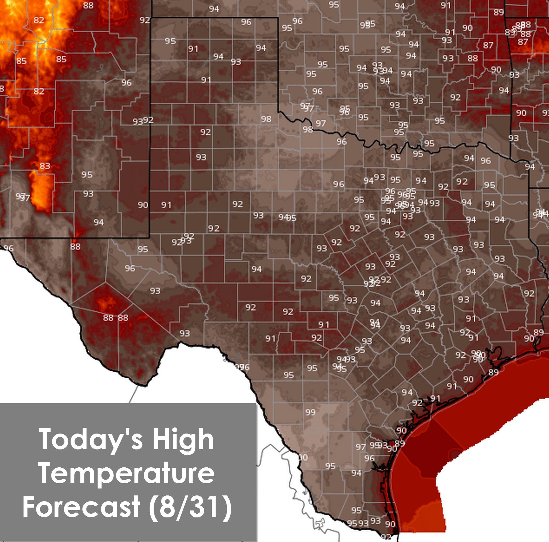
With a dormant upper level pattern in place we won’t see any major weather influences for the next few days. Temperatures today will climb up into the 90s across all of Texas which is right where we should be for August 31. Those lucky enough to get a nearby shower/storm this afternoon should see temperatures fall back into the 80s.

For tonight temperatures will fall back into the 70s across most of Texas. Those across the Texas Panhandle and West Texas will see upper 60s. Finally the higher elevations down in Big Bend and around Alpine will drop back into the 50s and 60s tonight.


0 Comments