
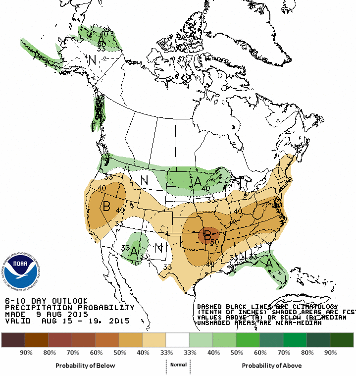
Another toasty summer week is in the forecast as the heat dome remains in place. Temperatures for today will top out in the 98-108 degree range. The hottest temperatures will be across North and Northeast Texas with 104 to 107 degrees. Deep South Texas, around Del Rio and Eagle Pass, will also top out around 107F this afternoon. We do note the slightly less oppressive forecast for our friends in the Texas Panhandle where only mid to upper 80s are in the forecast. Scattered thunderstorms are possible this evening across the Texas Panhandle. Those along the Oklahoma/Texas Panhandle borders have the highest likelihood of seeing a storm. Severe weather is not anticipated but a stronger pulse storm is possible with 50 MPH winds and nickel size hail. Those storms along with a weak cool front will cause temperatures to drop into the upper 60s tonight in the Panhandle and South Plains. If you manage a break in the clouds check out the Perseid Meteor Shower. That’ll peak Wednesday Night/Thursday Morning with a new moon. The remainder of Texas will see temperatures only drop into the upper 70s tonight. The D/FW Metroplex and Northeast Texas will struggle to get below 80-82 degrees with heat index values in the upper 80s all of Monday night. Tuesday will be seasonably cooler across the Texas Panhandle and South Plains with mid to upper 80s for the high temperatures. Northeast Texas, North Texas, and the Red River Valley into Northwest Texas will see temperatures about 3-5 degrees cooler than today – which isn’t saying much considering the ongoing heat. Everyone else south of that line will see very hot temperatures with 99-107 degrees again on Tuesday.
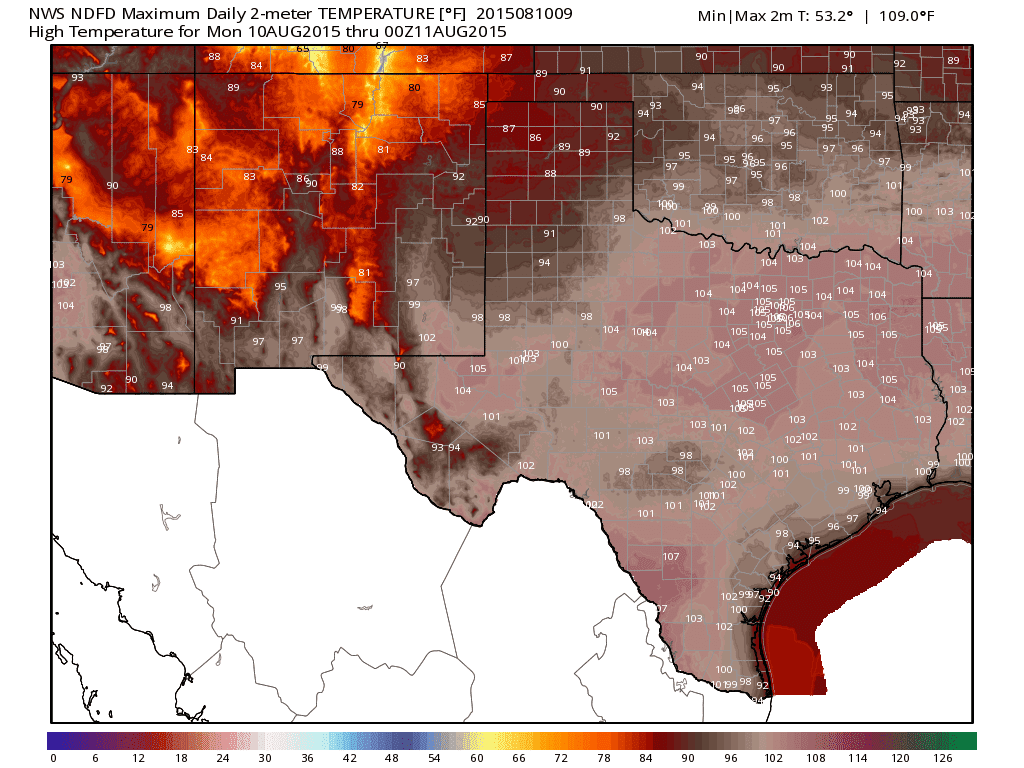
Today’s High Temperature Forecast
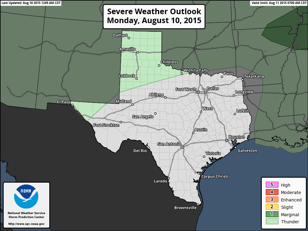
Severe Weather Outlook for Today & Tonight
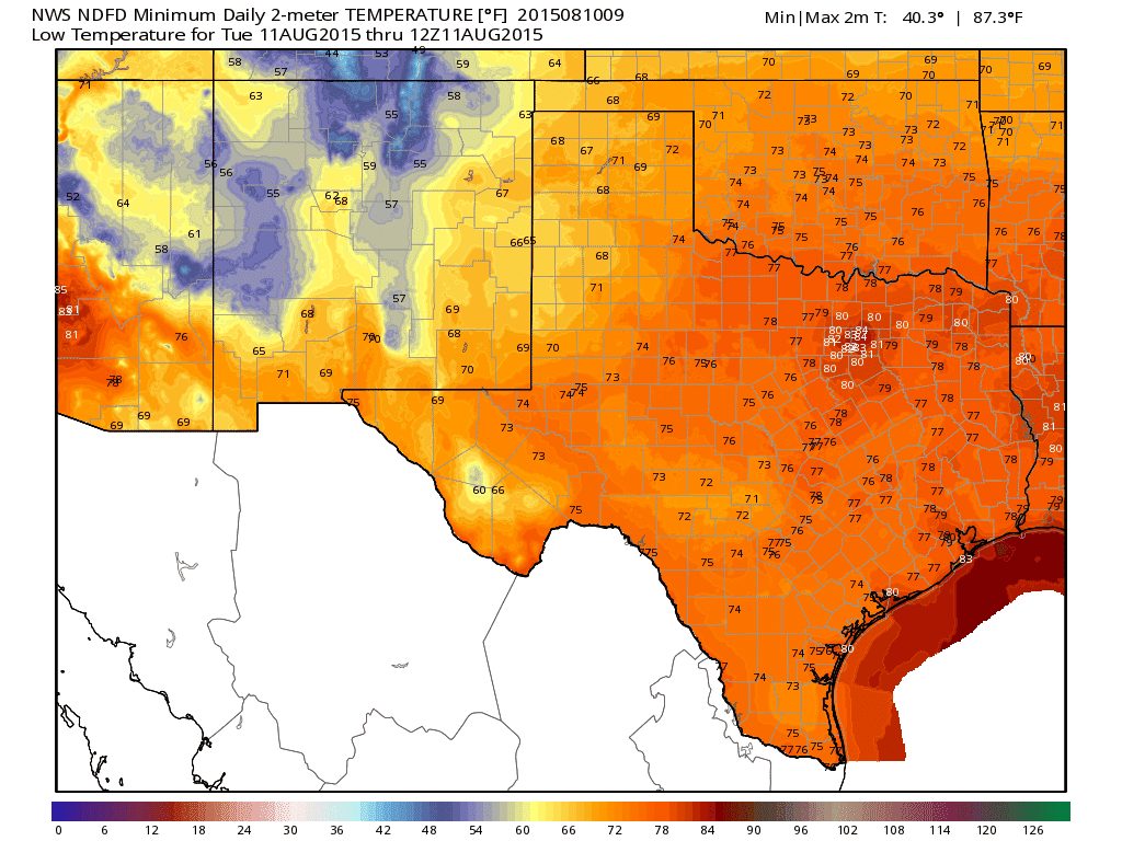
Tonight’s Low Temperature Forecast
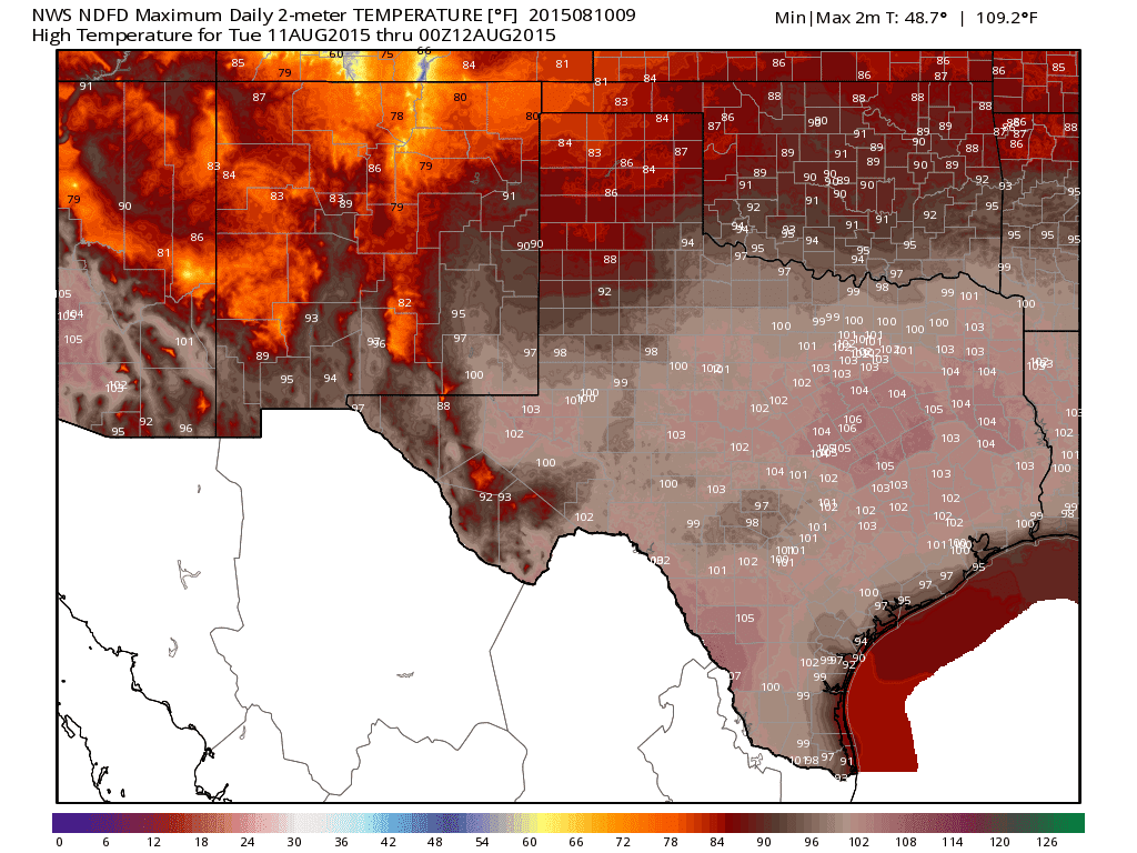
Tuesday’s High Temperature Forecast
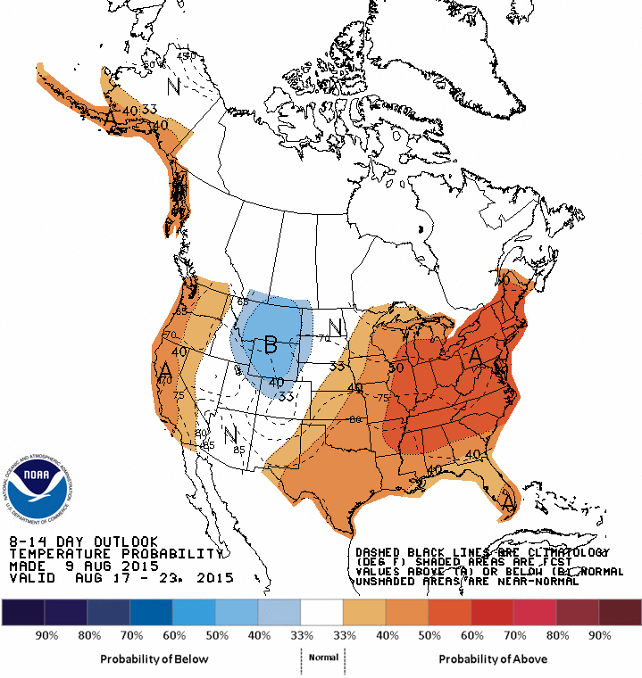
I’m hopeful we may see temperatures drop a bit towards the end of the week. Our pesky heat dome should shift a tad north allowing for a weak northerly flow over parts of Texas. The northern half of the state will hopefully see temperatures in the mid/upper 90s and lower 100s versus the 101-107 expected today. Rain chances look low but hopefully we can squeeze out a rouge shower later this week. Otherwise a dry August continues with elevated grass fire danger.


0 Comments