
High pressure will build back over the state this week bringing back the hot and mostly dry conditions we’re familiar with every year in August. The evening and nocturnal showers and storms we’ve experienced the past several days across the panhandle and western Texas will come to an end by mid-week, and we’ll be looking at rain-free across the state into next weekend. Highs will top out in the upper 90s to 100s the remainder of the week through at least Sunday, with some parts of west central and northwest Texas reaching 105 to 107 and flirting with exceeding record highs in a few areas.
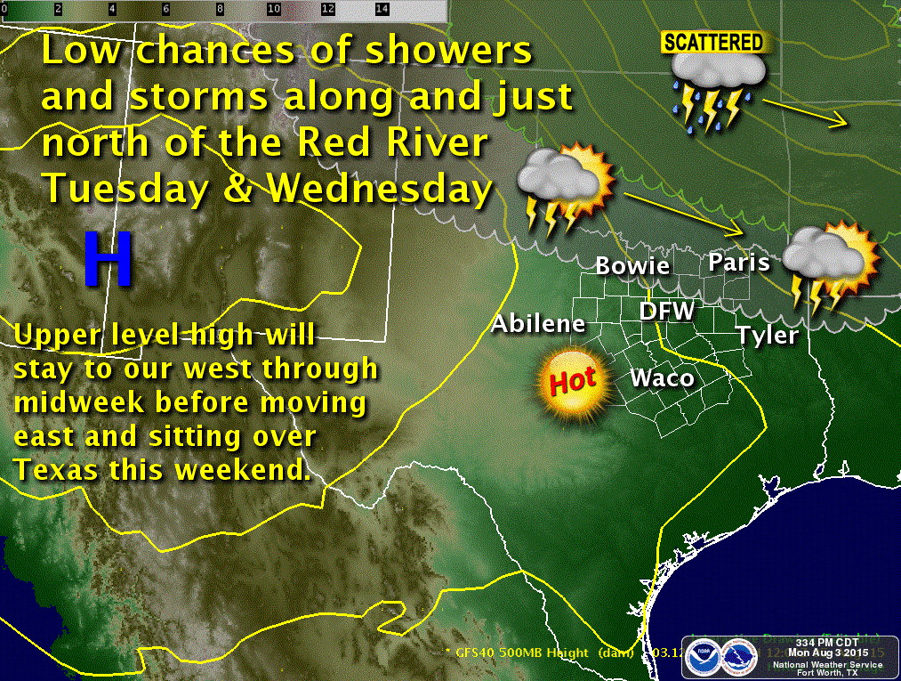
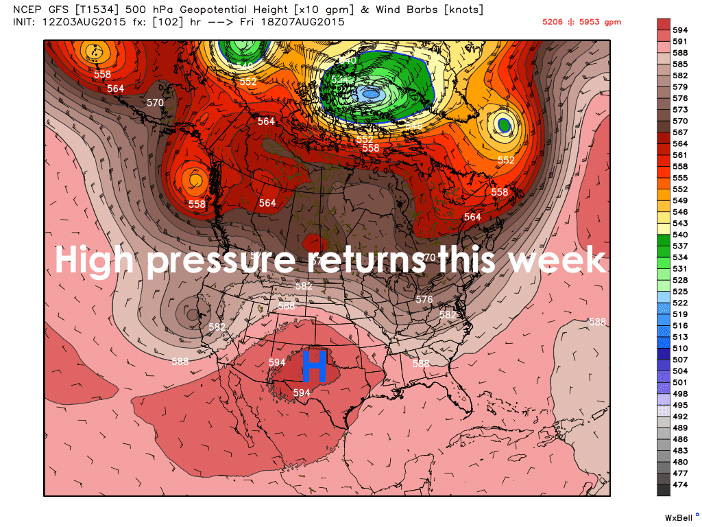 The only glimmer of hope this week is the chance for a few showers and storms across the Red River counties in north Texas Tuesday and Wednesday as a couple of upper level disturbances round the top of the high pressure dome over our state. Right now, it looks like most of the lift from the disturbances will pass too far to our north to have much of an impact on north Texas. Lack of moisture will also be an issue as well; however, we will have some instability in place both days across northern Texas…meager on Tuesday, better on Wednesday…so a stray pop-up shower or storm developing north of I-20 cannot be completely ruled out. Best chances Tuesday look to be northwest of the DFW metro, and for Wednesday the best chances look to be northeast of the metro. Outside of these chances though, rain looks pretty bleak for quite some time and hot weather looks to continue into next week as well. August in Texas!


0 Comments