


Isolated thunderstorms are expected later this afternoon and evening across the northwest half of the Texas Panhandle. Those storm chances increase a bit tonight with scattered storms possibly moving in from New Mexico and Kansas. I don’t think we’ll have enough oomph to get severe storms but I can’t rule out a stronger wind gust or small hail. A rouge shower is also possible along the Gulf Coast. Outside of the rain chances mentioned above the remainder of Texas will by hot and dry today.
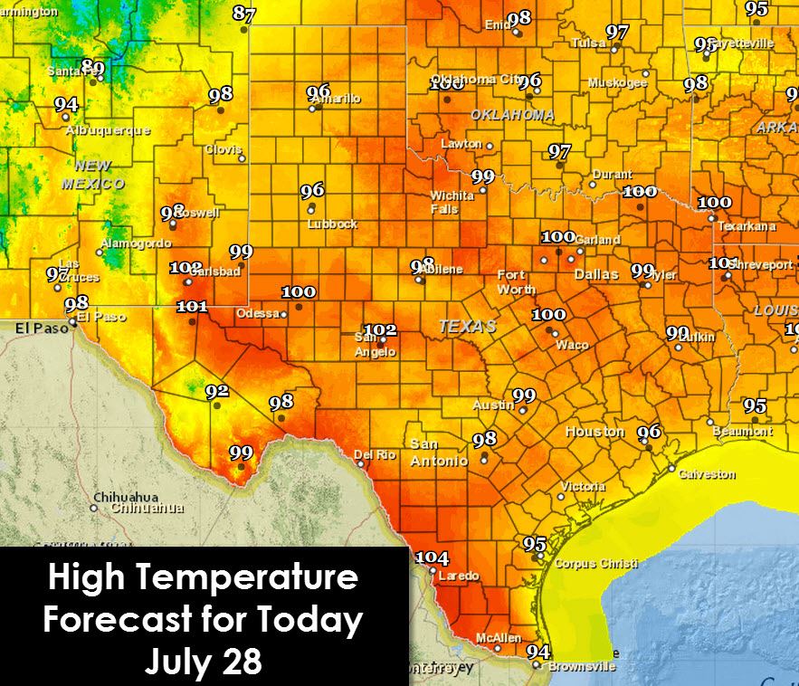
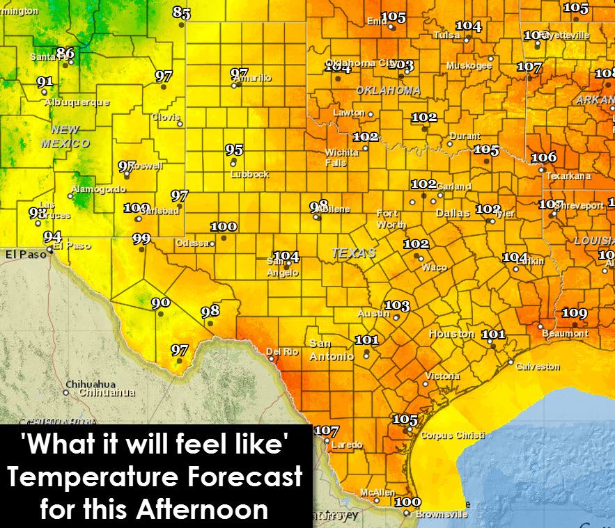
For high temperatures today we’ll see them range from 95 to 105 degrees. Heat index values will be 2 to 10 degrees above the air temperature today. We should see temperatures drop off a degree or two later this week. A widespread cool off is not in the forecast at this time for the next 7 days, if not longer.
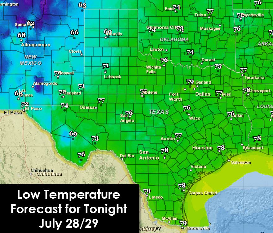
Low temperatures will range from 68 in the Texas Panhandle and the Alpine Mountains to the upper 70s across the rest of Texas. As usual the urban cities will be the warmest tonight as the heat island effect keeps things toasty all night.
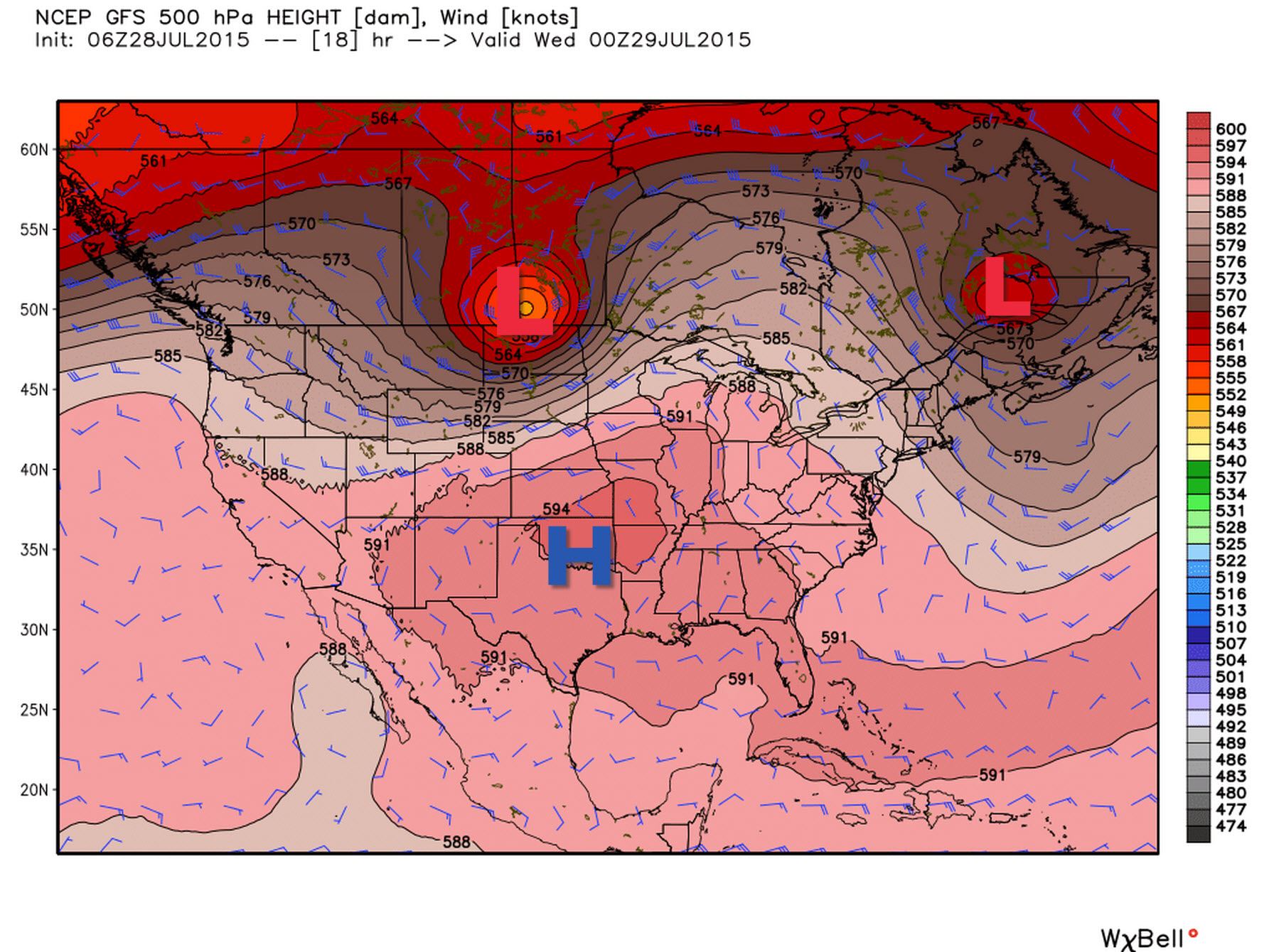

The heat ridge in place right over Texas is going to shift west by the weekend. With the heat ridge shifting west a bit we’ll see temperatures drop slightly into next week along with the chance for a couple afternoon boomers. This will not be anything to write home but at least its something.


0 Comments