
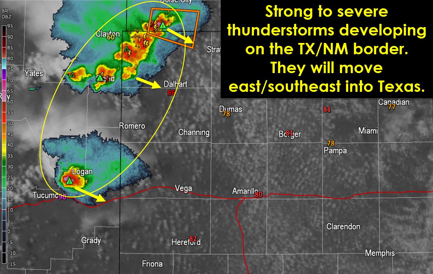
Strong to severe thunderstorms are developing from just northeast of Tucumcari northeast to Texline and Boise City. These thunderstorms are making slow progress to the east/southeast at 15-20 MPH. At the moment these storms are discrete/semi-discrete but we do expect growth into a cluster or line later this evening. Modest wind shear aloft along with ample instablity in the atmosphere will support an organized thunderstorm mode. A severe weather watch is possible this evening as thunderstorms move into Texas from New Mexico. Straightline winds up to 70 MPH along with pocket-change size hail will be possible. The tornado threat is nonzero. Storms will move east/southeast this evening and potentially impact the southern Panhandle and South Plains closer to midnight. Not all storms will be severe. Localized flooding will be a threat as well.


0 Comments