
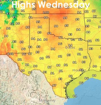
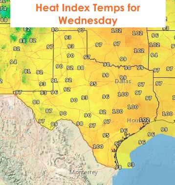
We’ve now reached that time of the year when forecasters get bored. Well, we get bored at least…LOL! But, yes, we’re looking at a typical summertime pattern pretty much through the end of this week with scattered pop-up showers and thunderstorms expected each afternoon through the weekend. For the rest of this evening, ongoing shower activity across the state is expected to die out shortly now that the sun is setting. We’re not expecting a repeat of last night’s stubborn Duracell battery convection that lasted well beyond what was anticipated across parts of north and west Texas this morning. Tonight and tomorrow morning should be mostly quiet and rain-free. Tonight’s lows will be seasonal and humid for all but the more arid regions of western Texas. Highs tomorrow will be seasonal as well, with Heat Index readings at or close to 100 degrees over parts of north and central Texas.

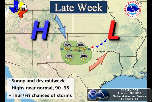
Showers are possible again Wednesday, but increasing high pressure from west to east will help keep the radar a little less active. Wednesday night into Thursday, the panhandle will become more active as high pressure retreats a bit west and a series of weak-ish upper level disturbances pass overhead. We’ll also have a weak frontal boundary drop into the panhandle by Thursday and hang around for a few days. This will bring chances for nightly convection back beginning Wednesday and potential for Thursday and Friday nights as well.
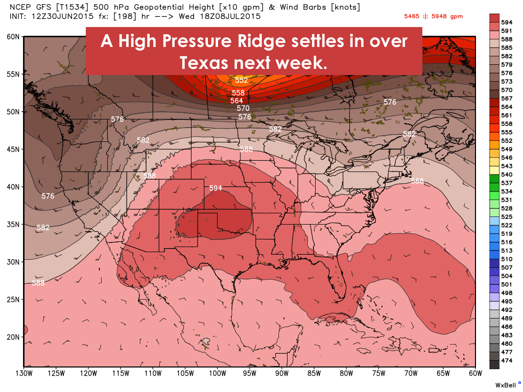
Looking ahead to next week…it looks like we’ll see high pressure move east and settle in over the state for at least a good 5 to 7 days. If that happens, we could see our first widespread batch of 100 degree temps this year. We knew it was bound to happen sometime, and we’ve been very fortunate with a cooler than normal spring and early summer thus far. We’ll have more on next week’s potential “heat wave” in our forecasts this weekend.


0 Comments