
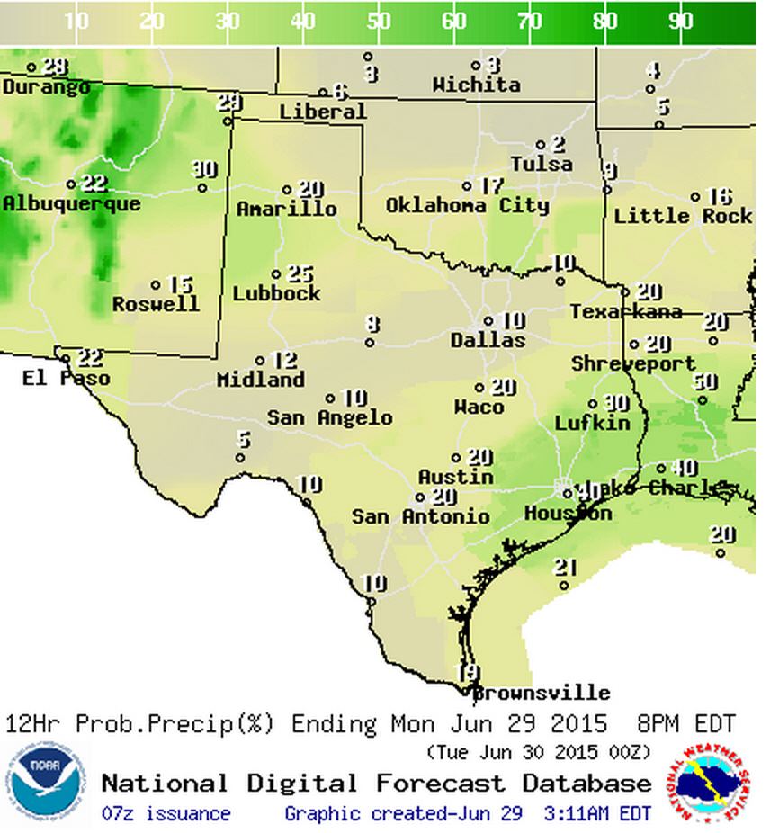
Chance of rain today (%)
After the northern half of Texas experienced a ‘drier’ heat this past weekend we’re heading back into our usual summer weather pattern. Humid and hot conditions will be the name of the game this week with the same usual weather every day this week. Isolated to widely scattered thunderstorms are expected to develop this afternoon across East Texas, Southeast Texas, South-Central, and Central Texas. These popcorn storms are caused by the sea breeze moving inland and is typical most summer afternoons. Isolated strong storms will be possible in West and Northwest Texas this afternoon as well with localized gusty winds and perhaps some hail. All activity should diminish after sunset this evening. Remember that all thunderstorms produce dangerous cloud to ground lightning. When Thunder Roars Go Indoors! We’ve had several fatalities over the past week from lightning strikes across the United States. Don’t be the next one!
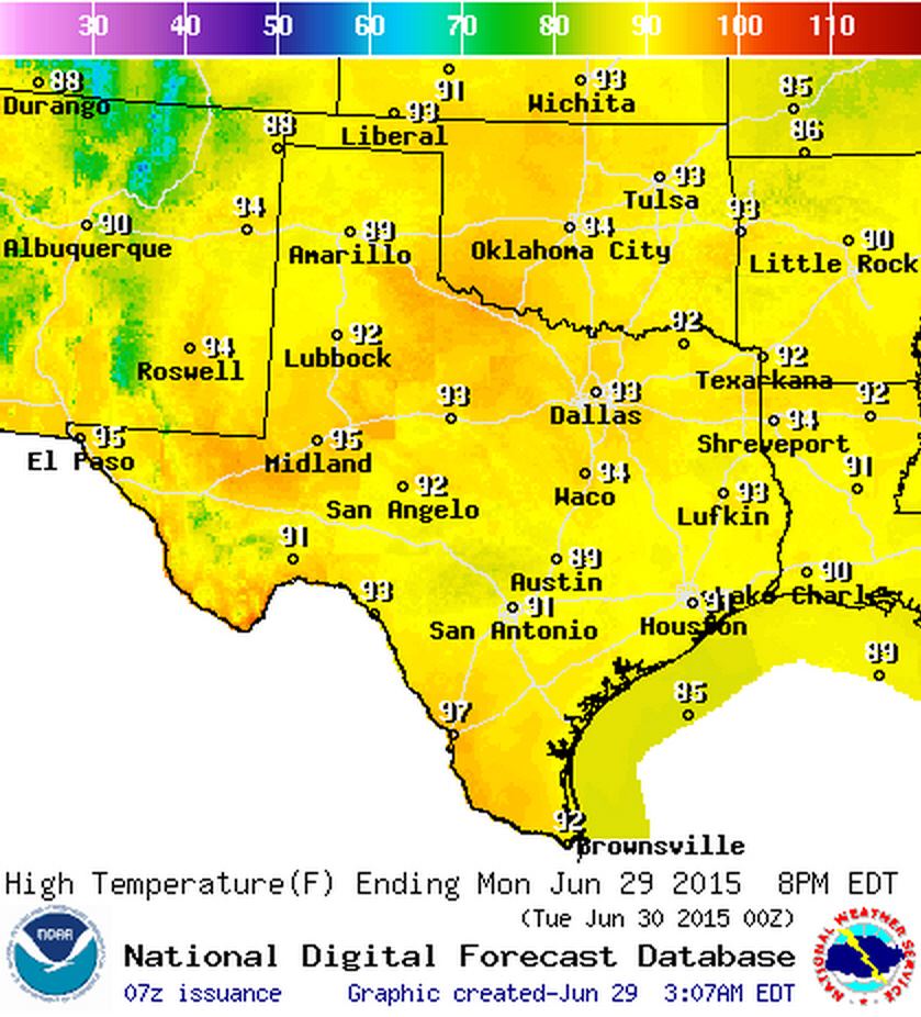
Monday (June 29) High Temperature Forecast
Temperatures will climb right to around average for late June today with 90s across all of Texas. The more humid locations will see heat index values approach 100 degrees. Relief in the form of a shower/storm nearby will be the hope of many by this afternoon. Outflow winds from showers/storms will help cool some folks down into the 70s/80s by late afternoon.


0 Comments