
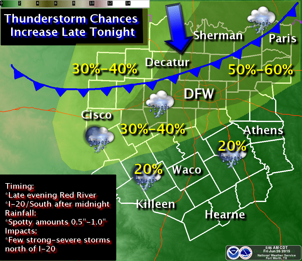
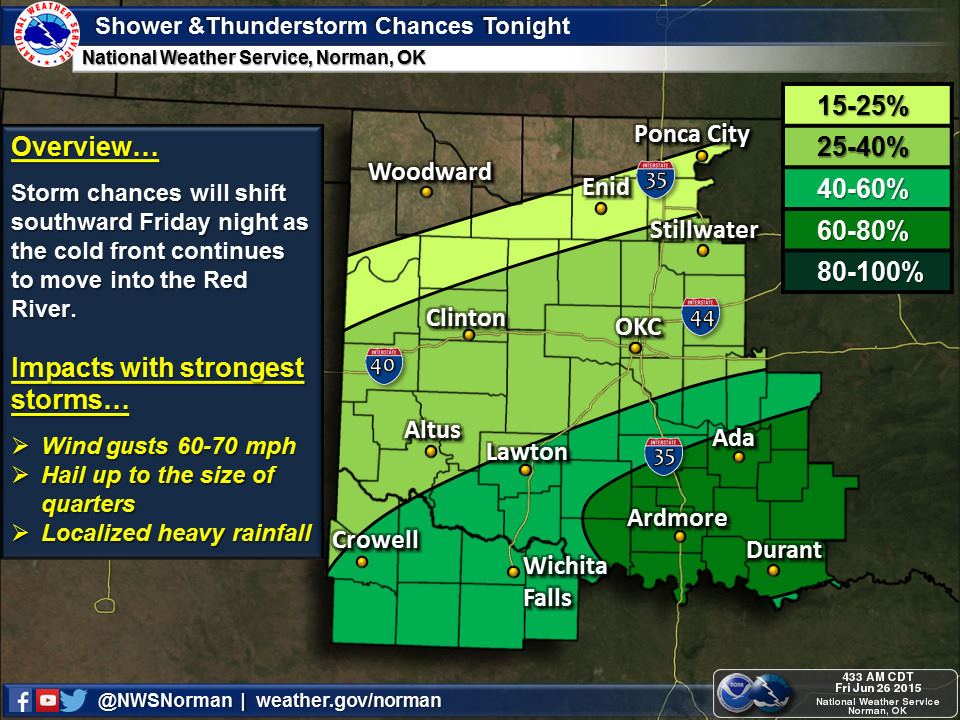
A weak cold front currently located across the southern Texas Panhandle east into southern Oklahoma will continue to slowly move south this afternoon. Winds north of the boundary are out of the north with only a minor temperature drop. This boundary will become a focal point for scattered thunderstorm development this afternoon.
There is a marginal to slight risk of severe thunderstorms this afternoon with storms that fire up on that boundary. They’ll also make progress south. The strongest storms will be capable of producing 1.00-1.25″ diameter hail along with wind gusts up to 70 MPH. Frequent cloud to ground lightning and locally heavy rain are always threats with summer storms. The threat for severe weather will lower late this evening as storms push closer to Interstate 20.
I believe the Texas Tech WRF has a good handle on what we can expect through late tonight so I’ll share a few simulated radar images. As usual don’t expect things to look exactly like what the weather model shows.
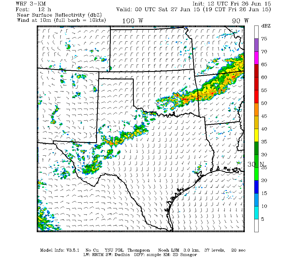
TTU WRF Simulated Radar at 7 PM CT

TTU WRF Simulated Radar at 10 PM CT
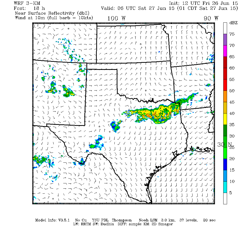
TTU WRF Simulated Radar at 1 AM CT Saturday
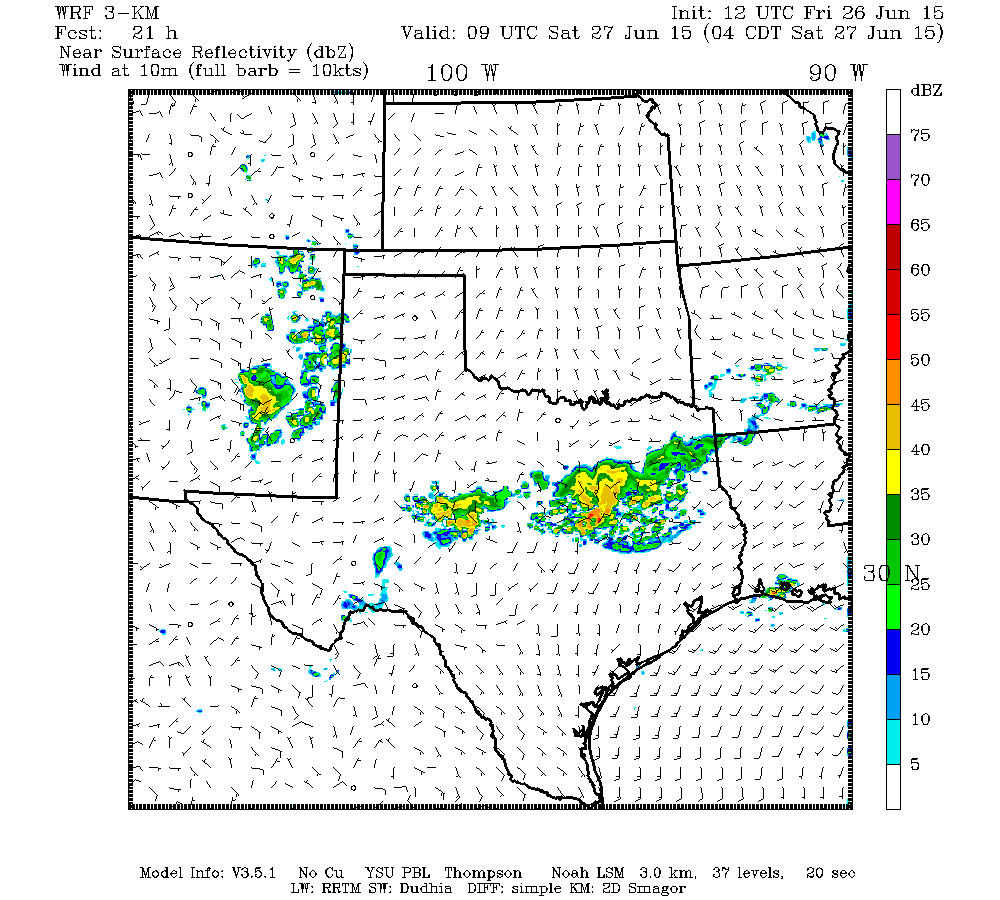
TTU WRF Simulated Radar at 4 AM CT Saturday


0 Comments