
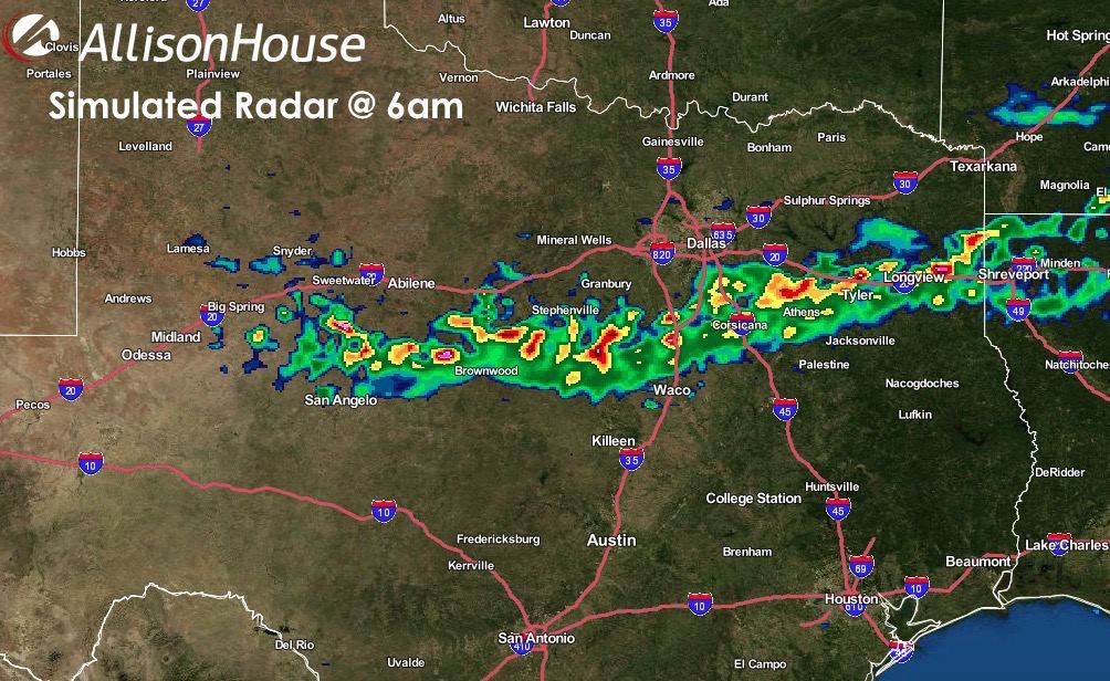
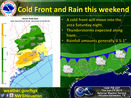
Rain and thunderstorms continue to develop ahead of a weak cold front that’s expected to move through northern Texas late tonight. Another round of storms is possible overnight as the front moves through, so folks could be looking at round 2 coming through after midnight. So far, no significant reports of hail…the main threats have been gusty winds, heavy downpours with localized street flooding, and lightning. The radar image below shows the current position of the front with radar as of 9:15pm. It’s the storms developing right along the front at this time which we expect to move through the area late tonight and into tomorrow morning. We don’t expect widespread severe with this next round, but additional heavy downpours, gusty winds and more lightning are certainly a possibility.

Early tomorrow…storms will continue to develop before sunrise along the front as it slowly drifts south. It’s likely we’ll see some lull in the threat for strong storms until the afternoon hours when things will ramp up again as we reach peak heating. By then, it’s expected that the front will be near the I-10 corridor across southern/southeast Texas where it will likely stall. For tomorrow, the best chances of strong storms will be along and ahead of the front, mainly south of a line from Lufkin, Centerville, Georgetown and out towards Junction. We’ll also see the daily coastal/seabreeze showers added to the mix by mid-afternoon as well.


0 Comments