
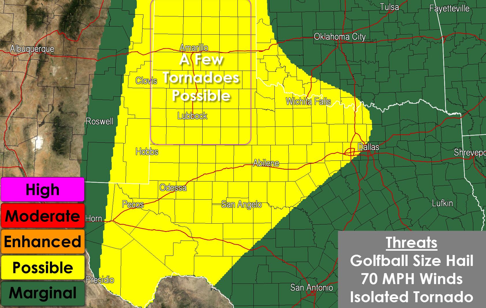
Like Wednesday another fairly active thunderstorm forecast is shaping up again today. Widespread severe weather isn’t expected nor are we expecting an outbreak. It’s a typical Late May day in Texas (well one that doesn’t involve the drought). A level 2 possible severe weather risk includes the Texas Panhandle, South Plains, West Texas, Permian Basin, Big Country, Concho Valley, Northwest Texas, and western North Texas. The most likely area for supercells with a tornado risk will be in the Texas Panhandle into the South Plains. Storms that fire out there early this afternoon could form into a cluster of storms as they move east/southeast this evening. Meanwhile another afternoon/evening chance for thunderstorms will exist across North Texas and the Red River Valley. Those storms will occur in an area of lower shear but could still be severe with quarter size hail and damaging wind gusts. Localized flash flooding is an obvious threat.
As always keep an eye to the sky and expect the unexpected weather wise! I’m not sure if I’ll be chasing again today. If I’m not I’ll be around to post frequent weather updates this afternoon/evening. If I am chasing updates will be more infrequent with Jenny posting updates (along with her real paying job!).


0 Comments