
Thursday, May 7 (Today)
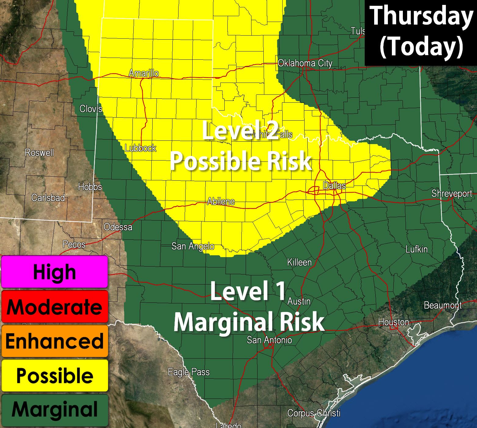
Severe thunderstorms are a possibility again this afternoon as our active May weather pattern continues. The Storm Prediction Center has highlighted the Texas Panhandle, Northwest Texas, Big Country, and North Texas in a severe weather risk this afternoon and evening. The evolution of how this afternoon plays out will actually hinge on what is going on this morning. The storms that impacted Northwest Texas and western North Texas may have left outflow boundaries which can be focal points for thunderstorm development and also can locally enhance the severe weather potential. The dryline may also come into play this afternoon with thunderstorm development. Another consideration regarding today’s severe weather potential will be how quickly we get the clouds and precipitation from this morning’s round of storms out of the way. The less clouds the more unstable the atmosphere can become. Wind shear values will be supportive of organized severe weather including the possibility of a tornado threat. Very large hail and damaging wind gusts are likely with the strongest storms. Low level wind shear will support some tornado threat with outflow boundaries locally enhancing the low level wind shear. We’ll have to watch storms that interact with outflow boundaries carefully for an enhanced tornado threat. Storms may fire up by early afternoon with little in the way of a cap in place. They’d likely continue through this evening with multiple rounds of storms possible.
Friday, May 8

An enhanced severe weather risk is expected across Northwest Texas, western North Texas, the Big Country, the Concho Valley, and Southwest Texas on Friday as the ingredients come together to support a possible severe weather event. The strongest storms may be capable of producing softball size hail, 80 MPH wind gusts, and tornadoes. Depending on how things evolve there is the potential for a significant severe weather threat on Friday afternoon and evening in Texas. Please check back for updates later today as this is an evolving forecast.
Saturday, May 9
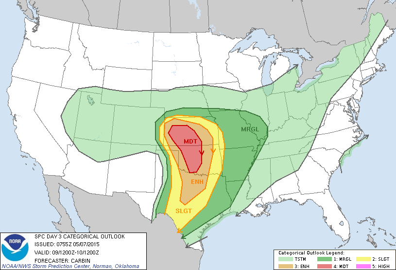
A regional severe weather outbreak is expected from North Texas through Oklahoma and Kansas as ingredients come together to support the possibility of a high-end severe weather threat. The Storm Prediction Center has already issued a Moderate Risk (level 4) for Kansas and Oklahoma with an Enhanced Risk (level 3) for North Texas and the Big Country. Like Friday this has the potential to feature significant severe weather with tornadoes, very large hail, and damaging wind gusts. Stay tuned for updates as we get closer to Saturday.


0 Comments