
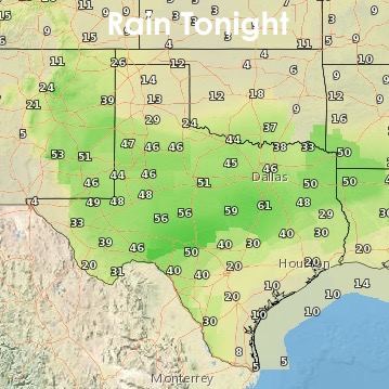
A cold front is currently draped across northern Texas and is stretched across the Trans Pecos region of western Texas. Showers and thunderstorms developed earlier this afternoon along and ahead of the frontal boundary in far west Texas. Spotty shower activity was noted elsewhere across central and north central Texas. The area of rain across western Texas is expected to continue for a few more hours with additional chances of rain developing overnight north of the frontal boundary across west central and north Texas. Here’s a overview of how the rain chances will shape up for tonight and into tomorrow. 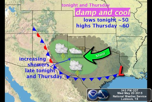
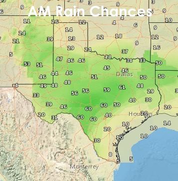
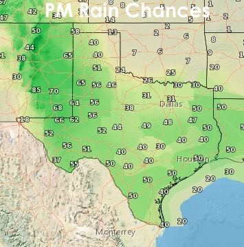
A few chances for storms returns tomorrow across west Texas and the Big Bend region. A few supercell thunderstorms are possible with a hail and high wind threat. Isolated tornadoes are possible across the Slight Risk area as well. Within the Marginal Risk area, a few strong storms mixed in with general showers is possible. Heavy downpours and additional flood risks are likely tomorrow with precipitable water values 1 to 2 standard deviations above normal. In a nutshell…more rain!

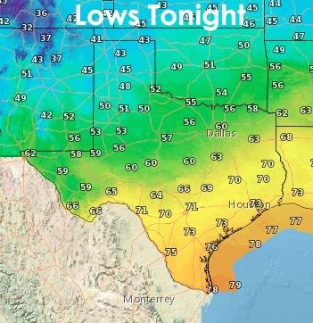
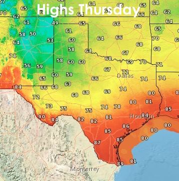
Lows tonight behind the front, pleasantly cool for this time of the year with parts of the panhandle and into northern Texas getting down into the 40’s and 50’s…a good 10 to 15 degrees below normal for this time of the year. Highs tomorrow will also be pleasant behind the front…and folks across north central and northeast Texas will be enjoying pleasant humidity values compared to what we’ve had the past week.
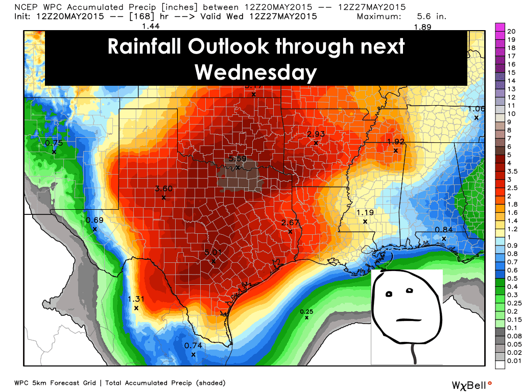
A Look Ahead: Unfortunately, the weekend looks a bit rainy…with Sunday into Monday bringing the greatest chances. Hard to pinpoint at this time exactly where and when rain will be falling but it looks like folks with outdoor plans this weekend will need to be sure they have a Plan B in place in case of showers in your particular location. We may get a brief break from the rain the first few days of next week, after that, it looks like more on and off rain chances through the next weekend as well. Below is the latest outlook for rainfall through next Wednesday. That’s as far as this graphical outlook goes, so stay tuned for updates!


0 Comments