
Track the storms and flooding with our free interactive weather radar. We provide this tool so you can keep up with the weather near you or across the country! Click here or visit texasstormchasers.com/radar
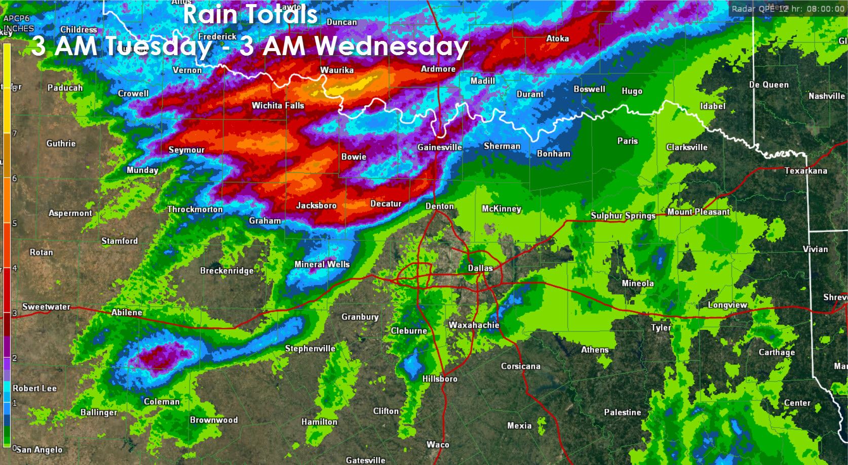
With active weather all night this will be a shorter than average morning blog. Much of this forecast will be based off the High Resolution Rapid Refresh (HRRR) weather model to keep up best with short-term trends. It may not be totally spot on but it should have a decent idea of what we’ll be dealing with through the mid-afternoon hours. The heavy thunderstorms with flooding should continue to push into Northeast Texas this morning while gradually weakening. We may see additional showers and storms pop up around or after sunrise from the South Plains east through North Texas. This activity is not expected to be severe and will gradually move south with individual cells moving east. Additional strong to severe thunderstorms may be in progress by noon across the Permian Basin. That activity would likely develop into a cluster and move east/southeast into the Hill Country, Concho Valley, and eventually may impact the I-35 corridor in Central Texas by late afternoon. Where we see this cluster of storms fire up and move is still up in the air – so don’t be surprised if that trends more north or even south as the day goes on. Even more storms may be in progress this afternoon in Southeast Texas as the atmosphere becomes unstable and we deal with the usual popcorn storms.
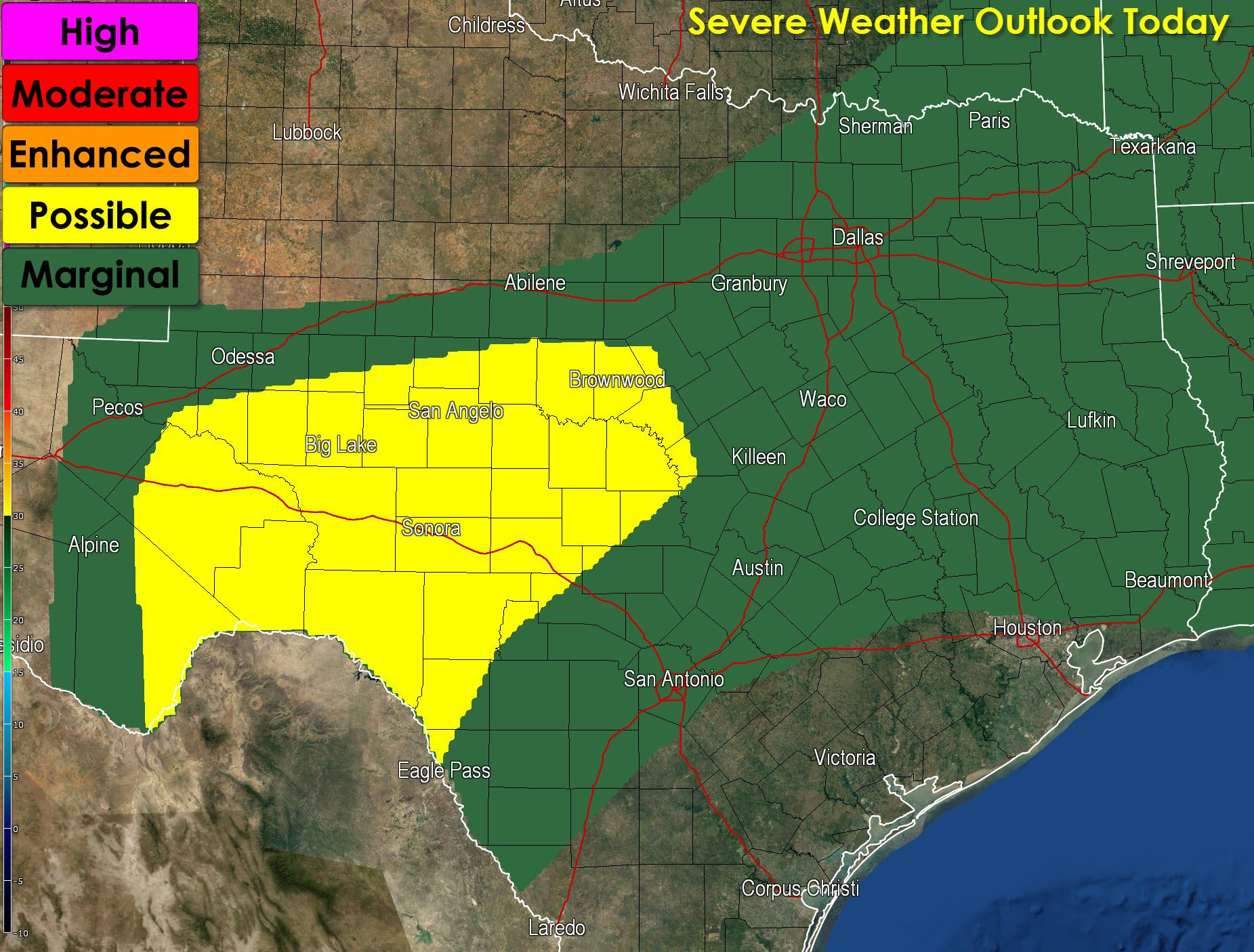
The strongest storms this afternoon may produce golfball size hail, 60 MPH wind gusts, and pose a flooding threat. Low level wind fields will not be as conducive for tornadoes today but with boundaries galore sitting around an isolated tornado threat certainly cannot be ruled out.
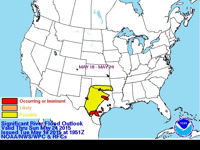
With portions of the state still underwater or completely saturated it won’t take much rain to cause flooding. Remember flash flooding can develop in minutes after a heavy rain falls so don’t drive into flood waters. It is worth noting that we’ll be dealing with significant river rises for the next week (if not longer) across Texas as more rain falls and rises move downsteam.


0 Comments