
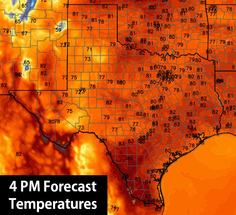
We began transitioning into a more active pattern on Sunday as thunderstorms fired up across the Texas Panhandle and South Plains. Coverage of showers and thunderstorms will increase today across the Texas Panhandle, West Texas, and Permian Basin. Locally heavy rain is possible this afternoon into tonight with the stronger cores along with some flooding risk. Outside of those areas today will be mostly dry with seasonal weather. Temperatures will climb into the lower 80s for most of Texas with mid to upper 80s in the Rio Grande Valley. We’ll see temperatures cool down by late afternoon across West Texas in the proximity of showers and thunderstorms. Most thunderstorm activity will make slow progress to the east today.
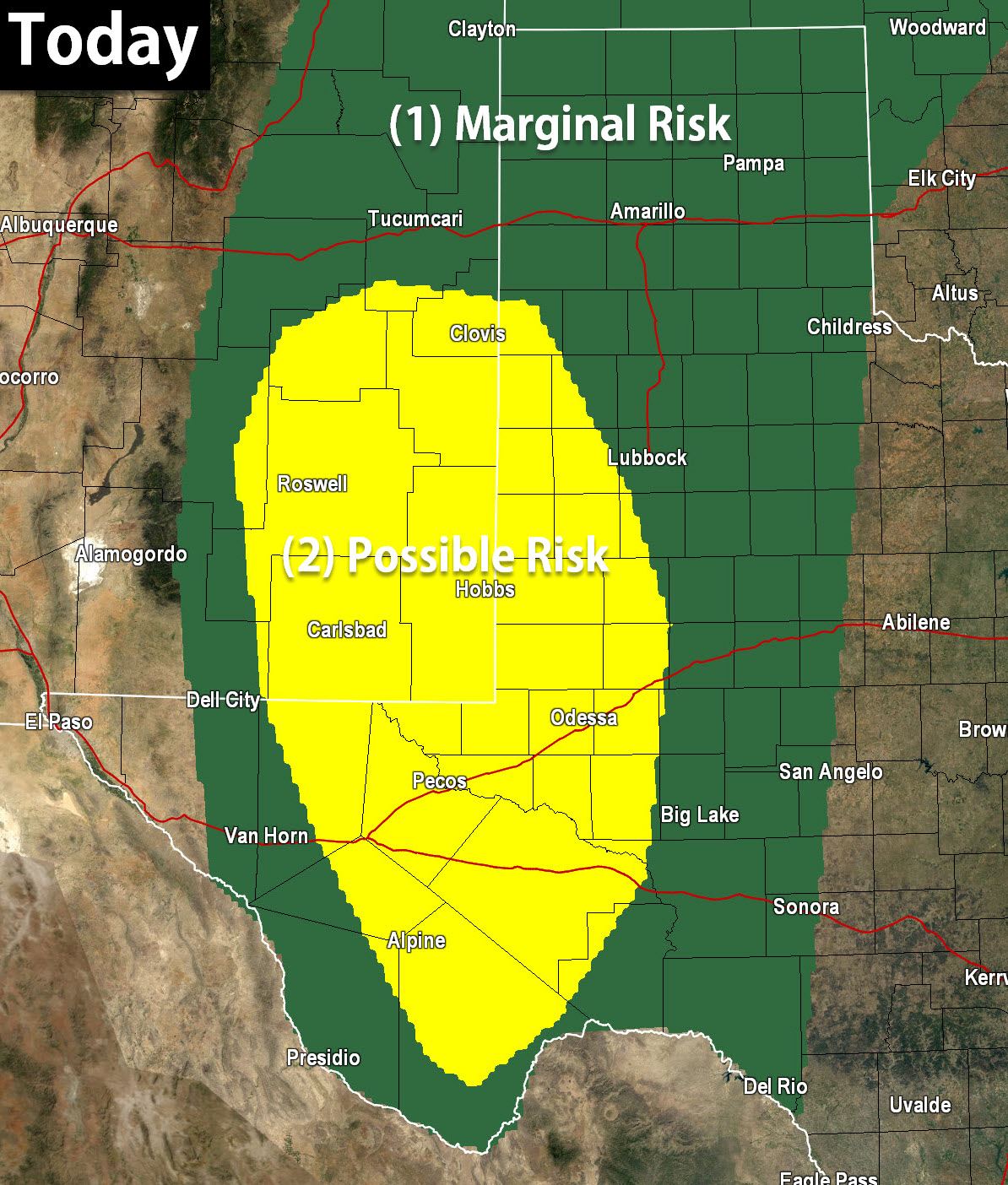
The Storm Prediction Center has issued a level 2/possible risk for severe weather risk across the Permian Basin and western South Plains for this afternoon and evening. This is where the relative highest wind shear will be collocated with a moderately unstable air mass. The strongest storms may be capable of producing hail up to the size of golf-balls and localized wind gusts over 60 MPH. A level 1/marginal severe weather risk includes all of the Texas Panhandle and West Texas where an isolated stronger storm will be possible today. We’re not really concerned with a tornado threat.
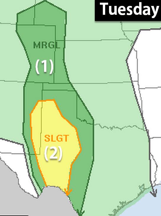
Much of the same areas will be under the gun on Tuesday as thunderstorms become more widespread. Heavy rains will also increase the threat for flooding – but we’ll talk more about that in a blog later today. Remember you can track all the active weather using our free interactive weather radar at texasstormchasers.com/radar


0 Comments