
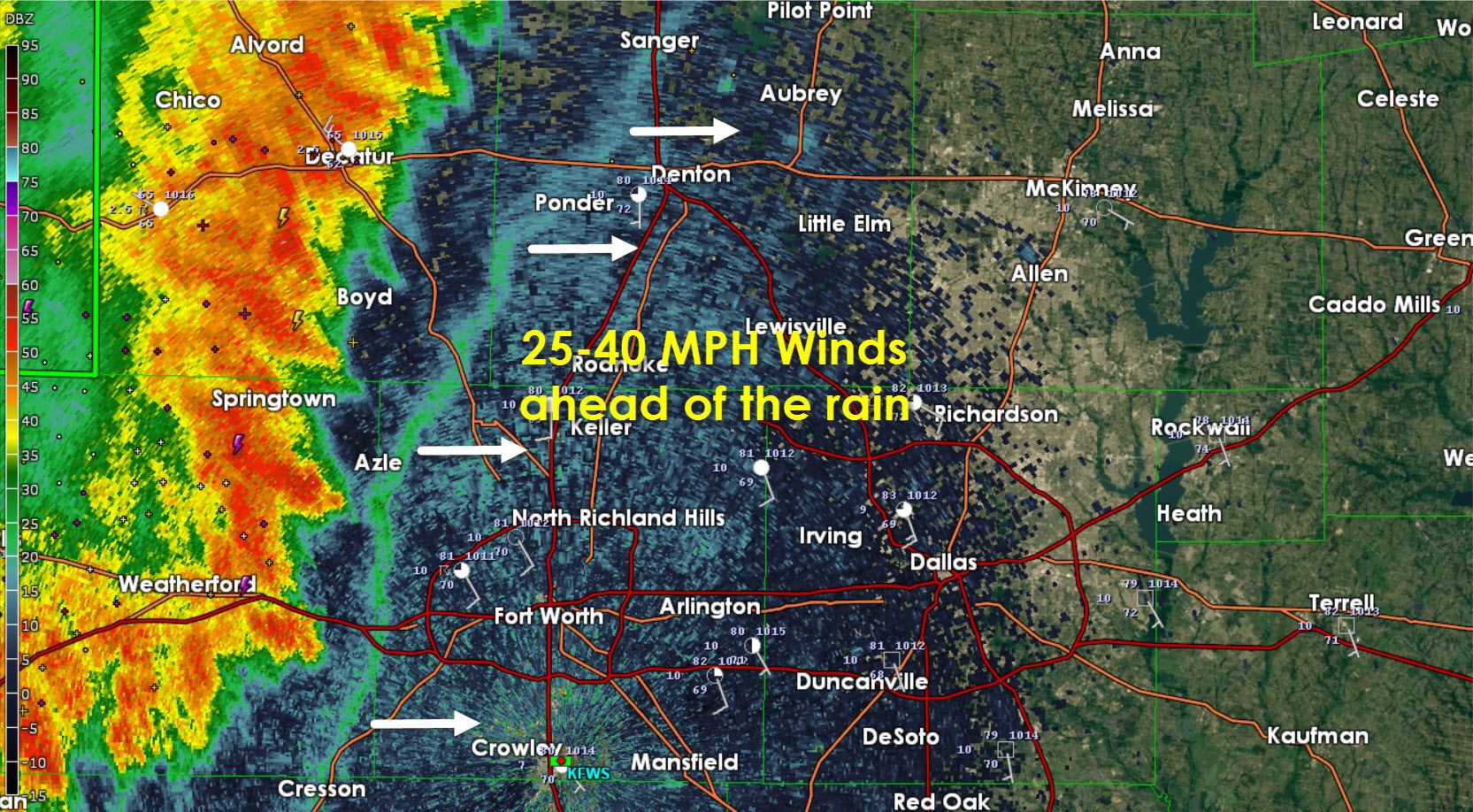
An outflow boundary about 5 miles east of thunderstorms is along a Sanger-Ponder-Azle-Cresson line in western D/FW. 25 to 40 MPH winds are possible along with a noticeable drop in temperatures. This wind shift will precede any rain. Not long after the thunderstorms will arrive. They’ve weakened compared to earlier this evening. An unintended consequence of the storm’s weakening is that their eastward progression has slowed. Producing heavy rain the threat for flooding is increasing in the D/FW Metroplex. Frequent cloud to ground lightning is also occuring. We’ll have a statewide update around 915PM.
Don’t be surprised if flash flooding becomes a problem in western D/FW by 10 PM should we see the heavy rainfall as I think it will.
Advertisements


0 Comments