
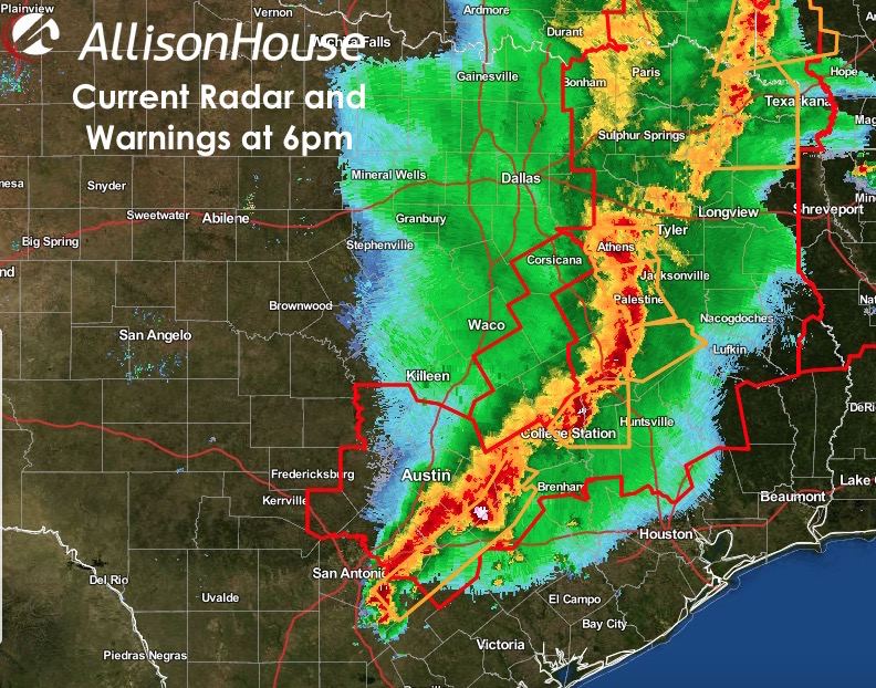
Our severe squall line of storms stretching from far northeast Texas down into the eastern Hill Country region continues to march east this evening. While it appears that our threat for tornadic spin-ups along the leading edge of the squall line is diminishing at the moment, there is still a risk of additional spin-ups into the evening hours across parts of central, northeast and east Texas where Tornado Watches remain in effect until 10pm. High winds, some in excess of 70mph, along with flooding rains will be the main threats as this line moves east over the next several hours. Wet soils have also made it easier for trees and telephone poles to topple over in high winds, so be aware of that issue as well.
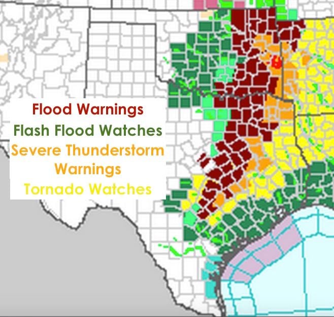
Numerous Flood Warnings (Red) and Watches (Green) remain in effect for a few more hours across much of the eastern half of the state. We expect additional Flood concerns into the late evening and early nighttime hours as this line of strong storms with heavy rain continues to move east. Take all of these Watches and Warnings seriously as we’ve already seen numerous reports today of high-water rescues…especially across the Hill Country and southern north Texas areas. If you don’t have to be out and about in this, it’s best to stay put! If you do have to venture out, stick with main and paved roadways with plenty of street lighting if at all possible so that you’re able to see standing water or debris on the roadway.


0 Comments