
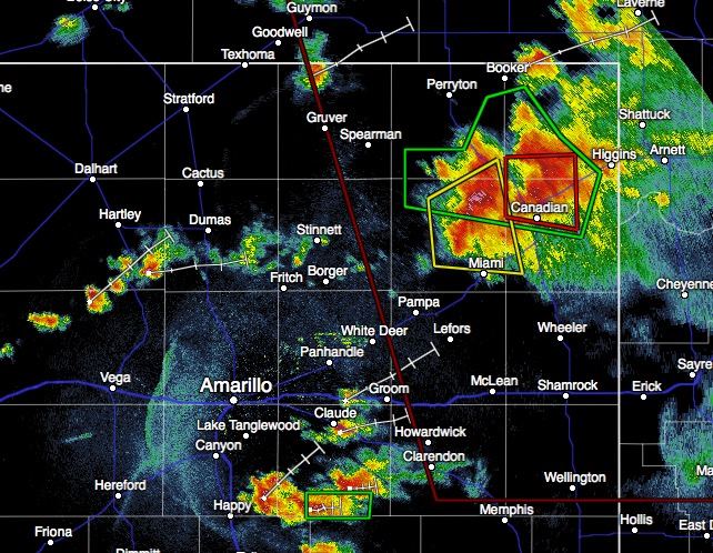
A torando-warned supercell thunderstorm continues to impact the eastern panhandle just north of Canadian. This storm has a history of producing multiple funnels and tornadoes, and is expected to continue doing so until after sunset and we begin to lose daytime heating. So far, all the tornadic activity has remained outside of town. We’re seeing reports of some possible injuries on a local gas drilling rig near Canadian, but no details if it’s related to the severe weather situation or not. This storm remains nearly stationary…moving at a blazing 5mph…so folks in the area will need to remain on high alert for a bit longer.
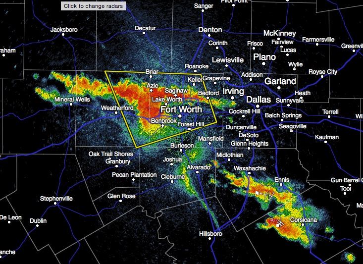
In north central Texas, a Severe Thunderstorm Warning is in effect for Tarrant and Parker counties until 8:15pm. This batch of cells is actually moving north/northeast at around 30mph. Winds in excess of 60mph and quarter size hail is likely. Additional batches of cells are also developing south/southeast of Dallas. Nothing severe warned at this time, but they’ll be producing heavy rains between Waxahachie, Ennis and Corsicana.
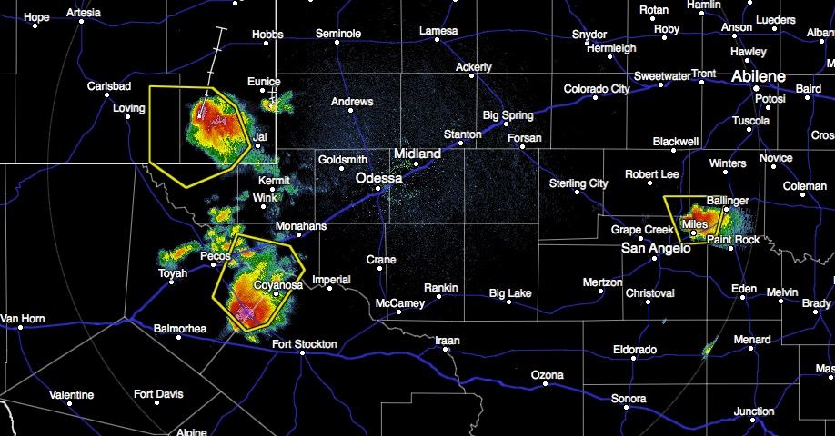
Across west and west central Texas, we have a few new cells popping up which have quickly become severe warned. The cell northwest of Ft. Stockton is likely producing 2 inch hail and 60+mph winds. The cell northeast of San Angelo is likely producing 1 inch hail and 60mph winds.
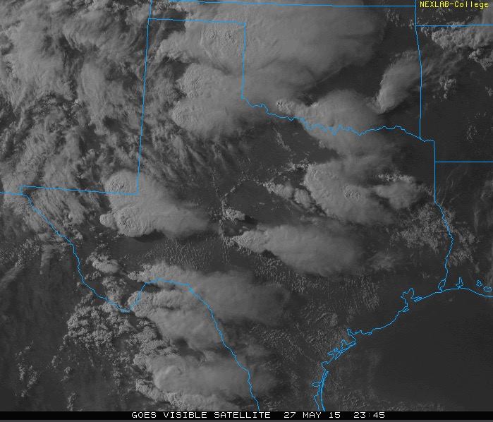
Last but not least, here’s a current look at visible satellite. Always neat to see things from space!


0 Comments