
Severe thunderstorm chances will ramp up tomorrow afternoon across a wide swath of the state as a closed low pressure system parks itself over the four corners region for a couple of days. The Storm Prediction Center has placed the panhandle down into central, southwest, south and southeast Texas under a Slight Risk of seeing severe storms develop by tomorrow afternoon. An Enhanced Risk area has been placed across parts of the central and eastern panhandle down into the northern rolling plains. This area will be the most susceptible to seeing severe storms with large hail, damaging winds and perhaps a tornado or two. Folks within any of the Slight and Enhanced risk areas will need to keep an eye on the weather tomorrow afternoon and be prepared to seek shelter should threatening weather approach. David and Paige will be out chasing in the panhandle. Ric Burney and I will be roaming the same region doing our version of chasing which is more like a flying monkey routine. 😀 Be sure to check out our Twitter, Facebook and Instagram feeds tomorrow afternoon for short video updates and random photos!


The NWS office in Amarillo Severe published a Weather Briefing for tonight into Thursday evening that you may want to check out….
Parts of central and south central Texas will also be under the gun for seeing strong to severe storm development. The greatest threats will be frequent lightning, large hail and damaging winds as scattered clusters of storms develop during the afternoon and evening hours. The tornado threat is very low, but it’s not zero. Again, the most favored area for tornado activity tomorrow will be across the central and eastern panhandle, but do stay aware of conditions in your area tomorrow afternoon if you’re out and about. A Severe Weather Briefing from the NWS office in Austin/San Antonio for the central Texas region has been shared below for your viewing.
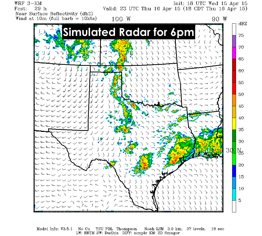
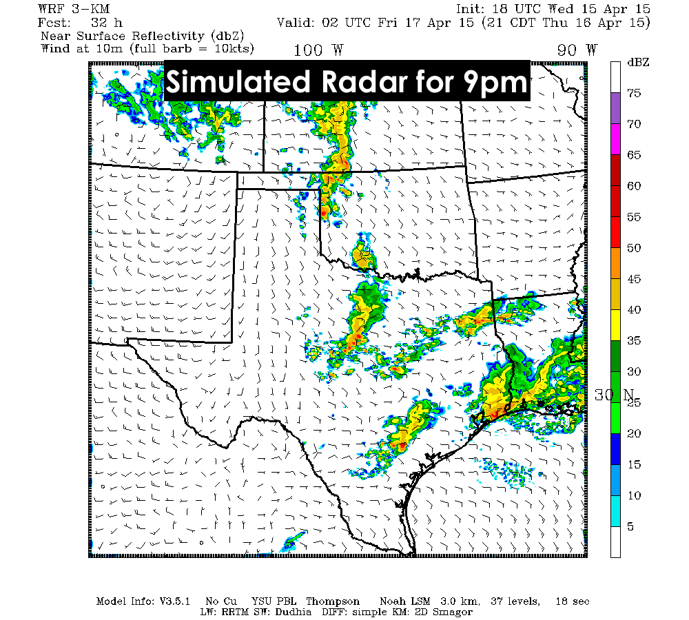
Here’s a look at what the radar might look like by tomorrow evening after the storms begin to fire up. As always, simulated radar is just a best guess at storm coverage, but it will give you an idea of what things might look like. I really hope we can get some good rain over areas that have missed out recently.


0 Comments