
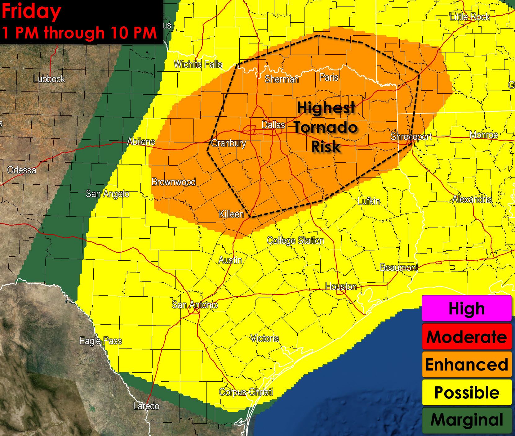
The Storm Prediction Center has issued an updated severe weather outlook for later today. A few things of note that have changed since our update last evening. This system is going to be a few hours slower and further west. That means instead of thunderstorms moving through the D/FW Metro around 1-4 PM we may end up seeing them in the 4-7 PM timeframe. There are still some questions about that so be sure to keep an eye on the forecast today. The dryline is going to hold back further west this afternoon. That means storms will fire well west of Interstate 35 and mature as they move east. It still looks like we should see the most intense thunderstorms along and east of Interstate 35 in terms of highest tornado potential. As the past two days have shown mother nature tends to remind us we’re essentially giving our best educated guess what she’s going to do. There are always a few surprises in an event and those usually don’t show up until a few hours before we get going. For that reason I encourage you to check back for forecast updates later today and keep up with the latest. Be sure you have a way to receive severe weather warnings and be ready to act if a dangerous thunderstorm approaches your location.
…THERE IS AN ENH RISK OF SVR TSTMS ACROSS PARTS OF NORTH CENTRAL
AND NORTHEAST TEXAS INTO ADJACENT PORTIONS OF SOUTHERN OKLAHOMA AND
THE ARKLATEX…
…THERE IS A SLGT RISK OF SVR TSTMS SURROUNDING THE ENH RISK
AREAS…ACROSS MUCH OF THE CENTRAL AND SOUTHERN PLAINS INTO WESTERN
GULF COASTAL AREAS AND THE LOWER MISSISSIPPI VALLEY…
…THERE IS A MRGL RISK OF SVR TSTMS AS FAR NORTH AS PORTIONS OF THE
NORTHERN PLAINS…AND AS FAR EAST AS THE CENTRAL GULF STATES…
…SUMMARY…
SEVERE THUNDERSTORMS ARE LIKELY THIS AFTERNOON INTO TONIGHT ACROSS
THE CENTRAL AND SOUTHERN PLAINS. THIS WILL INCLUDE THE RISK FOR
SUPERCELLS CAPABLE OF PRODUCING VERY LARGE HAIL AND PERHAPS A FEW
STRONG TORNADOES…MAINLY ACROSS PARTS OF CENTRAL KANSAS…AS WELL
AS PARTS OF NORTHEAST TEXAS INTO ADJACENT PORTIONS OF SOUTHERN
OKLAHOMA AND THE ARKLATEX REGION.


0 Comments