
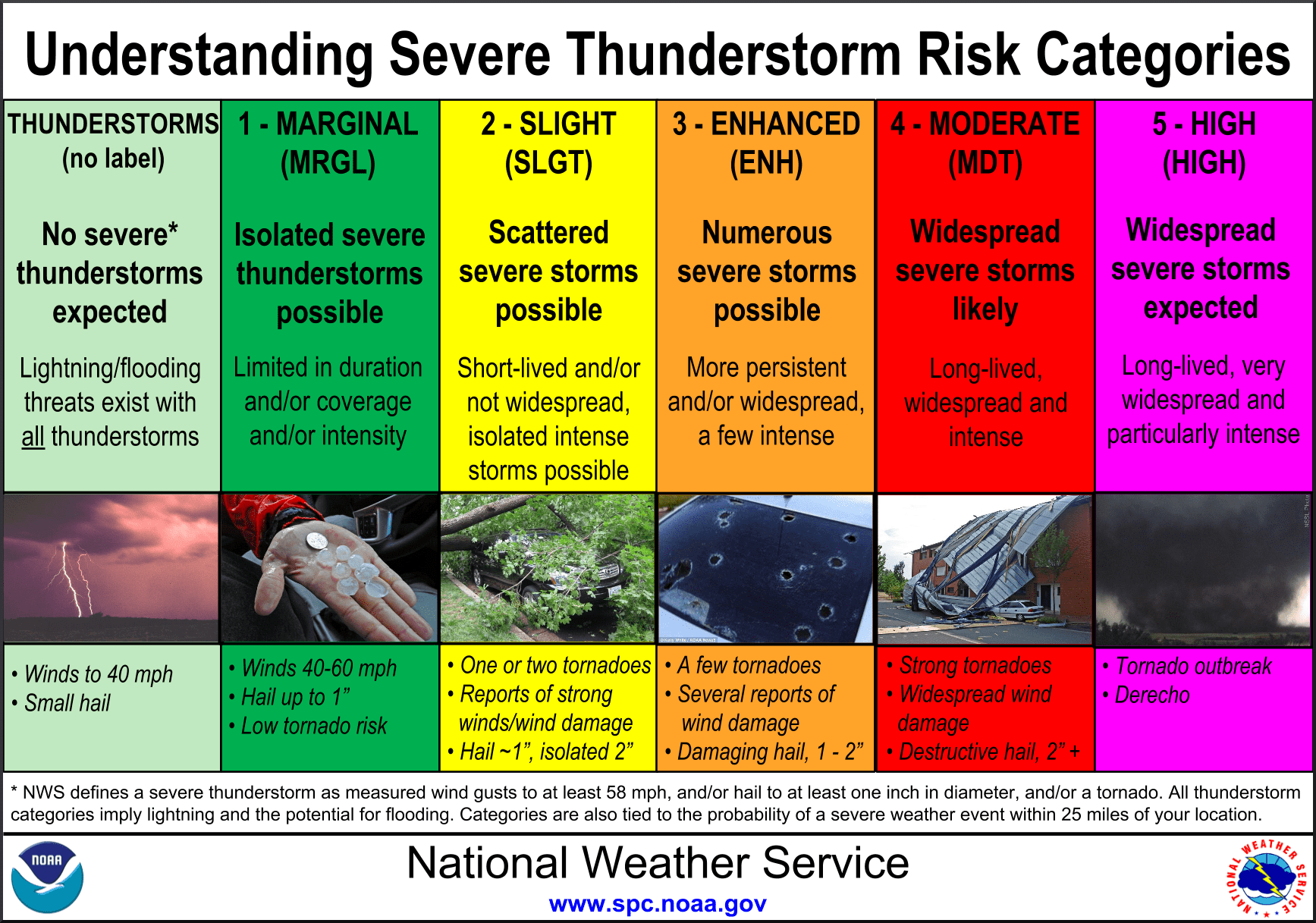
Risk definitions for severe weather outlook
As a reminder here are the definitions for each category on the severe weather outlook. Several factors including forecaster confidence, number of severe storms, potential strength of said storms are all factors that go into severe weather forecasting. We’ll forgo the typical weather roundup for a detailed discussion on upcoming severe weather potential.
Today
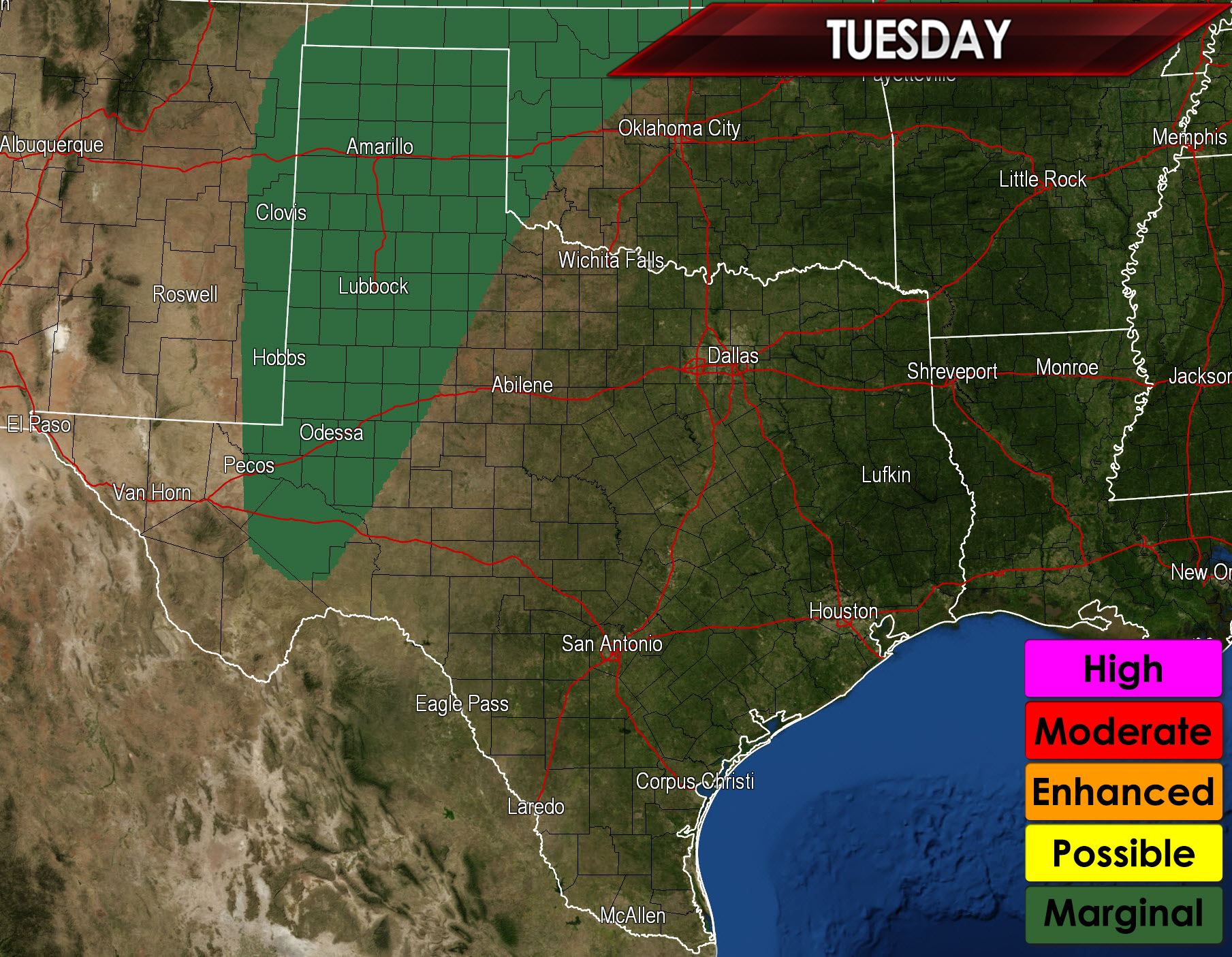
Limited moisture will help keep instablity values low today and a strong cap will likely prevent thunderstorm development through sunset. An isolated severe thunderstorm is possible across West-Central Texas into the Texas Panhandle late this afternoon into early this evening. The overall threat will remain marginal and isolated. The strongest storm may produce quarter size hail and localized wind gusts around 60 MPH. There is the potential for a more widespread round of thunderstorms to develop in the northern Texas Panhandle late Tuesday night into the morning hours on Wednesday. Some of those storms may be strong. Isolated thunderstorms are also possible in North and Northeast Texas but widespread severe weather is not expected.
Wednesday
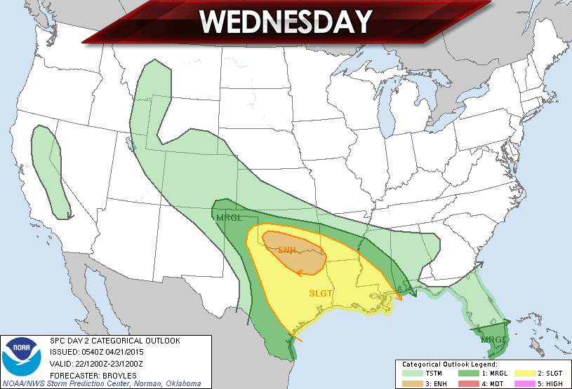
An enhanced risk of severe weather is in place for North and Northeast Texas. A slight risk includes Northwest Texas, Central Texas, East Texas, and Southeast Texas. A marginal severe weather risk is possible in the Texas Panhandle into Deep South Texas. A cluster of severe thunderstorms is possible by late afternoon on Wednesday just north of the Red River in southern Oklahoma. This cluster of storms would move southeast with the potential of large hail, destructive wind gusts, and isolated tornadoes. More isolated thunderstorms are possible across West-Central Texas with the strongest storms capable of producing damaging hail, strong winds, and a few tornadoes. There remains some uncertainty about the exact storm mode (discrete storms or clusters) so that aspect of the forecast will continue to be refined. We’ll have an updated severe weather outlook for Wednesday later this afternoon.
Thursday

Severe thunderstorms will be possible across North Texas, Central Texas, South Texas, East Texas, and Southeast Texas. The atmosphere is expected to be strongly unstable with impressive wind shear values in place. The overall setup will also depend on outflow boundaries left over from Wednesday’s storms. Damaging hail, destructive winds, and a few tornadoes will be possible on Thursday.


0 Comments