
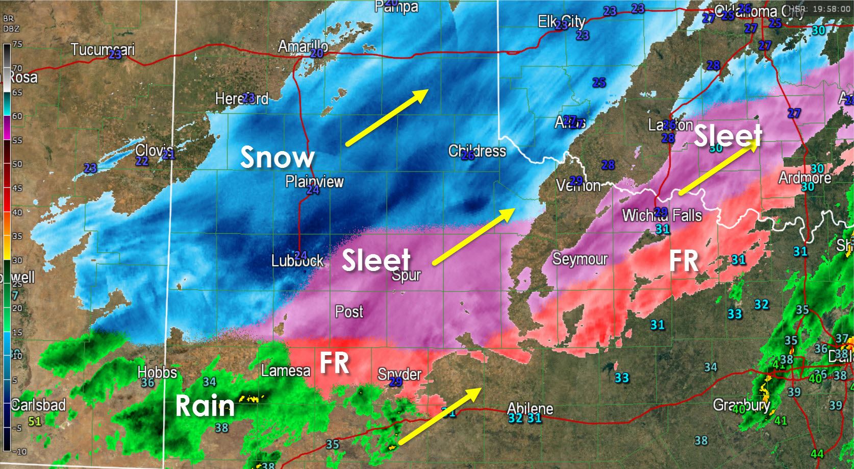
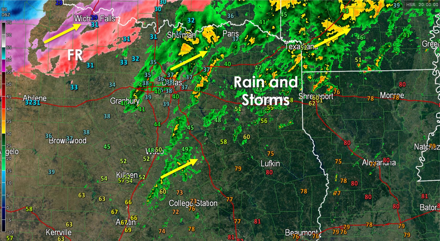
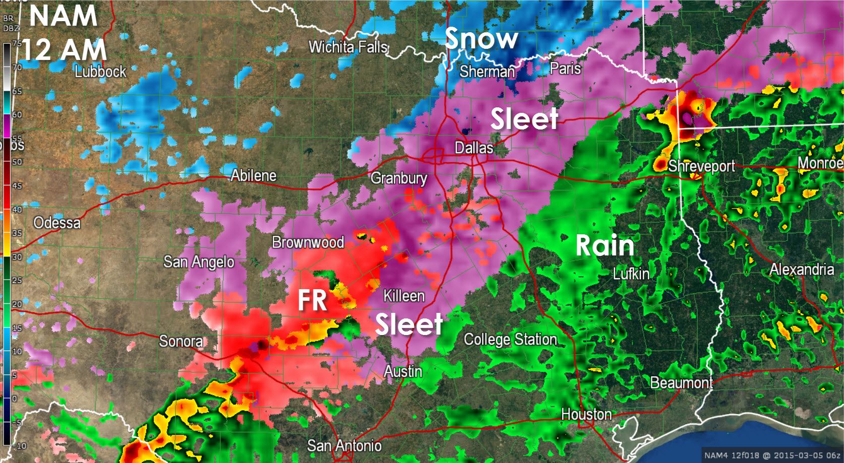
Heavy snow is now falling across the northern South Plains into the Caprock with snowfall rates approaching 1 inch per hour. Significant accumulations of snow will be possible as this heavy snow band moves northeast. Sleet and freezing rain are falling across the remainder of the South Plains into the Big Country and Northeast Texas. We’re now receiving reports of sleet along the Red River from Wichita Falls east to Sherman. Temperatures in the D/FW Metroplex are still above freezing and thus only rain. We’ll see a break this afternoon with the significant winter weather moving in after 6 PM this evening. The main show will be overnight for North, Central, South-Central, East and Northeast Texas
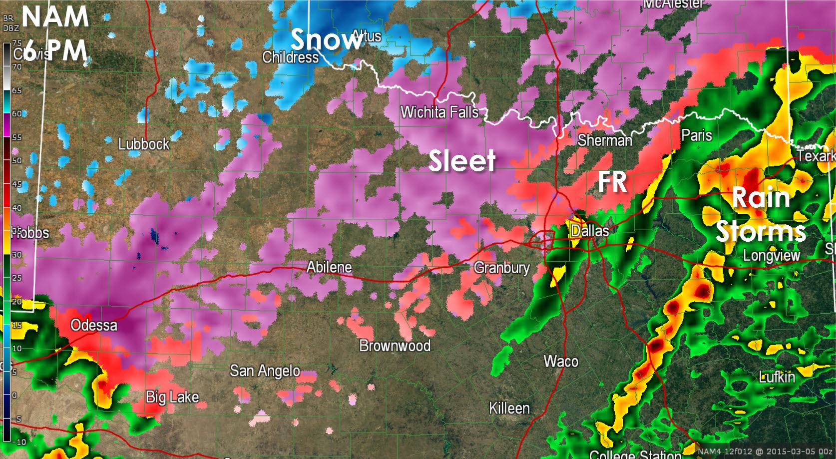
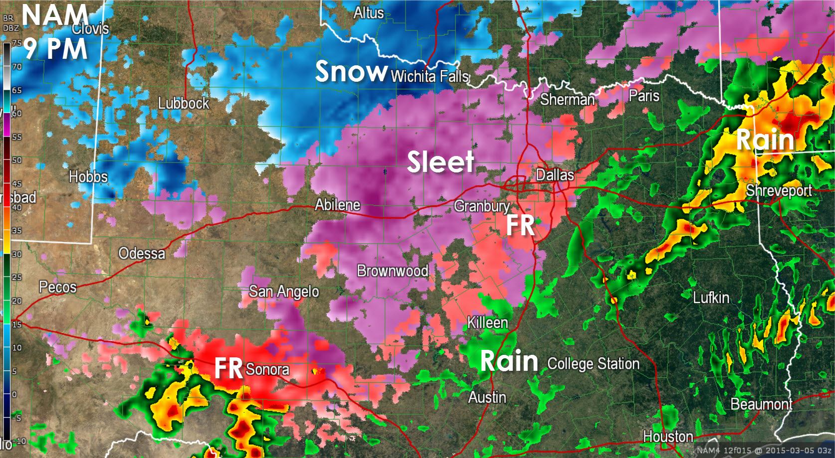
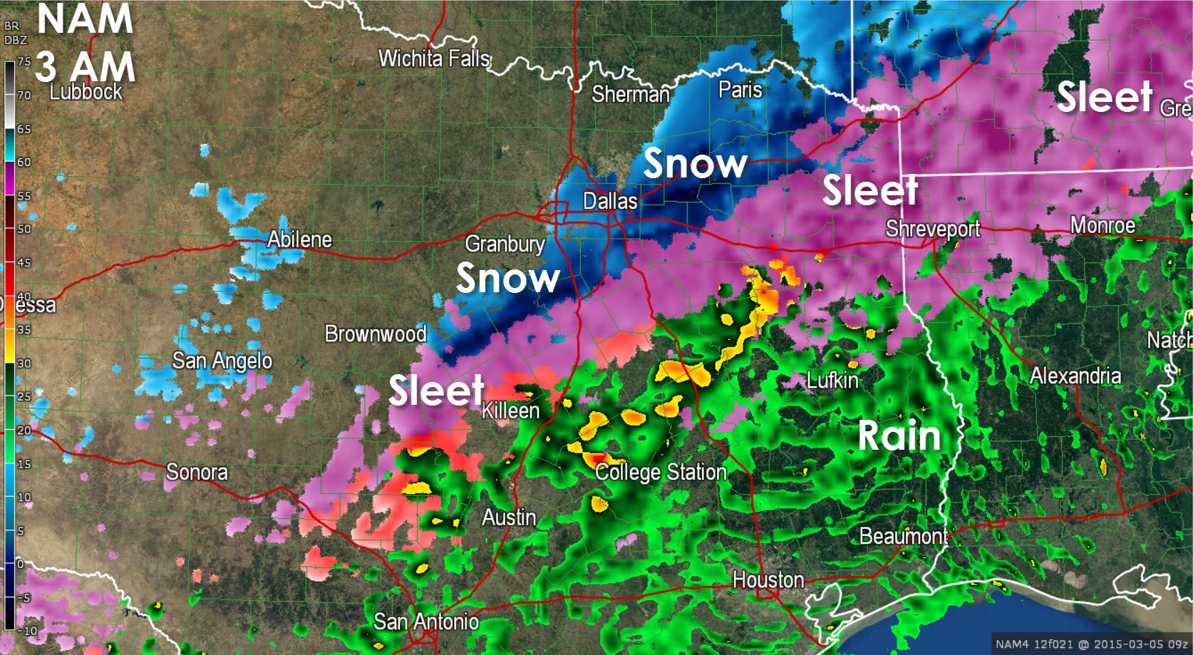
Here is what the North American Model is showing through this afternoon into tonight. This model seems to have the best idea of what’s going on right now, but as always models usually never get it 100 percent right. Either way we’re still expecting a changeover to sleet in the DFW Metroplex sometimes around or just after 6 PM. By midnight we should see sleet from Austin north to the Red River including nearly all of North and Central Texas. This is when we could also have areas of thundersleet producing locally enhanced sleet totals. Forecasts have not changed regarding accumulation totals from this morning’s blogs (see them if you’re interested in more detail). We’ll have a detailed afternoon update after 4 PM with any accumulation adjustements.


0 Comments