
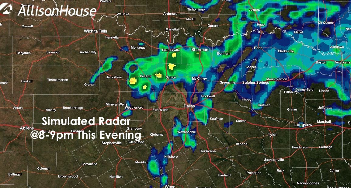
Another nice, warmer than normal and mostly dry day is expected across much of the state. Winds will be an issue today for the panhandle as our next cold front arrives. Gusts between 40 and 50 mph are possible with low humidity values increasing concerns for wildfires. Breezy to downright windy conditions are also expected today across parts of south central and central Texas this afternoon. Still a nice day for kite flying and outdoor gatherings, although you’ll need a few rocks to hold down the napkins on your picnic table. 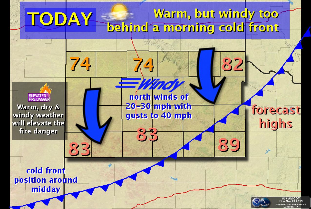 A weakish cold front will move into north Texas by this afternoon and is expected to stall across or just south of the I-20 corridor before midnight. As the front approaches, a few isolated strong storms may develop along its boundary in north Texas, primarily impacting the counties just north of the DFW metro. Once again, we have the capping inversion to keep a lid on most of the activity, but any storms that manage to break through the cap will have ample instability to work with and could quickly become strong with gusty winds, small hail and frequent cloud to ground lightning as the main threats.

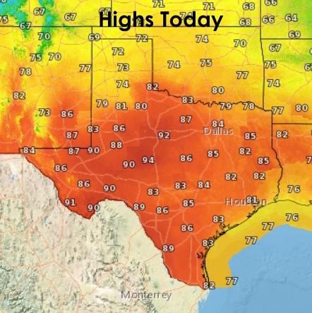
Highs today again above seasonal norms for most of the state. West central and western north Texas will likely see several cities reach 90 degrees by this afternoon. The arrival of the front this morning across the panhandle will result in temperatures only reaching the low to mid 70s by this afternoon.
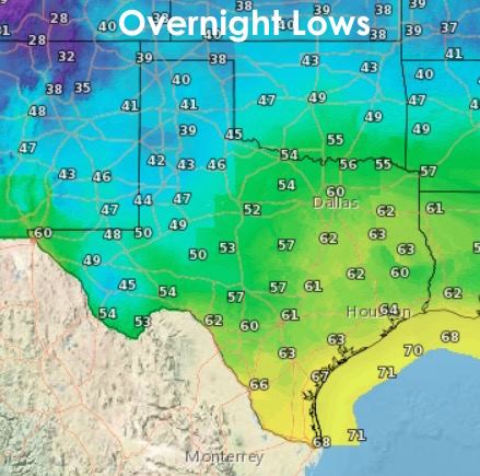
 Lows tonight will dip down into the 40s across the panhandle. Along and ahead of the cold front, temps will stay moderate and in the 50s and 60s.
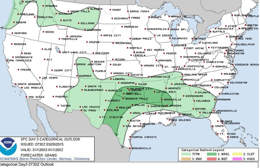
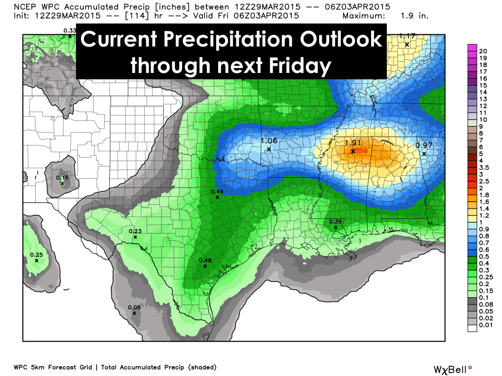
We’ll have several more chances for rain and a few storms this week beginning Tuesday through Wednesday. Right now, the rainfall accumulations don’t look all that spectacular, but with the next system still out in the Pacific, we could see some changes to that once the system moves onshore and is sampled by our weather balloon network. The same thing applies to the current Storm Prediction Center outlook below which outlines a large marginal risk area for a few strong to severe storms development Tuesday afternoon into early Wednesday. We’ll keep an eye on this for sure and have updates out as we get into the work week!


0 Comments