
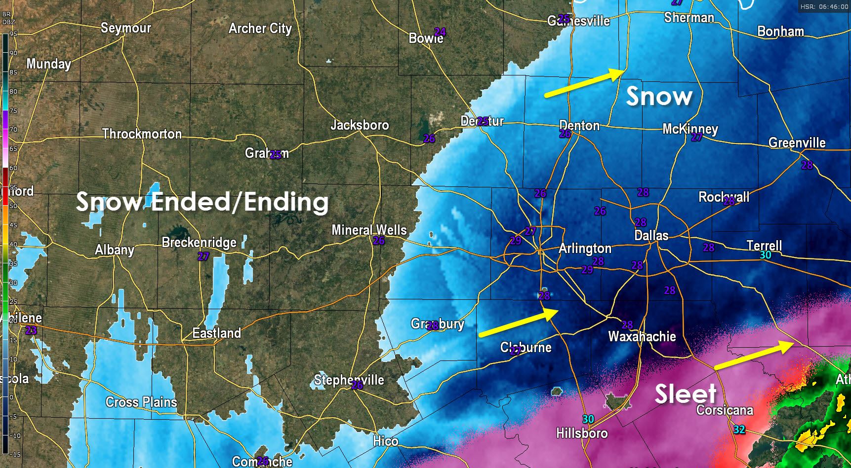
The back edge of the snow extends from Gainesville southwest to Decatur to Mineral Wells south to Stephenville. Snow, some heavy, continues to fall in the D/FW Metroplex where we’ve seen widespread 2 to 4 inch snow totals this morning. We’ve had a narrow corridor of 5 inch accumulations set up from Gainesville up into southern Denton County. Snow should begin to exit the D/FW Metroplex by 2 AM leaving gusty north winds and treacherous road conditions. Roads will not improve until late morning or early afternoon as temperatures rise above freezing, crews plow snow off roads, and the sun starts to work its magic.
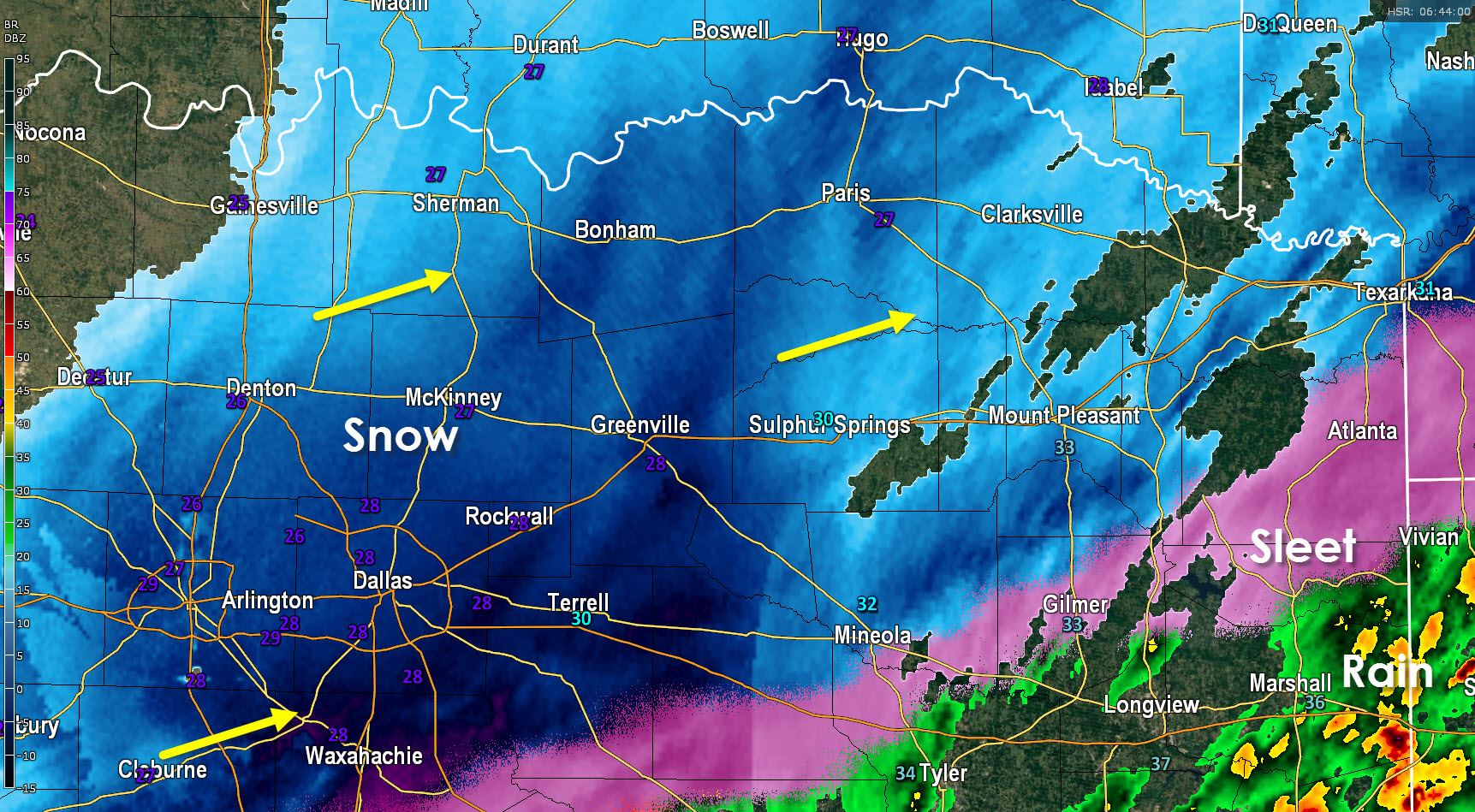
Most precipitation has now changed over to snow across Northeast Texas who just so happen to be up next to see the heavy snow. We’re expecting 1 to 3 inches of snow this morning with some locations getting enhanced totals up to 5 inches. Snow will accumulate on roads and make them slick and snow-packed. Snow will continue into the morning hours so most folks probably won’t have school or work.
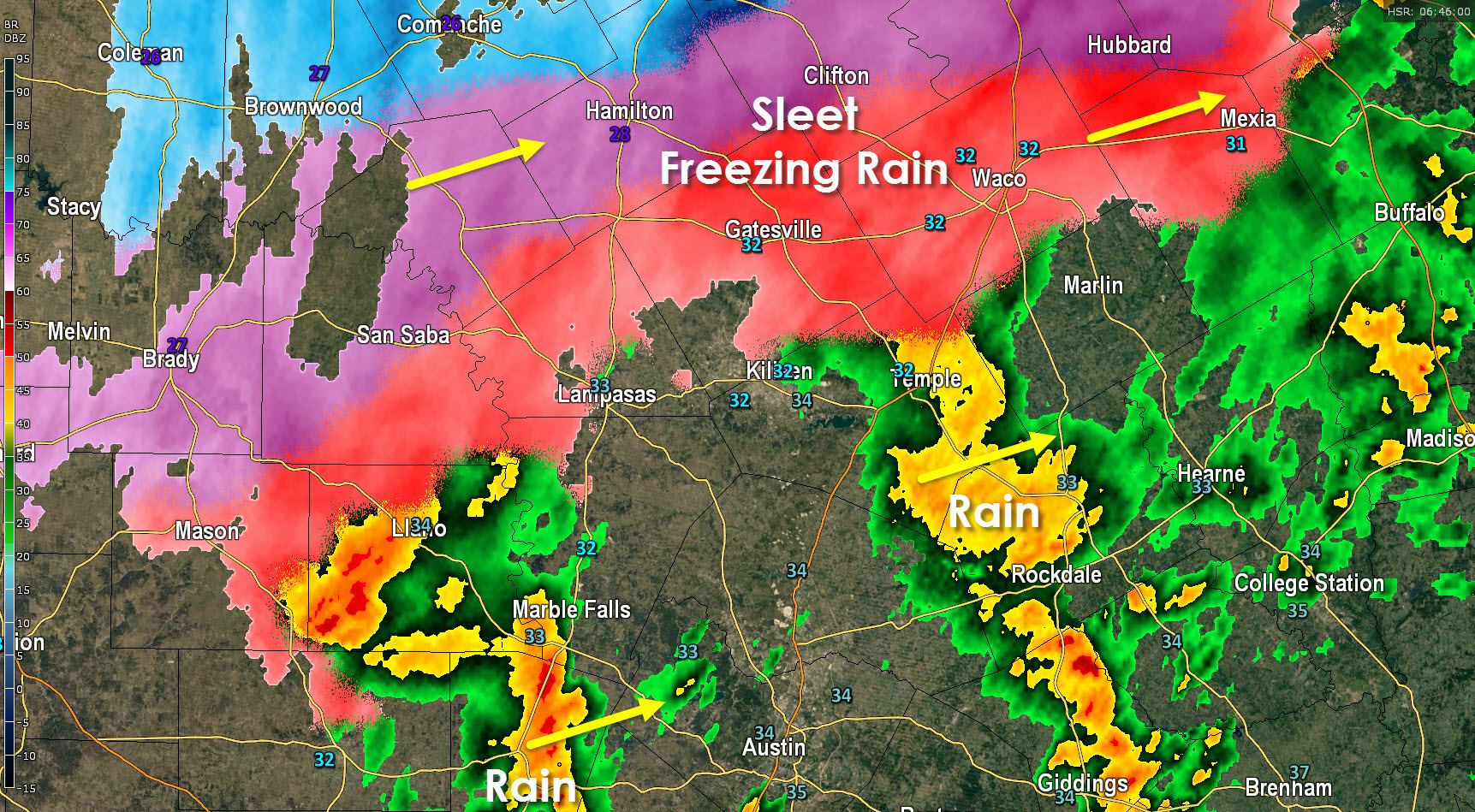
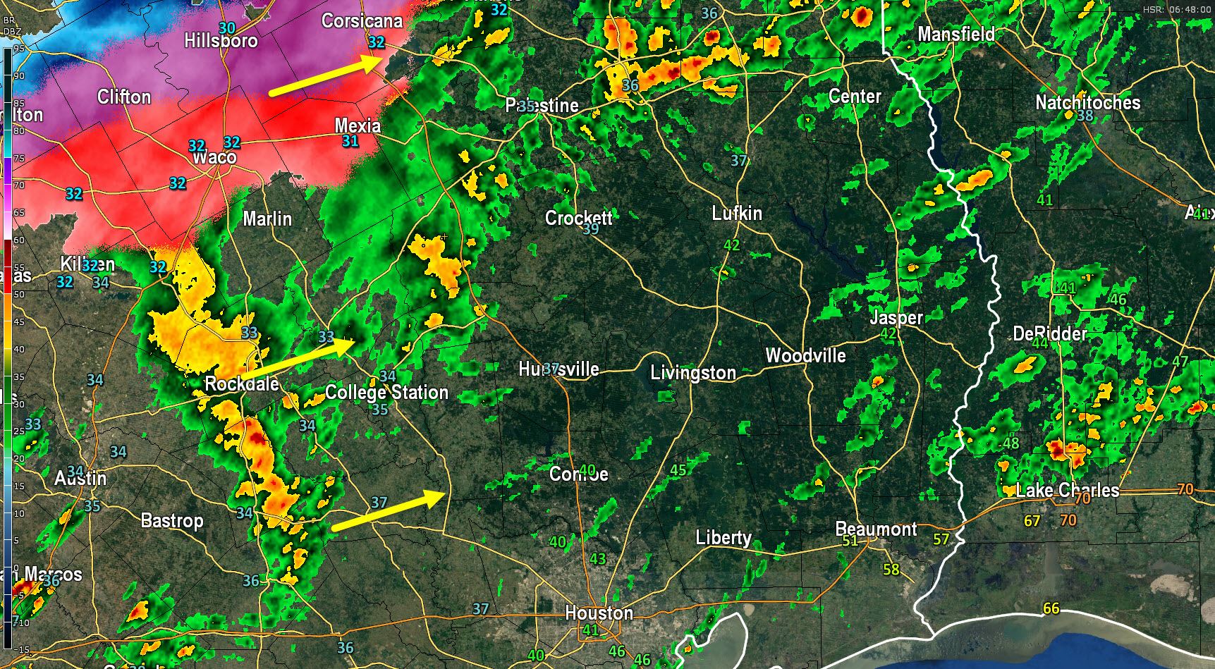
Temperatures have fallen to freezing in Corsicana, Mexia, Waco, Gatesville, Killeen, and Temple where rain is changing over to freezing rain and sleet. Accumulating sleet up to a quarter inch is possible with locally higher totals. Freezing rain may deposit a thin layer of ice. Either way we’ll likely see slick roads develop early this morning. The Austin Metro is still above freezing but some of the higher bridges have started to see a little ice form thanks to sleet that moved through earlier. The freezing line will continue to creep south and if Austin falls below freezing we’ll see rain change over to sleet and freezing rain. Biggest travel issues will be on bridges as ground temperatures are warmer compared to further north.
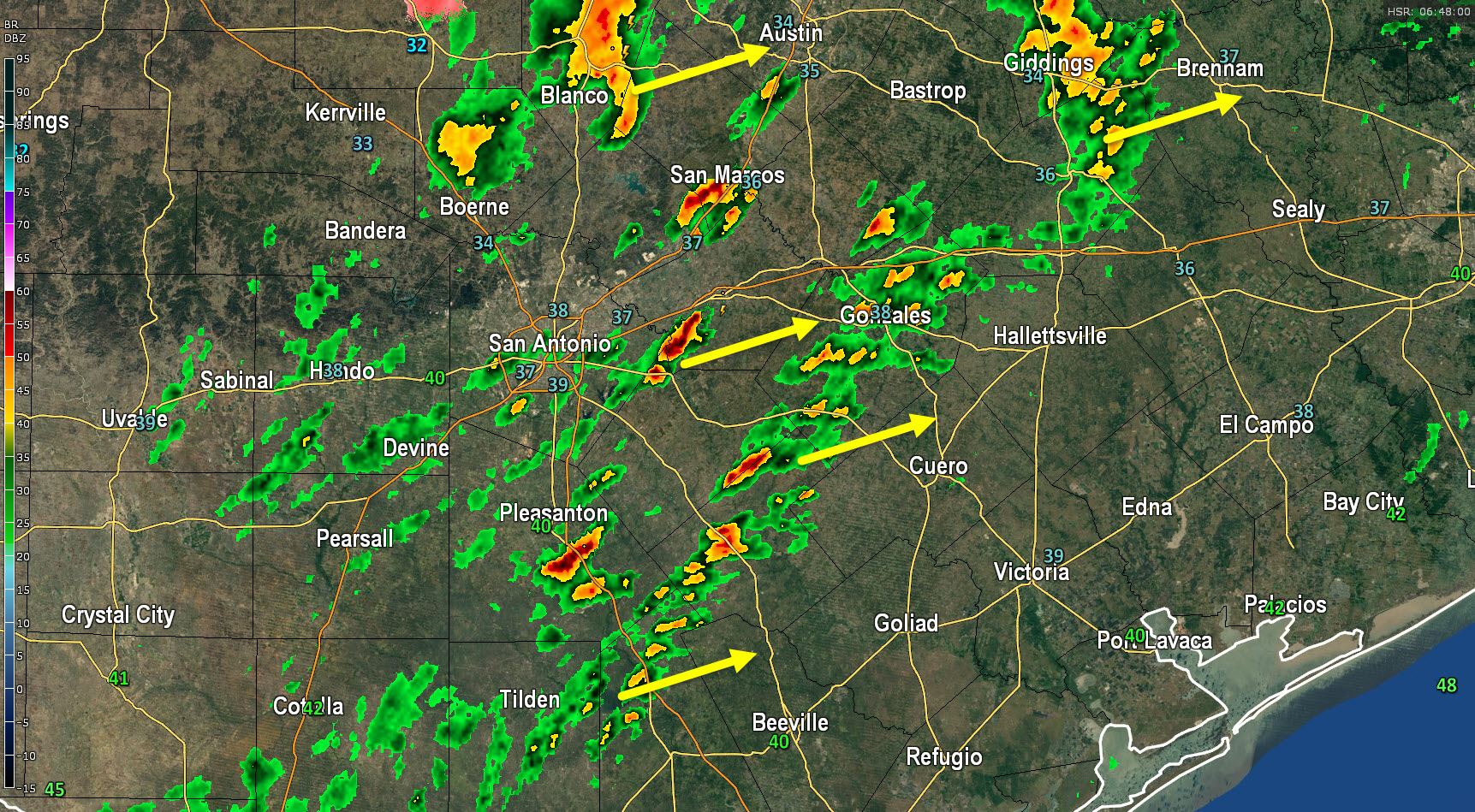
Showers and even a few thunderstorms continue to move northeast across South-Central Texas including the San ANtonio Metro south to near Beeville. Temperatures are in the upper 30s to lower 40s with no winter weather issues at this time. We may see a few icy spots on the north/northwest sides of the SAT metro this morning but overall it looks like temperatures should keep impacts minimal. Temperatures in the Brazos Valley are hovering just above freezing with additional precipitation moving into the area. Temperatures should continue to slowly drop and we may see a few icy spots develop in Bryan/College Station later this morning with a rain/sleet mix possible.
Radar Images and Projections


0 Comments