
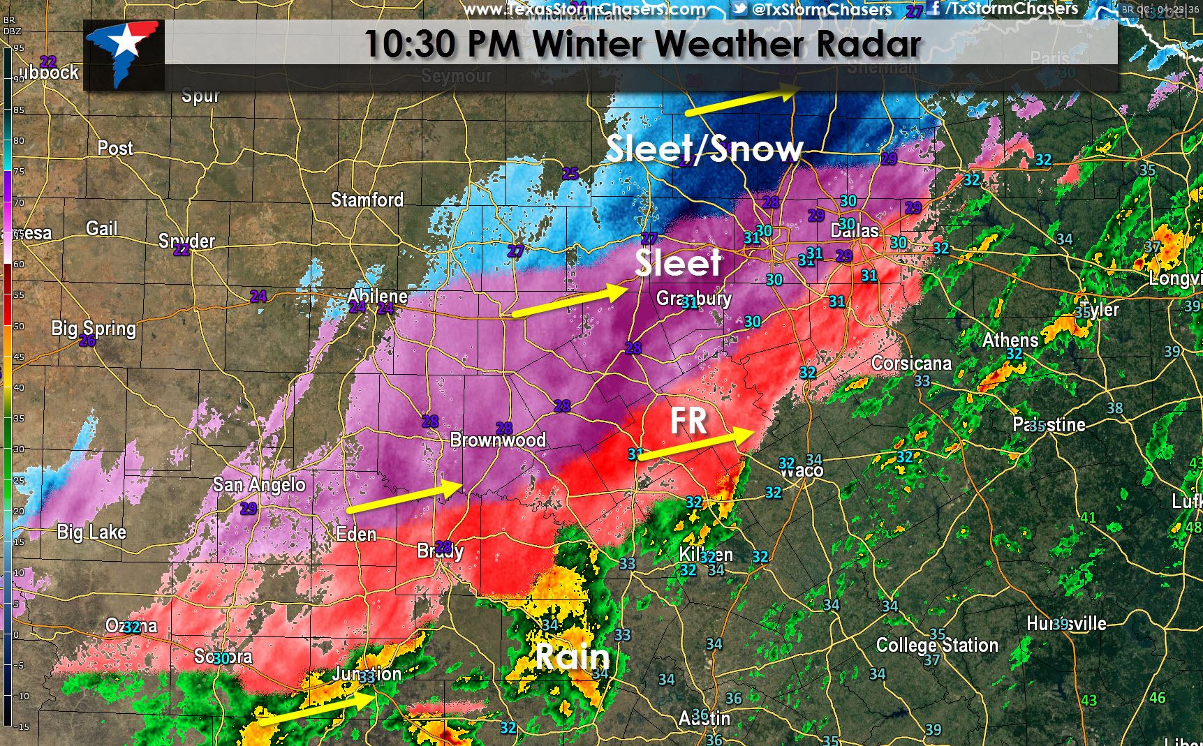
Heavy sleet has now moved into most of the D/FW Metroplex. This heavy sleet may mix with snow at times. Thundersleet is possible. Rapid accumulation of up to one inch of sleet is expected over the next few hours with all roads becoming slick and hazardous in the D/FW Metroplex. This is the main show we’ve been anticipating. A changeover to snow is possible across the northwestern half of D/FW through midnight with 1 to 3 inches of snow possible after the changeover. We expect most winter weather to exit the D/FW Metroplex by 2 AM.
Temperatures across Northeast Texas are now below freezing with areas of sleet and freezing rain moving northeast across the region. Heavy sleet will enter Northeast Texas after 11 PM (the same area impacting D/FW right now). Sleet accumulations up to 1 inch will be possible with all roads becoming slick and hazardous overnight.
Temperatures across Central Texas continue to fall and as they fall to freezing we’ll see rain change over to freezing rain and sleet. Some accumulations are expected and we could see icy bridges by midnight in Waco and even parts of Austin.


0 Comments