
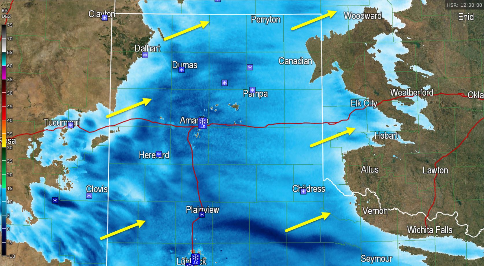
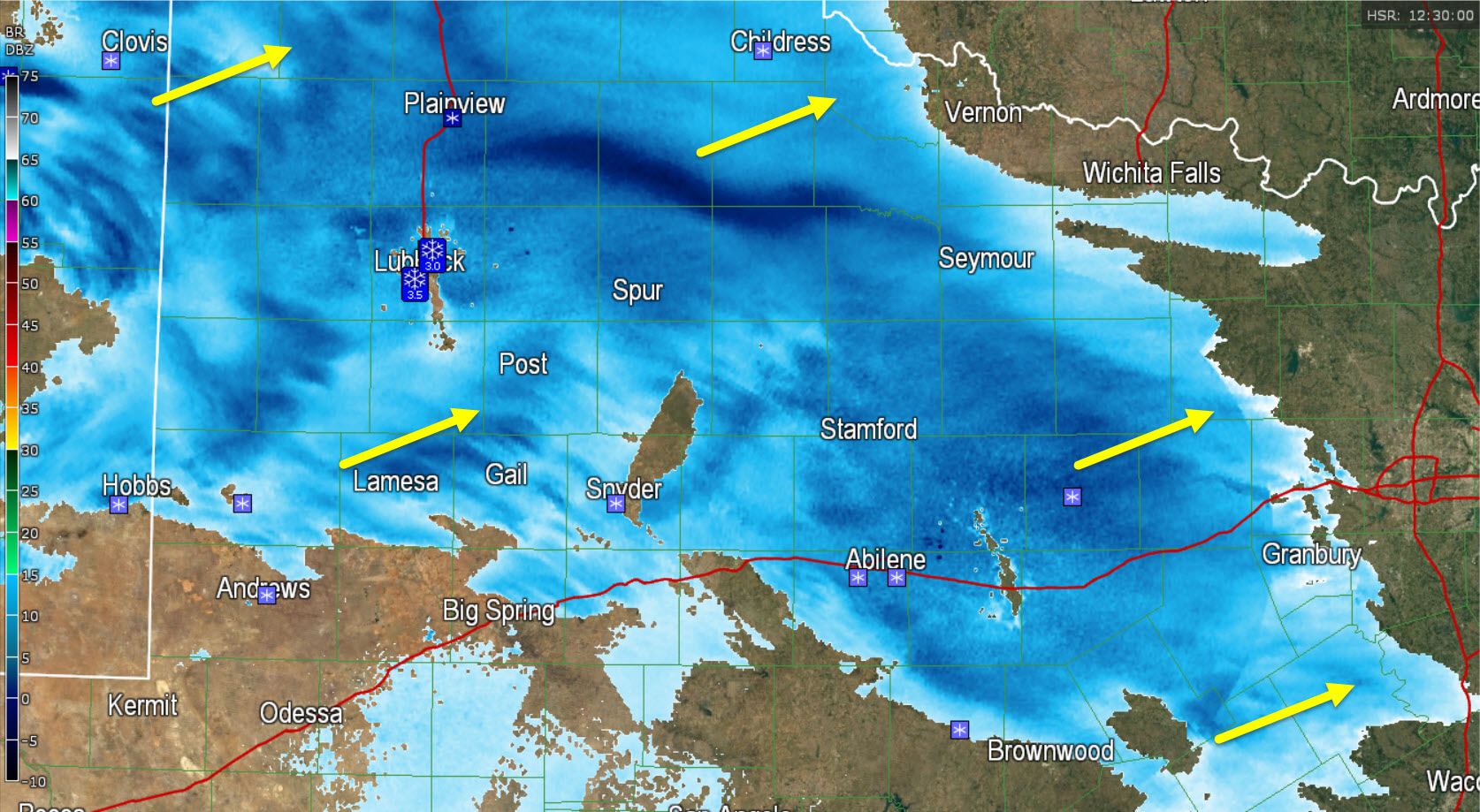
Light, to locally heavy snow continues to fall across the Texas Panhandle, South PLains, Northwest Texas, Rolling Plains, and now extends into the Big Country. This area of snow is moving east/northeast. Amarillo has reported 1.5 inches of snow, Friona has 4 inches of snow, and Lubbock has 3 to 4 inches of snow. This snow is moving northeast and will start weakening later this morning down to light snow. Light snow is now moving into Northwest Texas and western North Texas. We expect the snow to continue moving east/northeast this morning with continued development south to Interstate 20.
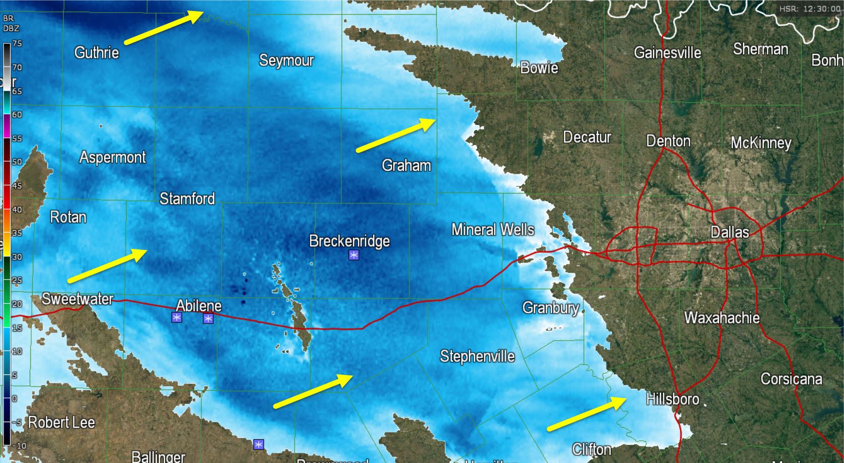
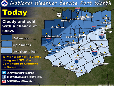
We still anticipate snow will enter western portions of the D/FW Metroplex between 7 and 8 AM with the remainder of the D/FW Metroplex starting to see light snow between 8 and 9 AM. We expect snow accumulations of half an inch up to 2 inches in the immediate D/FW Metroplex through early afternoon. Isolated accumulations up to 3 inches will be possible northwest of the D/FW Metroplex up into Northwest Texas. Some slushy/snow-covered roads will be possible this afternoon. Temperatures will remain below freezing and no melting is anticipated so roads could be a bit dicey all the way into tonight.


0 Comments