
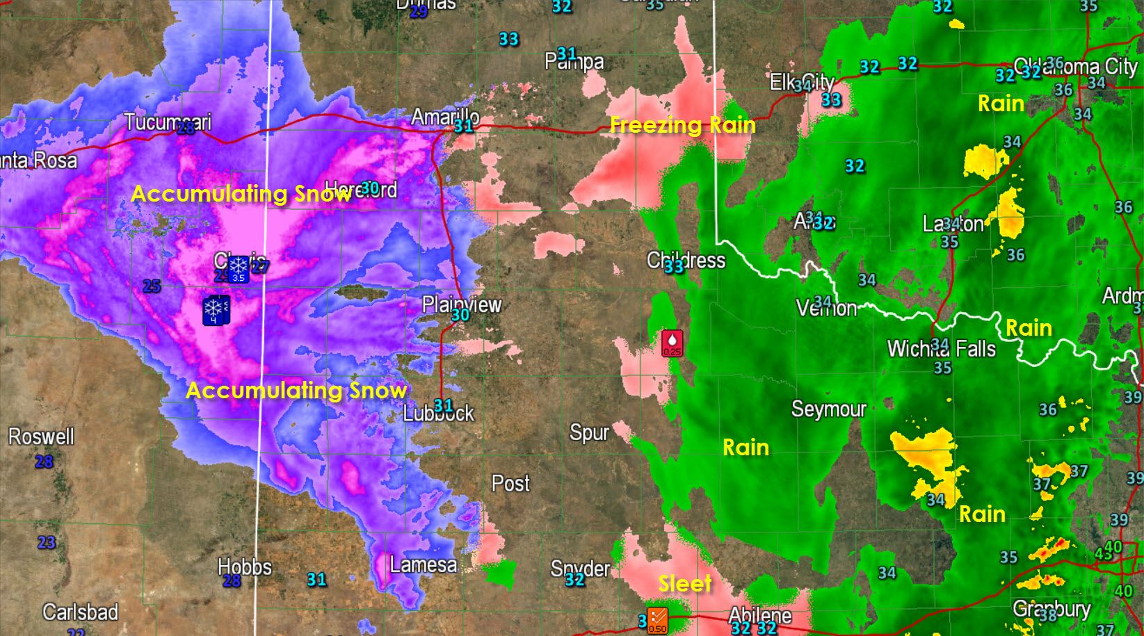


* Snow is increasing in coverage and intensity across the western half of the Texas Panhandle and South Plains. Sleet began falling in Amarillo a short time ago and that should change over to snow by midnight. Sleet/snow will begin in Lubbock shortly and will also change to snow. Accumulations of 1-3″ will be likely by midnight across the Southwest Panhandle and western South Plains. Locally heavy snow will occur over the next few hours and travel will become increasingly treacherous.
* A line of thunderstorms extending from near Weatherford south to Hamilton, Lampasas, to Blanco is moving east/northeast and will move through the D/FW Metroplex over the next two hours. Frequent cloud to ground lightning and heavy rain will occur with the storms. No severe weather is expected as the surface layer is quite stable (and cold).
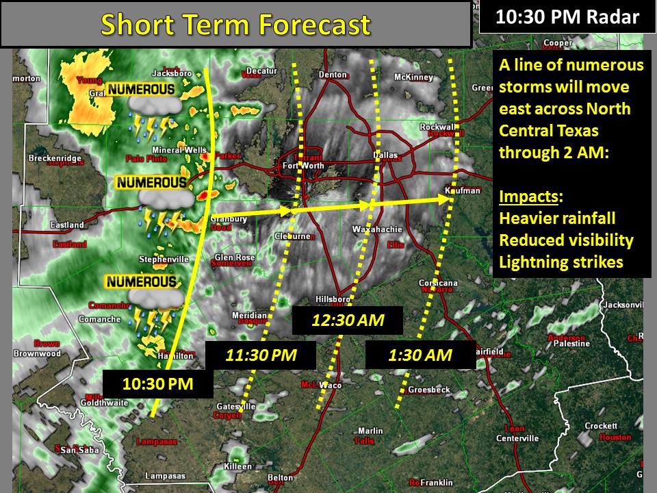
* Areas of rain will continue tonight into Saturday morning across North, Central, and East Texas. Severe weather is unlikely but a few stronger storms may produce frequent cloud to ground lightning and heavy rain. Activity is moving east/northeast.


0 Comments