
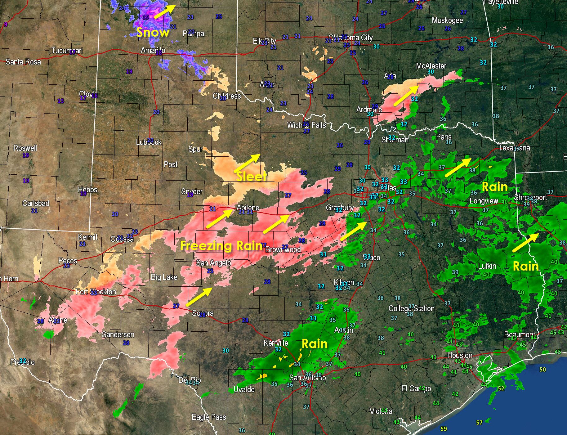
* Another band of freezing rain and rain will move into North Texas over the next hour from the southwest. This band will likely cause ice accumulations in areas where temperatures are below freezing (which is the western half of D/FW currently into western North Texas). Road conditions across those areas will go downhill in a hurry and have already become slick in spots.
* Rain continues across East Texas and now South-Central Texas where temperatures are above freezing and no winter impacts are expected.
* Freezing rain mixed with some sleet continues to fall from the Alpine Mountains northeast into the Concho Valley with some additional accumulation of sleet and ice possible through 9 AM. Road conditions remain slick and hazardous all across West Texas this morning.
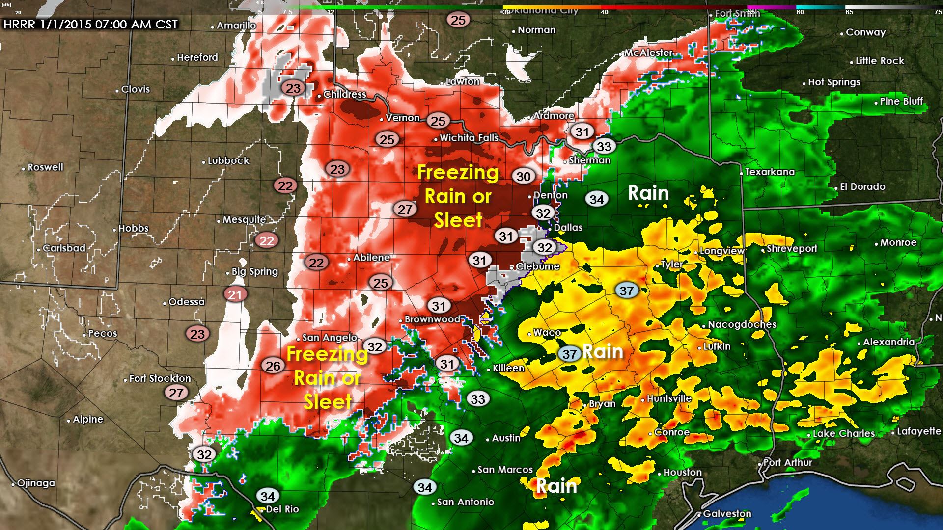
Here’s what the HRRR is saying it will look like on the radar around 7 AM with surface temperature overlays. You an see the freezing line pretty clearly going from Sherman southwest to Denton, D/FW Airport, Cleburne, into the Hill Country. We’ll likely see an uptick in freezing rain intensity over the next few hours and this is when we could start seeing significant accumulations of freezing rain and ice in areas that are below freezing. Road conditions will be dangerous and I would not advise heading out until early afternoon at the earliest when we start seeing temperatures climb. To the east of the freezing line where temperatures are above freezing its just going to be a cold rain with no winter weather or issues from ice. That said its still going to be nasty so if you can I’d recommend staying in the comfort of your home. Hopefully many of you don’t have to head into work today considering its New Years Day.


0 Comments